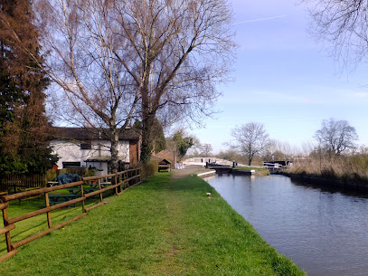
| Memorials | : | 0 |
| Location | : | Tushingham, Cheshire West and Chester Unitary Authority, England |
| Coordinate | : | 53.0115193, -2.7061829 |
| Description | : | Old Chads Church and Cemetery, accessed via Old Chads Lane and footpath/access across the field, can also park at new church on the main road and walk on footpath from there across the field. |
frequently asked questions (FAQ):
-
Where is Old St. Chad's Church and Cemetery?
Old St. Chad's Church and Cemetery is located at Tushingham, Cheshire West and Chester Unitary Authority ,Cheshire ,England.
-
Old St. Chad's Church and Cemetery cemetery's updated grave count on graveviews.com?
0 memorials
-
Where are the coordinates of the Old St. Chad's Church and Cemetery?
Latitude: 53.0115193
Longitude: -2.7061829
Nearby Cemetories:
1. St. Wenefredes Churchyard
Bickley, Cheshire West and Chester Unitary Authority, England
Coordinate: 53.0365490, -2.6924400
2. St Michael Churchyard
Marbury-cum-Quoisley, Cheshire East Unitary Authority, England
Coordinate: 53.0062980, -2.6564160
3. St. Oswald's Churchyard
Malpas, Cheshire West and Chester Unitary Authority, England
Coordinate: 53.0194240, -2.7669350
4. Malpas Cemetery
Malpas, Cheshire West and Chester Unitary Authority, England
Coordinate: 53.0262800, -2.7633600
5. United Reformed Church Burial Ground
Malpas, Cheshire West and Chester Unitary Authority, England
Coordinate: 53.0198355, -2.7673954
6. Bateman Memorial Chapel
Chorley, Cheshire East Unitary Authority, England
Coordinate: 53.0549000, -2.6368300
7. St Margaret Churchyard
Wrenbury-cum-Frith, Cheshire East Unitary Authority, England
Coordinate: 53.0256700, -2.6073340
8. Holy Trinity Churchyard
Bickerton, Cheshire East Unitary Authority, England
Coordinate: 53.0770280, -2.7326350
9. Bickerton Municipal Cemetery
Bickerton, Cheshire East Unitary Authority, England
Coordinate: 53.0773110, -2.7329560
10. Brown Knoll Methodist Chapel
Broxton, Cheshire West and Chester Unitary Authority, England
Coordinate: 53.0766700, -2.7538600
11. Christ Church
Ash Magna, Shropshire Unitary Authority, England
Coordinate: 52.9575430, -2.6287860
12. St. John's Churchyard
Threapwood, Cheshire West and Chester Unitary Authority, England
Coordinate: 53.0023350, -2.8359540
13. St Michael Churchyard
Baddiley, Cheshire East Unitary Authority, England
Coordinate: 53.0488780, -2.5905830
14. Harthill Chester Churchyard
Harthill, Cheshire West and Chester Unitary Authority, England
Coordinate: 53.0924840, -2.7469490
15. St John The Baptist Churchyard
Ightfield, Shropshire Unitary Authority, England
Coordinate: 52.9438900, -2.6081000
16. St Edith Churchyard
Shocklach, Cheshire West and Chester Unitary Authority, England
Coordinate: 53.0457000, -2.8487100
17. Coton Primitive Methodist Chapel
Cotonwood, Shropshire Unitary Authority, England
Coordinate: 52.9191890, -2.6926830
18. St. John the Divine Churchyard
Burwardsley, Cheshire West and Chester Unitary Authority, England
Coordinate: 53.1035280, -2.7251110
19. St Mary's Churchyard
Coddington, Cheshire West and Chester Unitary Authority, England
Coordinate: 53.0926800, -2.8184900
20. Calverhall Holy Trinity
Calverhall, Shropshire Unitary Authority, England
Coordinate: 52.9311270, -2.5917490
21. St Mary Churchyard
Acton, Cheshire East Unitary Authority, England
Coordinate: 53.0737140, -2.5511740
22. St. Boniface Churchyard
Bunbury, Cheshire East Unitary Authority, England
Coordinate: 53.1182360, -2.6453990
23. St Alban's Churchyard
Tattenhall, Cheshire West and Chester Unitary Authority, England
Coordinate: 53.1217800, -2.7688900
24. All Saints Churchyard
Handley, Cheshire West and Chester Unitary Authority, England
Coordinate: 53.1153060, -2.7990430

