
| Memorials | : | 1 |
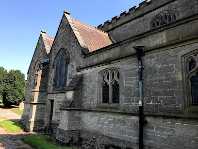
| Location | : | Calverhall, Shropshire Unitary Authority, England |
| Coordinate | : | 52.9311270, -2.5917490 |
frequently asked questions (FAQ):
-
Where is Calverhall Holy Trinity?
Calverhall Holy Trinity is located at Calverhall, Shropshire, TF9 3RS, United Kingdom , Calverhall, Shropshire Unitary Authority ,Shropshire , TF9 3RSEngland.
-
Calverhall Holy Trinity cemetery's updated grave count on graveviews.com?
1 memorials
-
Where are the coordinates of the Calverhall Holy Trinity?
Latitude: 52.9311270
Longitude: -2.5917490
Nearby Cemetories:
1. St John The Baptist Churchyard
Ightfield, Shropshire Unitary Authority, England
Coordinate: 52.9438900, -2.6081000
2. Christ Church
Ash Magna, Shropshire Unitary Authority, England
Coordinate: 52.9575430, -2.6287860
3. St Peter Churchyard
Adderley, Shropshire Unitary Authority, England
Coordinate: 52.9517090, -2.5061580
4. Coton Primitive Methodist Chapel
Cotonwood, Shropshire Unitary Authority, England
Coordinate: 52.9191890, -2.6926830
5. St Luke's Churchyard
Hodnet, Shropshire Unitary Authority, England
Coordinate: 52.8536780, -2.5772160
6. St Michael Churchyard
Marbury-cum-Quoisley, Cheshire East Unitary Authority, England
Coordinate: 53.0062980, -2.6564160
7. St. Mary's Churchyard
Edstaston, Shropshire Unitary Authority, England
Coordinate: 52.8830727, -2.7182040
8. St Margaret Churchyard
Wrenbury-cum-Frith, Cheshire East Unitary Authority, England
Coordinate: 53.0256700, -2.6073340
9. St. Mary's Churchyard
Hales, Shropshire Unitary Authority, England
Coordinate: 52.9024580, -2.4274470
10. Old St. Chad's Church and Cemetery
Tushingham, Cheshire West and Chester Unitary Authority, England
Coordinate: 53.0115193, -2.7061829
11. Saint Mary Church
Mucklestone, Newcastle-Under-Lyme Borough, England
Coordinate: 52.9328620, -2.4098060
12. St Michael Churchyard
Baddiley, Cheshire East Unitary Authority, England
Coordinate: 53.0488780, -2.5905830
13. St. Wenefredes Churchyard
Bickley, Cheshire West and Chester Unitary Authority, England
Coordinate: 53.0365490, -2.6924400
14. St Michael & All Angels
Childs Ercall, Shropshire Unitary Authority, England
Coordinate: 52.8222524, -2.4975524
15. St. Swithun's Churchyard
Cheswardine, Shropshire Unitary Authority, England
Coordinate: 52.8660400, -2.4187700
16. St Oswald's Church Burial Ground
Hinstock, Shropshire Unitary Authority, England
Coordinate: 52.8346100, -2.4577700
17. Bateman Memorial Chapel
Chorley, Cheshire East Unitary Authority, England
Coordinate: 53.0549000, -2.6368300
18. St. Oswald's Churchyard
Malpas, Cheshire West and Chester Unitary Authority, England
Coordinate: 53.0194240, -2.7669350
19. United Reformed Church Burial Ground
Malpas, Cheshire West and Chester Unitary Authority, England
Coordinate: 53.0198355, -2.7673954
20. Nantwich Quaker Burial Ground (Defunct)
Nantwich, Cheshire East Unitary Authority, England
Coordinate: 53.0645719, -2.5214206
21. Malpas Cemetery
Malpas, Cheshire West and Chester Unitary Authority, England
Coordinate: 53.0262800, -2.7633600
22. Barker Street Chapel Chapelyard
Nantwich, Cheshire East Unitary Authority, England
Coordinate: 53.0658770, -2.5222890
23. St Mary's Church
Nantwich, Cheshire East Unitary Authority, England
Coordinate: 53.0671000, -2.5206000
24. All Saints Church
Clive, Shropshire Unitary Authority, England
Coordinate: 52.8116250, -2.7212930