
| Memorials | : | 0 |
| Location | : | Amersfoort Municipality, Netherlands |
| Coordinate | : | 52.1601500, 5.3896600 |
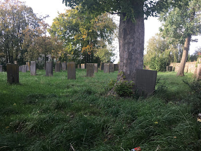
| Description | : | Two cemeteries on either side of the road: The Sephardic cemetery ("Al Mee Menoechot") in use from 1670-1727. There is only one stone remaining, which is unreadable. Specific location: 52.16045, 5.39006 The Ashkenazi cemetery was in use from 1700-1883. |
frequently asked questions (FAQ):
-
Where is Oode Joodse begraafplaats Bloemendalsestraat?
Oode Joodse begraafplaats Bloemendalsestraat is located at 150 Bloemendaalsestraat Amersfoort Municipality ,Utrecht , 3811 ERNetherlands.
-
Oode Joodse begraafplaats Bloemendalsestraat cemetery's updated grave count on graveviews.com?
0 memorials
-
Where are the coordinates of the Oode Joodse begraafplaats Bloemendalsestraat?
Latitude: 52.1601500
Longitude: 5.3896600
Nearby Cemetories:
1. Amersfoort Roman Catholic Cemetery
Amersfoort, Amersfoort Municipality, Netherlands
Coordinate: 52.1509300, 5.3818700
2. Joodse Begraafplaats Soesterweg
Amersfoort, Amersfoort Municipality, Netherlands
Coordinate: 52.1570050, 5.3699520
3. Amersfoort Soesterkwartier Cemetery
Amersfoort, Amersfoort Municipality, Netherlands
Coordinate: 52.1575100, 5.3689900
4. Algemene Begraafplaats Oud Leusden
Oud-Leusden, Leusden Municipality, Netherlands
Coordinate: 52.1310600, 5.3721800
5. Amersfoort Concentration Camp
Leusden Municipality, Netherlands
Coordinate: 52.1322500, 5.3652800
6. Rusthof Cemetery
Oud-Leusden, Leusden Municipality, Netherlands
Coordinate: 52.1288100, 5.3758500
7. Hoevelaken Begraafplaats
Hoevelaken, Nijkerk Municipality, Netherlands
Coordinate: 52.1785700, 5.4530100
8. Algemene Begraafplaats
Soest, Soest Municipality, Netherlands
Coordinate: 52.1712700, 5.3074300
9. Joodse Begraafplaats Nijkerkerveen
Nijkerkerveen, Nijkerk Municipality, Netherlands
Coordinate: 52.2064170, 5.4693330
10. Baarn Nieuwe Begraafplaats
Baarn, Baarn Municipality, Netherlands
Coordinate: 52.2031500, 5.2909500
11. Woudenberg General Cemetery
Woudenberg, Woudenberg Municipality, Netherlands
Coordinate: 52.0823400, 5.4079800
12. Begraafplaats Soesterberg
Soest Municipality, Netherlands
Coordinate: 52.1091680, 5.2883344
13. Nijkerk Begraafplaats
Nijkerk, Nijkerk Municipality, Netherlands
Coordinate: 52.2188900, 5.4803400
14. Grote Kerk
Nijkerk, Nijkerk Municipality, Netherlands
Coordinate: 52.2228390, 5.4830470
15. Baarn Oude Begraafplaats
Baarn, Baarn Municipality, Netherlands
Coordinate: 52.2155600, 5.2840900
16. Katholieke Begraafplaats
Maarn, Utrechtse Heuvelrug Municipality, Netherlands
Coordinate: 52.0673700, 5.3790400
17. Begraafplaats Zeister Bosrust
Zeist, Zeist Municipality, Netherlands
Coordinate: 52.0898060, 5.2776180
18. Lage-Vuursche Kerkhof
Lage-Vuursche, Baarn Municipality, Netherlands
Coordinate: 52.1805100, 5.2238600
19. Nieuwe Begraafplaats
Driebergen-Rijsenburg, Utrechtse Heuvelrug Municipality, Netherlands
Coordinate: 52.0641100, 5.3100900
20. Barneveld Begraafplaats De Plantage
Barneveld, Barneveld Municipality, Netherlands
Coordinate: 52.1353200, 5.5718900
21. Oude Algemene Begraafplaats
Zeist, Zeist Municipality, Netherlands
Coordinate: 52.0910100, 5.2400300
22. Joodse Begraafplaats
Barneveld Municipality, Netherlands
Coordinate: 52.1409500, 5.5780800
23. Bilthoven Den en Rust Cemetery
Bilthoven, De Bilt Municipality, Netherlands
Coordinate: 52.1407776, 5.2003312
24. Doorn Nieuwe Algemene Begraafplaats
Doorn, Utrechtse Heuvelrug Municipality, Netherlands
Coordinate: 52.0484200, 5.3203200