
| Memorials | : | 0 |
| Location | : | Cazadero, Sonoma County, USA |
| Coordinate | : | 38.5313260, -123.0886990 |
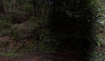
| Description | : | This cemetery listing is from the first edition of the Sonoma County Cemetery Records Book, which edition was not protected by copyright at the time of its printing. There is currently only 1 known burial at this ranch--Infant Son Otis, son of Hamilton and Nellie Otis. The location of the Hamilton Otis Ranch and cemetery was in the Cazadero District of Sonoma County, which included the small town of Cazadero, as well as the surrounding open land which consisted mostly of ranches and farms. ******************************************************** |
frequently asked questions (FAQ):
-
Where is Otis Ranch Cemetery?
Otis Ranch Cemetery is located at Cazadero, Sonoma County ,California ,USA.
-
Otis Ranch Cemetery cemetery's updated grave count on graveviews.com?
0 memorials
-
Where are the coordinates of the Otis Ranch Cemetery?
Latitude: 38.5313260
Longitude: -123.0886990
Nearby Cemetories:
1. Walter Brain Ranch Cemetery
Cazadero, Sonoma County, USA
Coordinate: 38.5332340, -123.0852850
2. Elim Grove Cemetery
Cazadero, Sonoma County, USA
Coordinate: 38.5169590, -123.0887470
3. Cunningham Ranch Cemetery
Cazadero, Sonoma County, USA
Coordinate: 38.5405680, -123.1089740
4. Kricke Ranch Cemetery
Cazadero, Sonoma County, USA
Coordinate: 38.5036910, -123.0790620
5. Del Stewart Ranch Cemetery
Cazadero, Sonoma County, USA
Coordinate: 38.4998290, -123.0793090
6. William Churchman Ranch Cemetery
Cazadero, Sonoma County, USA
Coordinate: 38.5671810, -123.1205180
7. Trosper Ranch Cemetery
Cazadero, Sonoma County, USA
Coordinate: 38.5720120, -123.1201740
8. Slattery Ranch Cemetery
Cazadero, Sonoma County, USA
Coordinate: 38.5529520, -123.1593130
9. Duncans Mills Cemetery
Duncans Mills, Sonoma County, USA
Coordinate: 38.4593560, -123.0547780
10. Redwood Memorial Gardens
Guerneville, Sonoma County, USA
Coordinate: 38.5071983, -122.9927979
11. Saint Catherines Church Cemetery
Monte Rio, Sonoma County, USA
Coordinate: 38.4691010, -123.0104980
12. Howie Ranch Cemetery
Cazadero, Sonoma County, USA
Coordinate: 38.5644960, -123.2060050
13. Seaview Cemetery
Seaview, Sonoma County, USA
Coordinate: 38.5433006, -123.2230988
14. Fort Ross State Historic Park Cemetery
Jenner, Sonoma County, USA
Coordinate: 38.5147490, -123.2400160
15. McPeak Cemetery
Forestville, Sonoma County, USA
Coordinate: 38.5098190, -122.9280929
16. McPeak Cemetery
Hacienda, Sonoma County, USA
Coordinate: 38.5097008, -122.9272003
17. Benitz Ranch Cemetery
Jenner, Sonoma County, USA
Coordinate: 38.5304480, -123.2692660
18. Rouff - Thomas Cemetery
Cloverdale, Sonoma County, USA
Coordinate: 38.5404960, -123.2851310
19. Druids Occidental Cemetery
Occidental, Sonoma County, USA
Coordinate: 38.4104996, -122.9419022
20. Cooper Cemetery
Stewarts Point, Sonoma County, USA
Coordinate: 38.6128464, -123.2773285
21. Forestview Cemetery
Forestville, Sonoma County, USA
Coordinate: 38.4677010, -122.8834000
22. Green Valley Cemetery
Sebastopol, Sonoma County, USA
Coordinate: 38.4424019, -122.8869019
23. Sugarloaf Cemetery
Annapolis, Sonoma County, USA
Coordinate: 38.6534800, -123.2643300
24. Gilliam Cemetery
Graton, Sonoma County, USA
Coordinate: 38.4314995, -122.8816986