
| Memorials | : | 0 |
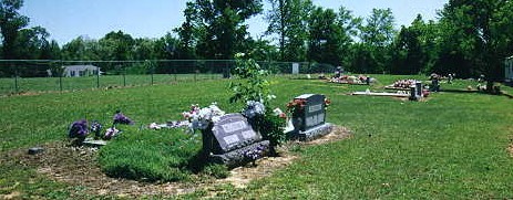
| Location | : | Lexington, Henderson County, USA |
| Coordinate | : | 35.5908080, -88.4342830 |
| Description | : | From the intersection of TN-22 Alt & S. Broad St/ TN-22, south of Lexington, travel south southwest on TN-22 Alt. for 3.3 mi., turning east (left) into the parking area of the Palestine Pentecostal Church & to the cemetery besides it. |
frequently asked questions (FAQ):
-
Where is Palestine Pentecostal Church Cemetery?
Palestine Pentecostal Church Cemetery is located at 7201 TN-22 Alt Lexington, Henderson County ,Tennessee , 38351USA.
-
Palestine Pentecostal Church Cemetery cemetery's updated grave count on graveviews.com?
0 memorials
-
Where are the coordinates of the Palestine Pentecostal Church Cemetery?
Latitude: 35.5908080
Longitude: -88.4342830
Nearby Cemetories:
1. Palestine Church Cemetery
Lexington, Henderson County, USA
Coordinate: 35.5904470, -88.4478410
2. Macedonia Cemetery
Henderson County, USA
Coordinate: 35.6018890, -88.4190140
3. County Farm Cemetery
Lexington, Henderson County, USA
Coordinate: 35.6081890, -88.4157540
4. Mullins Cemetery
Lexington, Henderson County, USA
Coordinate: 35.6078360, -88.4533310
5. Mount Zion Cemetery
Lexington, Henderson County, USA
Coordinate: 35.5623150, -88.4213170
6. Horn Cemetery
Lexington, Henderson County, USA
Coordinate: 35.6041440, -88.3988320
7. Piney Cemetery
Lexington, Henderson County, USA
Coordinate: 35.6029880, -88.3948500
8. Caraway Cemetery
Henderson County, USA
Coordinate: 35.5699997, -88.3996964
9. Jordan Cemetery
Lexington, Henderson County, USA
Coordinate: 35.5551000, -88.4357000
10. Priddy Graveyard
Lexington, Henderson County, USA
Coordinate: 35.5648260, -88.4688010
11. Scott Cemetery
Lexington, Henderson County, USA
Coordinate: 35.6331110, -88.4388890
12. Chapel Hill Baptist Church Cemetery
Lexington, Henderson County, USA
Coordinate: 35.5983900, -88.4864500
13. Cooper Cemetery
Henderson County, USA
Coordinate: 35.5924988, -88.4935989
14. New Bethel Cemetery
Lexington, Henderson County, USA
Coordinate: 35.6244030, -88.4800220
15. Cooper's Grove Church Cemetery
Lexington, Henderson County, USA
Coordinate: 35.6459320, -88.4398000
16. Big Springs Cemetery
Henderson County, USA
Coordinate: 35.5456009, -88.4756012
17. Center Hill Holiness Church Cemetery
Lexington, Henderson County, USA
Coordinate: 35.5414280, -88.3987560
18. Old Bethel Church Cemetery
Lexington, Henderson County, USA
Coordinate: 35.6393610, -88.4722500
19. Garrett Cemetery
Huron, Henderson County, USA
Coordinate: 35.5554150, -88.4938810
20. Center Hill Cemetery
Henderson County, USA
Coordinate: 35.5407890, -88.3920830
21. Old Big Springs Cemetery
Huron, Henderson County, USA
Coordinate: 35.5394520, -88.4762550
22. Mills Darden Cemetery
Lexington, Henderson County, USA
Coordinate: 35.6134700, -88.5051910
23. Phelps Family Cemetery
Huron, Henderson County, USA
Coordinate: 35.5573500, -88.5022250
24. Old Jacks Creek Church Cemetery
Huron, Henderson County, USA
Coordinate: 35.5254930, -88.4526830