
| Memorials | : | 0 |
| Location | : | Pendock, Malvern Hills District, England |
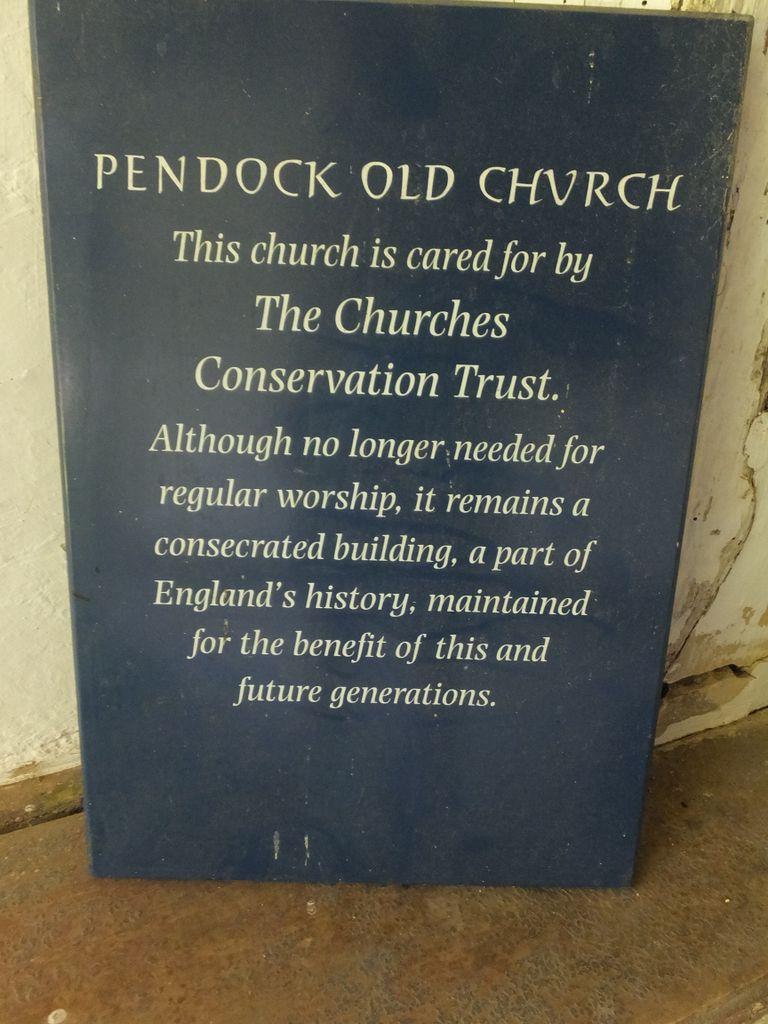
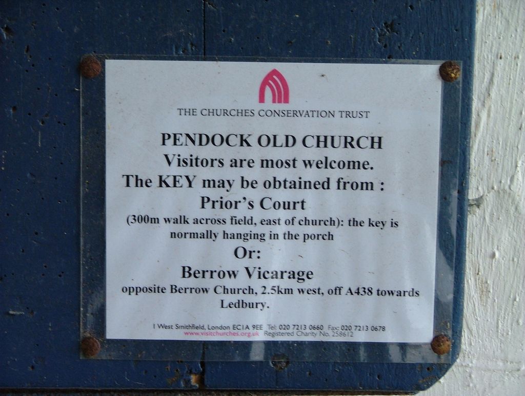
| Phone | : | 020 7213 0660 |
| Coordinate | : | 52.0014720, -2.2679110 |
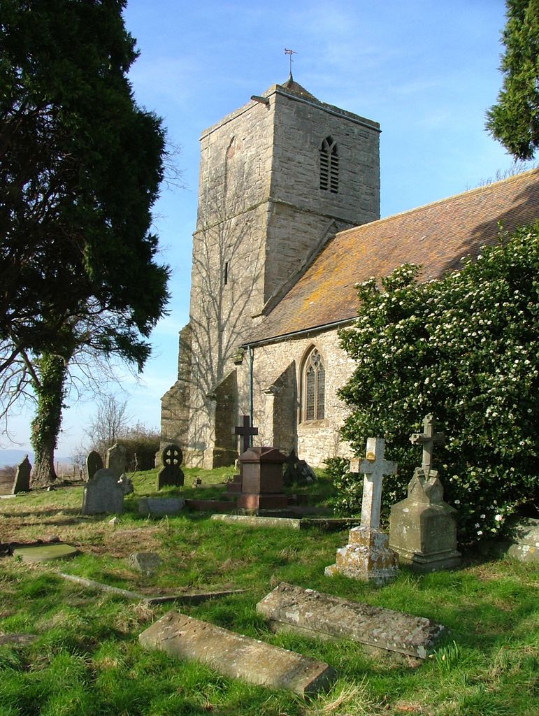
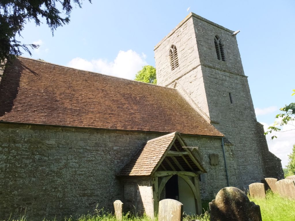
| Description | : | Church disused since 1987. You get to the church from the minor road through a farm gate (remember to close it) and along a slightly overgrown track for 280 meters (300 yards) to a grass parking area. |
frequently asked questions (FAQ):
-
Where is Pendock Old Church?
Pendock Old Church is located at Pendock, Malvern Hills District ,Worcestershire , GL19 4QLEngland.
-
Pendock Old Church cemetery's updated grave count on graveviews.com?
0 memorials
-
Where are the coordinates of the Pendock Old Church?
Latitude: 52.0014720
Longitude: -2.2679110
Nearby Cemetories:
1. Pendock Churchyard
Pendock, Malvern Hills District, England
Coordinate: 52.0015108, -2.2678653
2. St Faith Churchyard
Berrow, Malvern Hills District, England
Coordinate: 52.0065770, -2.3018720
3. St. Peter and St. Paul Churchyard
Birtsmorton, Malvern Hills District, England
Coordinate: 52.0176100, -2.2912600
4. St. Mary's Churchyard
Longdon, Malvern Hills District, England
Coordinate: 52.0244900, -2.2370600
5. St. Gregory Churchyard
Castlemorton, Malvern Hills District, England
Coordinate: 52.0332900, -2.3003800
6. St. Mary the Virgin Churchyard
Forthampton, Tewkesbury Borough, England
Coordinate: 51.9912630, -2.2072860
7. St Nicholas Churchyard
Queenhill, Malvern Hills District, England
Coordinate: 52.0280900, -2.2044100
8. St. Michael and All Angels Churchyard
Tirley, Tewkesbury Borough, England
Coordinate: 51.9552600, -2.2341600
9. All Saints Churchyard
Hollybush, Malvern Hills District, England
Coordinate: 52.0282510, -2.3384140
10. St Peters Churchyard
Bushley, Malvern Hills District, England
Coordinate: 52.0076000, -2.1834000
11. St. Mary's Churchyard
Deerhurst, Tewkesbury Borough, England
Coordinate: 51.9679540, -2.1899710
12. St. James Churchyard
Welland, Malvern Hills District, England
Coordinate: 52.0577700, -2.2974900
13. Welland Cemetery
Welland, Malvern Hills District, England
Coordinate: 52.0591625, -2.3021845
14. Church of the Good Shepherd Churchyard
Malvern Hills District, England
Coordinate: 52.0632720, -2.2624630
15. St. Bartholomew's Churchyard
Redmarley, Forest of Dean District, England
Coordinate: 51.9795670, -2.3622700
16. St. Mary's Churchyard
Ripple, Malvern Hills District, England
Coordinate: 52.0378900, -2.1822900
17. Holy Trinity Churchyard
Apperley, Tewkesbury Borough, England
Coordinate: 51.9510043, -2.2029317
18. Upton-upon-Severn Cemetery
Upton-upon-Severn, Malvern Hills District, England
Coordinate: 52.0585550, -2.2148520
19. Baptist Burial Ground 1655
Tewkesbury, Tewkesbury Borough, England
Coordinate: 51.9915680, -2.1614440
20. St Peter & St Paul Churchyard
Upton-upon-Severn, Malvern Hills District, England
Coordinate: 52.0611229, -2.2181928
21. St Mary the Virgin Churchyard
Bromsberrow, Forest of Dean District, England
Coordinate: 52.0008740, -2.3768560
22. Tewkesbury Abbey
Tewkesbury, Tewkesbury Borough, England
Coordinate: 51.9902520, -2.1604280
23. Tewkesbury Cemetery
Tewkesbury, Tewkesbury Borough, England
Coordinate: 51.9862920, -2.1607700
24. St. Mary Magdalene's Churchyard
Twyning, Tewkesbury Borough, England
Coordinate: 52.0230800, -2.1561800