
| Memorials | : | 4 |
| Location | : | Bunker, Lewis County, USA |
| Coordinate | : | 46.6088840, -123.0863790 |
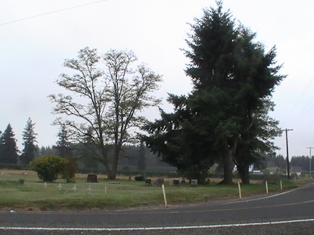
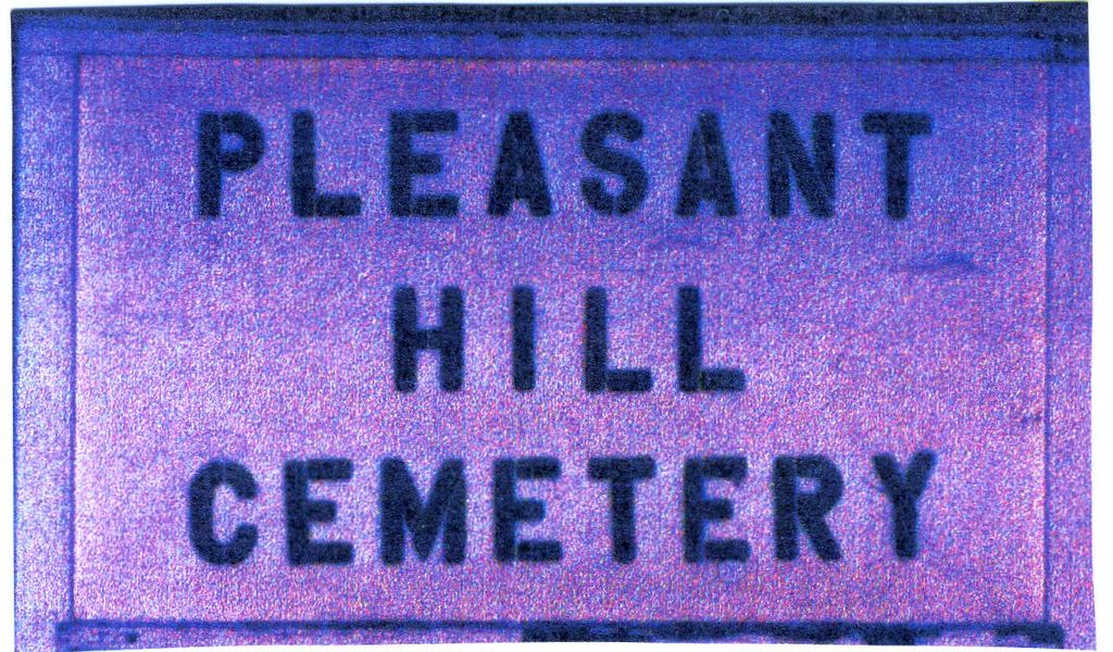
| Description | : | Location of the Pleasant Hill Cemetery (also known as the Wasson Cemetery). Located in Township 13 North, Range 3 West, Section 17 in Lewis County, Washington. Starting from Exit #77 of Interstate 5. Go west on Washington Highway 6 for 5 1/2 miles and take a left turn of Curtis Hill Road. Go up the hill for about 3/4 of a mile and take a left turn on Pleasant Hill Road. The Pleasant Hill Cemetery is about 1/2 mile down Pleasant Hill Road on the right side of the road. This data has been compiled from several visits to the cemetery,... Read More |
frequently asked questions (FAQ):
-
Where is Pleasant Hill Cemetery?
Pleasant Hill Cemetery is located at Bunker, Lewis County ,Washington ,USA.
-
Pleasant Hill Cemetery cemetery's updated grave count on graveviews.com?
3 memorials
-
Where are the coordinates of the Pleasant Hill Cemetery?
Latitude: 46.6088840
Longitude: -123.0863790
Nearby Cemetories:
1. Claquato Cemetery
Chehalis, Lewis County, USA
Coordinate: 46.6469002, -123.0216980
2. Newaukum Hill Cemetery
Lewis County, USA
Coordinate: 46.6338980, -122.9768320
3. Original Boistfort Cemetery
Boistfort, Lewis County, USA
Coordinate: 46.5234680, -123.1287680
4. Boistfort Cemetery
Boistfort, Lewis County, USA
Coordinate: 46.5228700, -123.1313650
5. Fern Hill Cemetery
Chehalis, Lewis County, USA
Coordinate: 46.6366710, -122.9418560
6. Greenwood Cemetery
Chehalis, Lewis County, USA
Coordinate: 46.6511002, -122.9389038
7. Napavine Cemetery
Napavine, Lewis County, USA
Coordinate: 46.5817000, -122.9039000
8. Dryad Cemetery
Dryad, Lewis County, USA
Coordinate: 46.6467667, -123.2665329
9. Pioneer Cemetery
Centralia, Lewis County, USA
Coordinate: 46.7290300, -122.9898100
10. Mountain View Cemetery
Centralia, Lewis County, USA
Coordinate: 46.7289009, -122.9843979
11. Washington Lawn Cemetery
Centralia, Lewis County, USA
Coordinate: 46.7209320, -122.9606040
12. Greenwood Memorial Park
Centralia, Lewis County, USA
Coordinate: 46.7372017, -122.9824982
13. Saint Joseph Cemetery
Pe Ell, Lewis County, USA
Coordinate: 46.5732590, -123.3012070
14. Forest Lawn Cemetery
Pe Ell, Lewis County, USA
Coordinate: 46.5649190, -123.3008280
15. Saint Josephs Catholic Cemetery
Pe Ell, Lewis County, USA
Coordinate: 46.5648880, -123.3031070
16. Lincoln Creek Cemetery
Galvin, Lewis County, USA
Coordinate: 46.7604700, -123.1446600
17. Winlock Cemetery
Winlock, Lewis County, USA
Coordinate: 46.4898000, -122.9336000
18. Snow Cemetery
Lewis County, USA
Coordinate: 46.4552994, -123.0083008
19. Finn Hill Cemetery
Lewis County, USA
Coordinate: 46.7564011, -123.1919022
20. Saint Urban Catholic Cemetery
Winlock, Lewis County, USA
Coordinate: 46.5177200, -122.8856500
21. Secena Cemetery
Oakville, Grays Harbor County, USA
Coordinate: 46.8061600, -123.1611900
22. Chehalis Tribal Cemetery
Thurston County, USA
Coordinate: 46.8068570, -123.1602260
23. Little Falls Cemetery
Vader, Lewis County, USA
Coordinate: 46.4105988, -122.9867020
24. Cogdil Family Cemetery
Thurston County, USA
Coordinate: 46.7747010, -122.8826590