
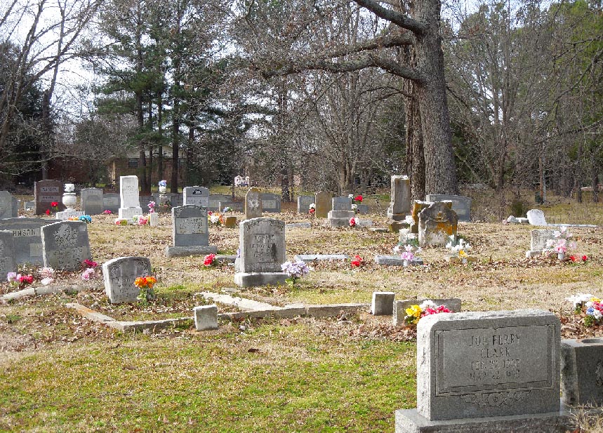
| Memorials | : | 0 |
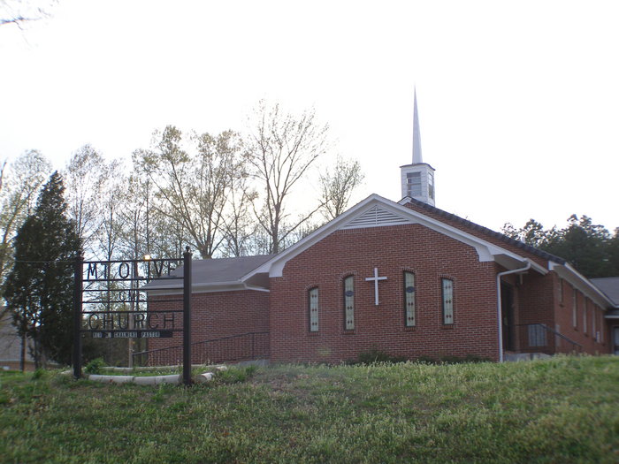
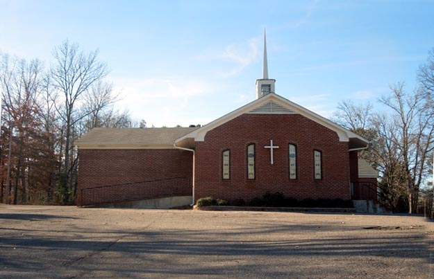
| Location | : | Nesbit, DeSoto County, USA |
| Coordinate | : | 34.8889750, -89.9375850 |
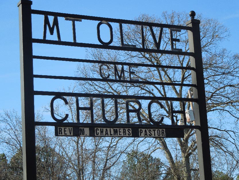
| Description | : | From the intersection of Getwell Rd. & I-269/MS-304, NE or Hernando, travel north on Getwell Rd. for 1.3 mi.; turning west (left) into the parking lot of the Mount Olive CME Church & to the cemetery to the north of the lot. |
frequently asked questions (FAQ):
-
Where is Mount Olive CME Church Cemetery?
Mount Olive CME Church Cemetery is located at 1919 Getwell Road Nesbit, DeSoto County ,Mississippi , 38651USA.
-
Mount Olive CME Church Cemetery cemetery's updated grave count on graveviews.com?
0 memorials
-
Where are the coordinates of the Mount Olive CME Church Cemetery?
Latitude: 34.8889750
Longitude: -89.9375850
Nearby Cemetories:
1. Bridgforth Cemetery #2
Pleasant Hill, DeSoto County, USA
Coordinate: 34.8828770, -89.9420470
2. Baker Family Cemetery
Pleasant Hill, DeSoto County, USA
Coordinate: 34.8793600, -89.9146300
3. Bridgforth Family Cemetery #1
Southhaven, DeSoto County, USA
Coordinate: 34.9106680, -89.9289170
4. Johnston Family Cemetery
Nesbit, DeSoto County, USA
Coordinate: 34.8726210, -89.9128810
5. Christian Church Cemetery
Hernando, DeSoto County, USA
Coordinate: 34.8608930, -89.9374030
6. Shiloh MB Church Cemetery
Southhaven, DeSoto County, USA
Coordinate: 34.9203610, -89.9195120
7. DeSoto Memorial Gardens
Southhaven, DeSoto County, USA
Coordinate: 34.9062800, -89.9784010
8. New Bethany Cemetery
Hernando, DeSoto County, USA
Coordinate: 34.8531000, -89.9547000
9. Saint Matthews Cemetery
Pleasant Hill, DeSoto County, USA
Coordinate: 34.8940840, -89.8864740
10. Banks Family Cemetery
Hernando, DeSoto County, USA
Coordinate: 34.8487500, -89.9628060
11. Bethlehem Cemetery
Nesbit, DeSoto County, USA
Coordinate: 34.8742630, -89.9898520
12. Slaughter Cemetery
Southaven, DeSoto County, USA
Coordinate: 34.9117790, -89.9874530
13. Bethlehem Baptist Church Cemetery
Hernando, DeSoto County, USA
Coordinate: 34.8747700, -89.9929200
14. Enon Springs Church Cemetery
DeSoto County, USA
Coordinate: 34.8456860, -89.9091190
15. New Hope Baptist Church Cemetery
Southaven, DeSoto County, USA
Coordinate: 34.9322450, -89.9663540
16. Greenview Memorial Gardens
Hernando, DeSoto County, USA
Coordinate: 34.8974920, -89.9981140
17. Oak Grove M.B. Church Cemetery
Nesbit, DeSoto County, USA
Coordinate: 34.8974750, -89.9982130
18. Pleasant Hill Community Cemetery
Pleasant Hill, DeSoto County, USA
Coordinate: 34.9184340, -89.8873670
19. New Jeremiah #2 Memorial Garden
Pleasant Hill (Frees Corners), DeSoto County, USA
Coordinate: 34.9182330, -89.8841640
20. Avery Chapel Cemetery
Southaven, DeSoto County, USA
Coordinate: 34.9331550, -89.9755330
21. Robinson Family Cemetery
Nesbit, DeSoto County, USA
Coordinate: 34.8876620, -90.0070020
22. Nesbit Cemetery
Hernando, DeSoto County, USA
Coordinate: 34.8872010, -90.0108340
23. Bakers Chapel Cemetery
Hernando, DeSoto County, USA
Coordinate: 34.8320430, -89.9114140
24. Knights Chapel CME Church Cemetery
Hernando, DeSoto County, USA
Coordinate: 34.8171990, -89.9371210