
| Memorials | : | 0 |
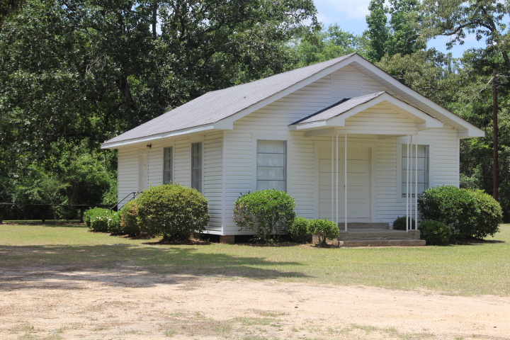
| Location | : | Mize, Smith County, USA |
| Coordinate | : | 31.8536400, -89.5126400 |
| Description | : | From Mize, MS proceed on Mississippi Highway 28 and Mississippi Highway 35 (MS 28 & MS 35) 3.1 miles (remaining on MS 28) to the intersection of Smith County Road 83A (SCR 83A.) Make a sharp Left (North) onto SCR 83A and continue six tenths of a mile until SCR 83A merges with Smith County Road 83 (SCR 83,) note SCR 83A will terminate at this point.) Continue on SCR 83 approximately 250 feet, cemetery will be on Left (West) side of road, specifically NE1/4 NE1/4, S8, T10N-R15W, Smith, Mize Quadrangle map USNG 16R BA 62319 27008 |
frequently asked questions (FAQ):
-
Where is Providence Baptist Church Cemetery?
Providence Baptist Church Cemetery is located at Smith County Road 83 Mize, Smith County ,Mississippi , 39116USA.
-
Providence Baptist Church Cemetery cemetery's updated grave count on graveviews.com?
0 memorials
-
Where are the coordinates of the Providence Baptist Church Cemetery?
Latitude: 31.8536400
Longitude: -89.5126400


Nearby Cemetories:
1. Jones Cemetery
Mize, Smith County, USA
Coordinate: 31.8704500, -89.5296100
2. Ed Sullivan Cemetery
Mize, Smith County, USA
Coordinate: 31.8439500, -89.5484300
3. Mize Cemetery
Mize, Smith County, USA
Coordinate: 31.8576794, -89.5548096
4. Pleasant Home Primitive Baptist Church Cemetery
Mize, Smith County, USA
Coordinate: 31.8905300, -89.5131000
5. Alex Sullivan Cemetery
Mize, Smith County, USA
Coordinate: 31.8249400, -89.5608000
6. Zion Hill Missionary Baptist Church Cemetery
Mize, Smith County, USA
Coordinate: 31.8359394, -89.5683136
7. Thomas F Sullivans Cemetery
Mize, Smith County, USA
Coordinate: 31.8335200, -89.5696100
8. Fairmount Waco Cemetery
Mize, Smith County, USA
Coordinate: 31.9001100, -89.5419200
9. Mozingo Cemetery
Smith County, USA
Coordinate: 31.9065342, -89.5250702
10. Old Miller Cemetery
Taylorsville, Smith County, USA
Coordinate: 31.8005409, -89.5008545
11. Pleasant Hills Mennonite Cemetery
Mize, Smith County, USA
Coordinate: 31.8613850, -89.5787720
12. Fellowship Cemetery
Taylorsville, Smith County, USA
Coordinate: 31.8302500, -89.4507000
13. Dry Ridge Church Cemetery
Mize, Smith County, USA
Coordinate: 31.9099860, -89.5295840
14. Old Zion Hill Cemetery
Mize, Smith County, USA
Coordinate: 31.7999900, -89.5438700
15. Byrd Cemetery
Mize, Smith County, USA
Coordinate: 31.8500920, -89.5831400
16. Mount Zion Baptist Church Cemetery
Taylorsville, Smith County, USA
Coordinate: 31.8816700, -89.4463196
17. New Liberty Landmark Baptist Church Cemetery
Smith County, USA
Coordinate: 31.7903500, -89.5116800
18. Rose Hill Cemetery
Mize, Smith County, USA
Coordinate: 31.8804100, -89.5848500
19. Harmony Baptist Church Cemetery
Mize, Smith County, USA
Coordinate: 31.9184190, -89.5370930
20. Speir Cemetery
Mize, Smith County, USA
Coordinate: 31.9158800, -89.4784100
21. Calvary Cemetery
Mize, Smith County, USA
Coordinate: 31.8526400, -89.6007700
22. Oak Grove Baptist Church Cemetery
Mize, Smith County, USA
Coordinate: 31.7933100, -89.5686700
23. Maranatha Baptist Cemetery
Mize, Smith County, USA
Coordinate: 31.8102880, -89.5921820
24. Lilly Valley Missionary Baptist Church Cemetery
Mount Olive, Covington County, USA
Coordinate: 31.7687740, -89.5074290