| Memorials | : | 104 |
| Location | : | Ashton-Under-Lyne, Metropolitan Borough of Tameside, England |
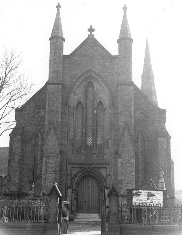
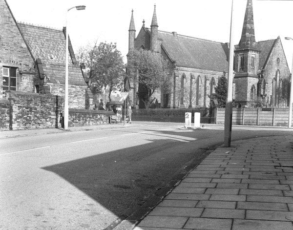
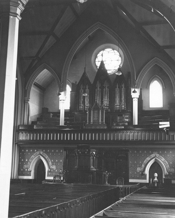
| Description | : | Queen Street Methodist Chapel was founded before 1840, the first burials here being in November 1841. Queen Street was renamed Queens Road circa 1932. The Chapel was closed in 1967, and then it was demolished. For a considerable time a green space occupied the site of the Chapel and it's grounds. Modern houses now occupy the site. The site is close to the junction with Whiteacre Road. On the opposite side of Queen's Road - between Whiteacre Road and Alderley Street - once stood the School attached to the Church. The School was built of stone, and originally would have... Read More |
frequently asked questions (FAQ):
-
Where is Queen's Road Methodist New Connection Chapel?
Queen's Road Methodist New Connection Chapel is located at No GPS information available Add GPSQueen's Road Ashton-Under-Lyne, Metropolitan Borough of Tameside ,Greater Manchester ,England.
-
Queen's Road Methodist New Connection Chapel cemetery's updated grave count on graveviews.com?
104 memorials
Nearby Cemetories:
1. Bethesda Methodist New Connexion
Dukinfield, Metropolitan Borough of Tameside, England
Coordinate: 53.4632891, -1.9958244
2. Dukinfield Cemetery and Crematorium
Dukinfield, Metropolitan Borough of Tameside, England
Coordinate: 53.4653300, -2.1101560
3. Dukinfield Old Chapel
Dukinfield, Metropolitan Borough of Tameside, England
Coordinate: 53.4753000, -2.1151700
4. St John's Churchyard
Dukinfield, Metropolitan Borough of Tameside, England
5. Mottram Cemetery
Mottram in Longdendale, Metropolitan Borough of Tameside, England
6. St. Michael Churchyard
Mottram in Longdendale, Metropolitan Borough of Tameside, England
7. Buried at the Crossroads
Ashton-Under-Lyne, Metropolitan Borough of Tameside, England
Coordinate: 53.5092100, -2.0332700
8. Christ Church
Ashton-Under-Lyne, Metropolitan Borough of Tameside, England
Coordinate: 53.5164000, -2.0486200
9. Hurst Cemetery
Ashton-Under-Lyne, Metropolitan Borough of Tameside, England
Coordinate: 53.5001310, -2.0812490
10. Methodist New Connexion Churchyard
Ashton-Under-Lyne, Metropolitan Borough of Tameside, England
Coordinate: 53.4820413, -2.0576195
11. St. Michaels and All Angels Churchyard
Ashton-Under-Lyne, Metropolitan Borough of Tameside, England
12. St. Peter's Churchyard
Ashton-Under-Lyne, Metropolitan Borough of Tameside, England
Coordinate: 53.4844700, -2.0538800
13. Hollingworth United Methodist Cemetery
Hollingworth, Metropolitan Borough of Tameside, England
Coordinate: 53.4632891, -1.9958244
14. Audenshaw Cemetery
Audenshaw, Metropolitan Borough of Tameside, England
Coordinate: 53.4653300, -2.1101560
15. Saint Stephens Churchyard
Audenshaw, Metropolitan Borough of Tameside, England
Coordinate: 53.4753000, -2.1151700
16. Haughton Green Wesleyan Chapel
Haughton Green, Metropolitan Borough of Tameside, England
17. St Mary Churchyard
Haughton Green, Metropolitan Borough of Tameside, England
18. Methodist New Connection
Mossley, Metropolitan Borough of Tameside, England
19. Mossley Cemetery
Mossley, Metropolitan Borough of Tameside, England
Coordinate: 53.5092100, -2.0332700
20. St. George Parish Churchyard
Mossley, Metropolitan Borough of Tameside, England
Coordinate: 53.5164000, -2.0486200
21. St. John the Evangelist Churchyard
Hurst, Metropolitan Borough of Tameside, England
Coordinate: 53.5001310, -2.0812490
22. Bethel Chapel Chapelyard
Stalybridge, Metropolitan Borough of Tameside, England
Coordinate: 53.4820413, -2.0576195
23. Independent Chapel
Stalybridge, Metropolitan Borough of Tameside, England
24. St George's Old Churchyard
Stalybridge, Metropolitan Borough of Tameside, England
Coordinate: 53.4844700, -2.0538800


