
| Memorials | : | 0 |
| Location | : | Rugby, Rugby Borough, England |
| Phone | : | (01788) 533715 |
| Website | : | www.rainsbrookcrematorium.co.uk/ |
| Coordinate | : | 52.3528167, -1.2465422 |
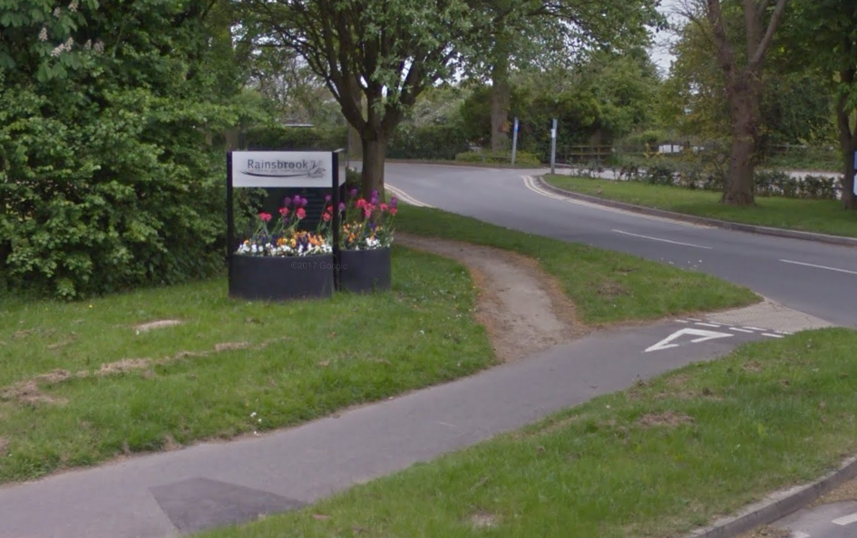
| Description | : | Rainsbrook Crematorium is a joint project between Rugby Borough Council and Daventry District Council. The crematorium is operated by Rugby Borough Council's bereavement services team on behalf of a joint committee which represents both authorities. The bereavement services team is based at Rainsbrook Cemetery and Crematorium. Rainsbrook Cemetery is owned and operated by Rugby Borough Council, along with four other cemeteries in Rugby. The bereavement services team is also responsible for the maintenance of six closed churchyards. Opening hours The reception at Rainsbrook opens from 9am to 5pm, Monday to Friday. Reception is closed on Saturdays, Sundays and public holidays. |
frequently asked questions (FAQ):
-
Where is Rainsbrook Cemetery and Crematorium?
Rainsbrook Cemetery and Crematorium is located at Ashlawn Road Rugby, Rugby Borough ,Warwickshire , CV22 5ETEngland.
-
Rainsbrook Cemetery and Crematorium cemetery's updated grave count on graveviews.com?
0 memorials
-
Where are the coordinates of the Rainsbrook Cemetery and Crematorium?
Latitude: 52.3528167
Longitude: -1.2465422
Nearby Cemetories:
1. St. Marie's Roman Catholic Church
Rugby, Rugby Borough, England
Coordinate: 52.3666391, -1.2642307
2. Clifton Road Cemetery
Rugby, Rugby Borough, England
Coordinate: 52.3722330, -1.2483020
3. Whinfield Cemetery
Rugby, Rugby Borough, England
Coordinate: 52.3718560, -1.2353290
4. Rugby School Chapel
Rugby, Rugby Borough, England
Coordinate: 52.3703890, -1.2639150
5. Watts Lane Cemetery
Rugby, Rugby Borough, England
Coordinate: 52.3592560, -1.2133530
6. St. Andrew's Churchyard
Rugby, Rugby Borough, England
Coordinate: 52.3726220, -1.2612630
7. Saint Marks Churchyard
Bilton, Rugby Borough, England
Coordinate: 52.3611920, -1.2854120
8. St. John's Baptist Churchyard
Hillmorton, Rugby Borough, England
Coordinate: 52.3659310, -1.2113290
9. Croop Hill Cemetery
Rugby, Rugby Borough, England
Coordinate: 52.3701510, -1.2829420
10. St Peter Churchyard
Dunchurch, Rugby Borough, England
Coordinate: 52.3372340, -1.2879220
11. St. Mary's Churchyard
Clifton upon Dunsmore, Rugby Borough, England
Coordinate: 52.3830220, -1.2208600
12. Dunchurch Baptist Churchyard
Dunchurch, Rugby Borough, England
Coordinate: 52.3393410, -1.2980990
13. St Mary's Parish Church
Barby, Daventry District, England
Coordinate: 52.3279870, -1.2041410
14. Clifton-Upon-Dunsmore Cemetery
Clifton upon Dunsmore, Rugby Borough, England
Coordinate: 52.3857800, -1.2197400
15. St. Michael & All Angels Churchyard
Rugby Borough, England
Coordinate: 52.3920240, -1.2540180
16. St Botolph's Churchyard
Rugby, Rugby Borough, England
Coordinate: 52.3895850, -1.2864420
17. St. Faith's Churchyard
Kilsby, Daventry District, England
Coordinate: 52.3356260, -1.1748520
18. A5 Watling Street Cemetery
Kilsby, Daventry District, England
Coordinate: 52.3363016, -1.1732250
19. St. John's Churchyard
Long Lawford, Rugby Borough, England
Coordinate: 52.3835940, -1.3071930
20. St. Nicholas Parish Churchyard
Willoughby, Rugby Borough, England
Coordinate: 52.3027580, -1.2446380
21. Lilbourne Burial Ground
Lilbourne, Daventry District, England
Coordinate: 52.3885400, -1.1792400
22. All Saints Churchyard
Lilbourne, Daventry District, England
Coordinate: 52.3919370, -1.1778810
23. St. Thomas Churchyard, Catthorpe
Catthorpe, Harborough District, England
Coordinate: 52.3986350, -1.1900710
24. St Peter's Churchyard
Grandborough, Rugby Borough, England
Coordinate: 52.2988800, -1.2791400