
| Memorials | : | 0 |
| Location | : | Hillmorton, Rugby Borough, England |
| Coordinate | : | 52.3659310, -1.2113290 |
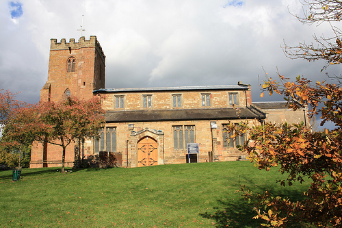
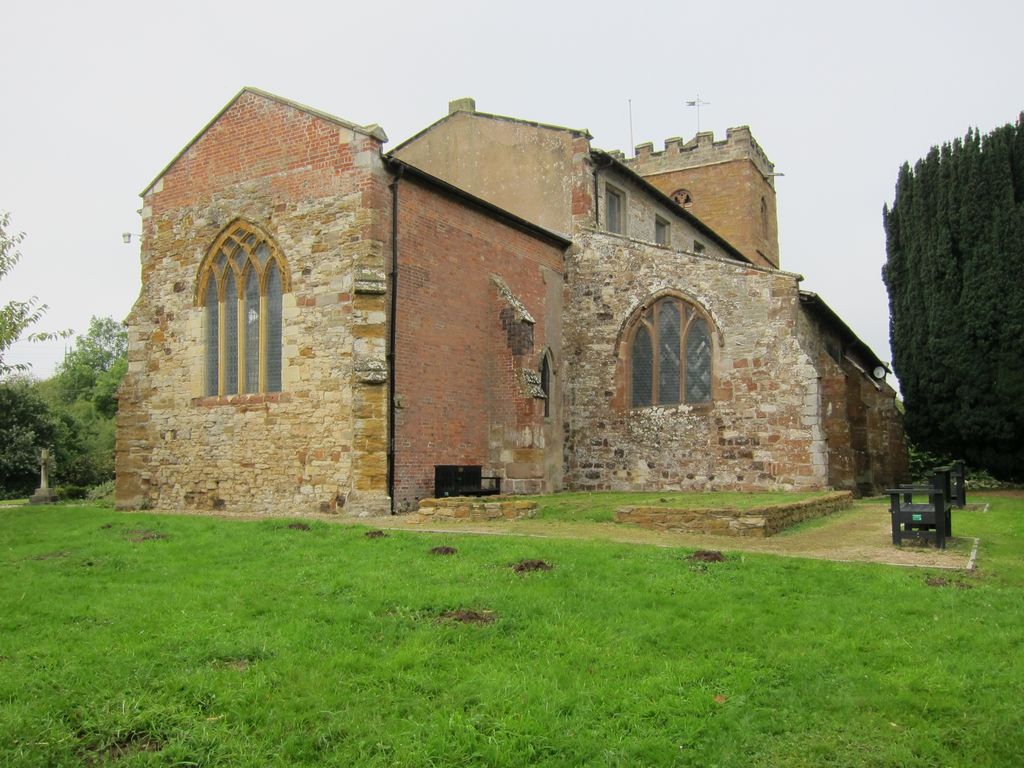
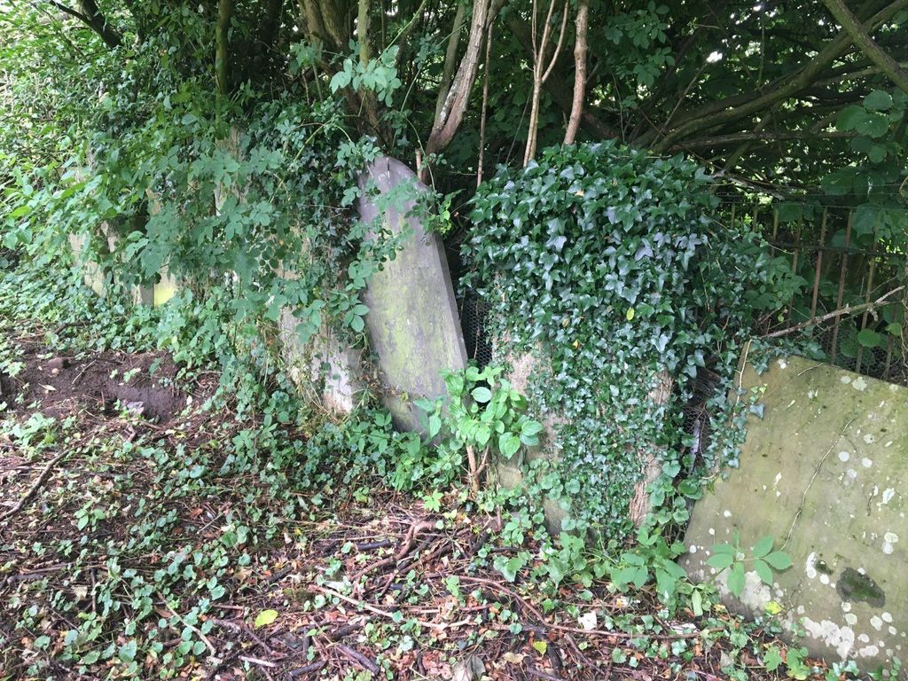
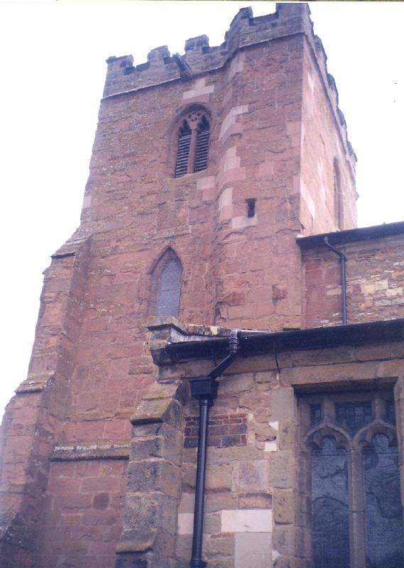
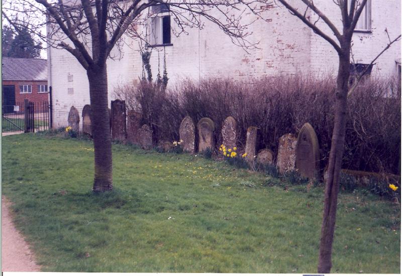
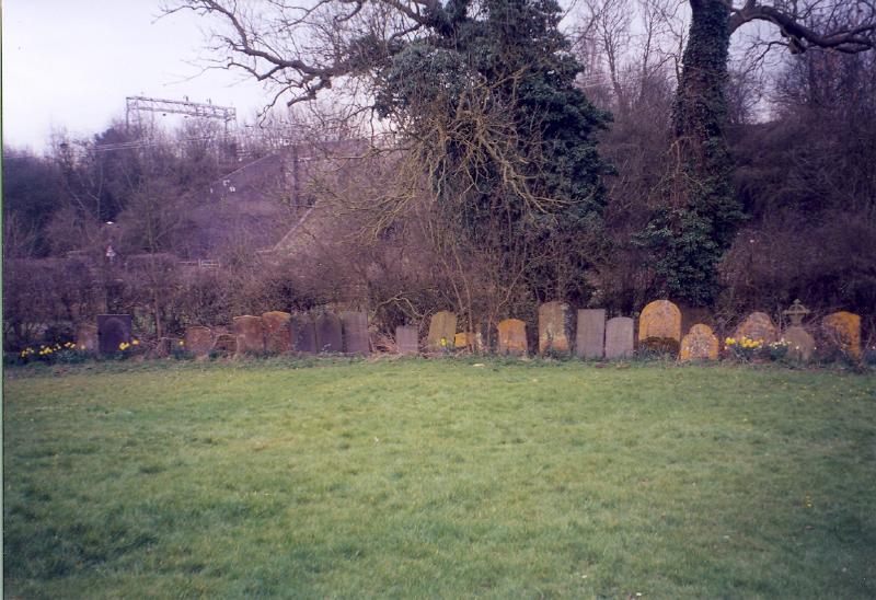
| Description | : | This church/cemetery is actually in Hillmorton. The older stones have been moved to the fenceline for easier maintenance of the church yard. The newer graves are on the back side of the church. |
frequently asked questions (FAQ):
-
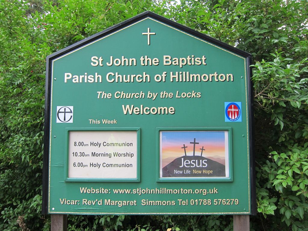
Where is St. John's Baptist Churchyard?
St. John's Baptist Churchyard is located at The Locks Hillmorton, Rugby Borough ,Warwickshire , CV21 4PPEngland.
-
St. John's Baptist Churchyard cemetery's updated grave count on graveviews.com?
0 memorials
-
Where are the coordinates of the St. John's Baptist Churchyard?
Latitude: 52.3659310
Longitude: -1.2113290
Nearby Cemetories:
1. Watts Lane Cemetery
Rugby, Rugby Borough, England
Coordinate: 52.3592560, -1.2133530
2. Whinfield Cemetery
Rugby, Rugby Borough, England
Coordinate: 52.3718560, -1.2353290
3. St. Mary's Churchyard
Clifton upon Dunsmore, Rugby Borough, England
Coordinate: 52.3830220, -1.2208600
4. Clifton-Upon-Dunsmore Cemetery
Clifton upon Dunsmore, Rugby Borough, England
Coordinate: 52.3857800, -1.2197400
5. Clifton Road Cemetery
Rugby, Rugby Borough, England
Coordinate: 52.3722330, -1.2483020
6. Rainsbrook Cemetery and Crematorium
Rugby, Rugby Borough, England
Coordinate: 52.3528167, -1.2465422
7. Lilbourne Burial Ground
Lilbourne, Daventry District, England
Coordinate: 52.3885400, -1.1792400
8. St. Andrew's Churchyard
Rugby, Rugby Borough, England
Coordinate: 52.3726220, -1.2612630
9. St. Marie's Roman Catholic Church
Rugby, Rugby Borough, England
Coordinate: 52.3666391, -1.2642307
10. Rugby School Chapel
Rugby, Rugby Borough, England
Coordinate: 52.3703890, -1.2639150
11. All Saints Churchyard
Lilbourne, Daventry District, England
Coordinate: 52.3919370, -1.1778810
12. St. Thomas Churchyard, Catthorpe
Catthorpe, Harborough District, England
Coordinate: 52.3986350, -1.1900710
13. St. Michael & All Angels Churchyard
Rugby Borough, England
Coordinate: 52.3920240, -1.2540180
14. St. Faith's Churchyard
Kilsby, Daventry District, England
Coordinate: 52.3356260, -1.1748520
15. A5 Watling Street Cemetery
Kilsby, Daventry District, England
Coordinate: 52.3363016, -1.1732250
16. St Mary's Parish Church
Barby, Daventry District, England
Coordinate: 52.3279870, -1.2041410
17. Greenhaven Woodland Burial Ground
Lilbourne, Daventry District, England
Coordinate: 52.3881390, -1.1545970
18. Croop Hill Cemetery
Rugby, Rugby Borough, England
Coordinate: 52.3701510, -1.2829420
19. Saint Marks Churchyard
Bilton, Rugby Borough, England
Coordinate: 52.3611920, -1.2854120
20. All Saints Churchyard
Shawell, Harborough District, England
Coordinate: 52.4123910, -1.2055290
21. St. Margaret Churchyard
Crick, Daventry District, England
Coordinate: 52.3476230, -1.1378110
22. Swinford cemetery
Swinford, Harborough District, England
Coordinate: 52.4088297, -1.1695096
23. Crick United Reformed Churchyard
Crick, Daventry District, England
Coordinate: 52.3469872, -1.1339944
24. St Botolph's Churchyard
Rugby, Rugby Borough, England
Coordinate: 52.3895850, -1.2864420