
| Memorials | : | 0 |
| Location | : | Bilton, Rugby Borough, England |
| Coordinate | : | 52.3611920, -1.2854120 |
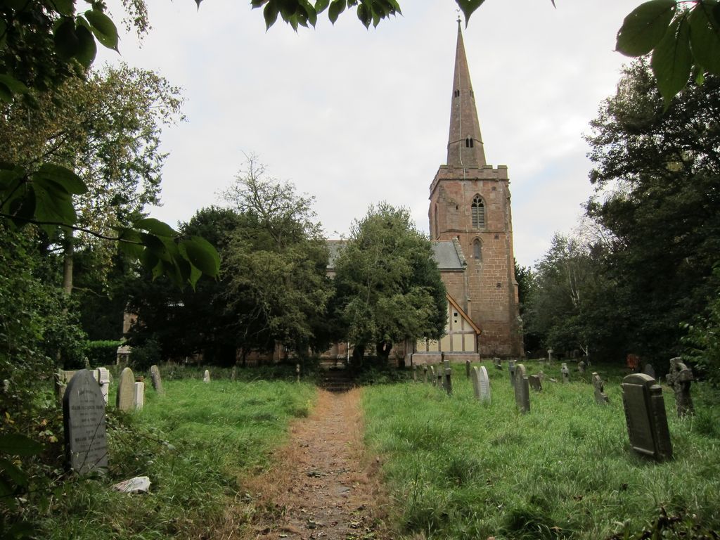
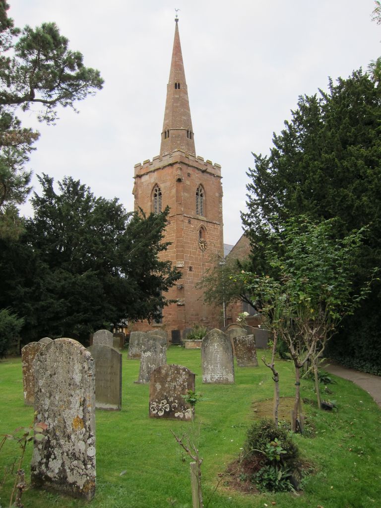
| Description | : | Bilton is an area of Rugby in Warwickshire and a ward of the Borough of Rugby. Bilton's name is derived from the Anglo-Saxon Beolatun (Beola's town), and it was mentioned in the Domesday Book as both Beltone and Bentone. Bilton was officially merged into the borough of Rugby in 1932. The old village centre of Bilton still survives and is located about 1.5 miles from Rugby town centre. The village green of Bilton contains the remains of an ancient cross and stocks. There has been a worshipping congregation in Bilton for at least 900 years. Way back in 1086 the... Read More |
frequently asked questions (FAQ):
-
Where is Saint Marks Churchyard?
Saint Marks Churchyard is located at Pool Close Bilton, Rugby Borough ,Warwickshire , CV22 7RNEngland.
-
Saint Marks Churchyard cemetery's updated grave count on graveviews.com?
0 memorials
-
Where are the coordinates of the Saint Marks Churchyard?
Latitude: 52.3611920
Longitude: -1.2854120
Nearby Cemetories:
1. Croop Hill Cemetery
Rugby, Rugby Borough, England
Coordinate: 52.3701510, -1.2829420
2. St. Marie's Roman Catholic Church
Rugby, Rugby Borough, England
Coordinate: 52.3666391, -1.2642307
3. Rugby School Chapel
Rugby, Rugby Borough, England
Coordinate: 52.3703890, -1.2639150
4. St. Andrew's Churchyard
Rugby, Rugby Borough, England
Coordinate: 52.3726220, -1.2612630
5. Dunchurch Baptist Churchyard
Dunchurch, Rugby Borough, England
Coordinate: 52.3393410, -1.2980990
6. St Peter Churchyard
Dunchurch, Rugby Borough, England
Coordinate: 52.3372340, -1.2879220
7. Rainsbrook Cemetery and Crematorium
Rugby, Rugby Borough, England
Coordinate: 52.3528167, -1.2465422
8. Clifton Road Cemetery
Rugby, Rugby Borough, England
Coordinate: 52.3722330, -1.2483020
9. St. John's Churchyard
Long Lawford, Rugby Borough, England
Coordinate: 52.3835940, -1.3071930
10. St Botolph's Churchyard
Rugby, Rugby Borough, England
Coordinate: 52.3895850, -1.2864420
11. Whinfield Cemetery
Rugby, Rugby Borough, England
Coordinate: 52.3718560, -1.2353290
12. St. Michael & All Angels Churchyard
Rugby Borough, England
Coordinate: 52.3920240, -1.2540180
13. St Peter's Churchyard
Church Lawford, Rugby Borough, England
Coordinate: 52.3832600, -1.3355600
14. Watts Lane Cemetery
Rugby, Rugby Borough, England
Coordinate: 52.3592560, -1.2133530
15. St. Mary's Churchyard
Clifton upon Dunsmore, Rugby Borough, England
Coordinate: 52.3830220, -1.2208600
16. St. John's Baptist Churchyard
Hillmorton, Rugby Borough, England
Coordinate: 52.3659310, -1.2113290
17. Clifton-Upon-Dunsmore Cemetery
Clifton upon Dunsmore, Rugby Borough, England
Coordinate: 52.3857800, -1.2197400
18. All Saints Church
Harborough Magna, Rugby Borough, England
Coordinate: 52.4092160, -1.3007650
19. Harborough Magna Cemetery
Harborough Magna, Rugby Borough, England
Coordinate: 52.4094260, -1.3021660
20. St Peters Churchyard
Bourton on Dunsmore, Rugby Borough, England
Coordinate: 52.3285270, -1.3612930
21. St Mary's Parish Church
Barby, Daventry District, England
Coordinate: 52.3279870, -1.2041410
22. St Peter's Churchyard
Grandborough, Rugby Borough, England
Coordinate: 52.2988800, -1.2791400
23. St. Nicholas Parish Churchyard
Willoughby, Rugby Borough, England
Coordinate: 52.3027580, -1.2446380
24. Holy Trinity Churchyard
Churchover, Rugby Borough, England
Coordinate: 52.4229460, -1.2506850