
| Memorials | : | 0 |
| Location | : | Atwood, Kenton County, USA |
| Coordinate | : | 38.8822900, -84.5001830 |
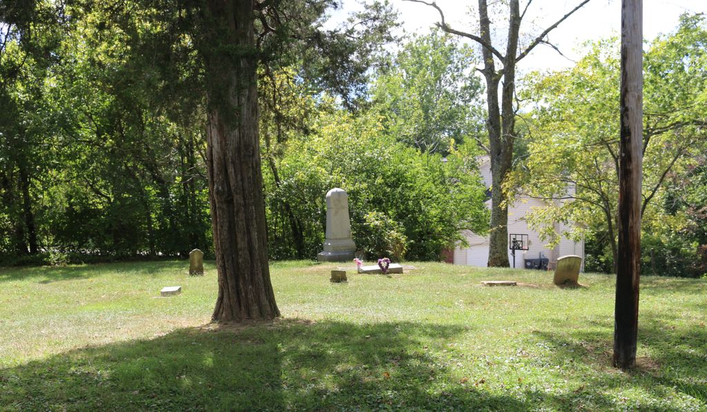
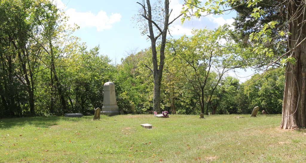
| Description | : | The cemetery is located on the north side of Rector Road about 0.3 miles east of its intersection with Moffett Road (Kentucky 2042). The cemetery is listed as Rector Cemetery on page 76 of Small Kenton County, Kentucky, Cemeteries, published by the Kenton County Historical Society, Cemetery Committee, and on page 76 of Kenton County Cemeteries, published by the Kenton County Historical Society, Covington, Kentucky, 1981. The cemetery inscriptions were recorded on 18 September 1977, reporting 12 graves identifiable by inscription and 1 unidentifiable grave. The cemetery location is given as latitude 39° 52’ 57” and longitude 84°... Read More |
frequently asked questions (FAQ):
-
Where is Rector Cemetery?
Rector Cemetery is located at 3280 Rector Road Atwood, Kenton County ,Kentucky , 41063USA.
-
Rector Cemetery cemetery's updated grave count on graveviews.com?
0 memorials
-
Where are the coordinates of the Rector Cemetery?
Latitude: 38.8822900
Longitude: -84.5001830
Nearby Cemetories:
1. Bravard Cemetery
Independence, Kenton County, USA
Coordinate: 38.8780560, -84.5100000
2. Callen Cemetery
Independence, Kenton County, USA
Coordinate: 38.8850000, -84.5266670
3. Young Cemetery
Morning View, Kenton County, USA
Coordinate: 38.8664017, -84.5239029
4. Pelley Cemetery
Kenton, Kenton County, USA
Coordinate: 38.8638890, -84.4791670
5. Rapp Cemetery
Visalia, Kenton County, USA
Coordinate: 38.8869440, -84.4677780
6. Adams Cemetery
Visalia, Kenton County, USA
Coordinate: 38.9088889, -84.4861111
7. Schwall Cemetery
Morning View, Kenton County, USA
Coordinate: 38.8875000, -84.4633330
8. Armstrong Cemetery #1
Nicholson, Kenton County, USA
Coordinate: 38.8961111, -84.5338889
9. Ragan Cemetery
Kenton, Kenton County, USA
Coordinate: 38.8569440, -84.4791670
10. Hoffman Cemetery
Independence, Kenton County, USA
Coordinate: 38.9102777, -84.5200000
11. Bird Cemetery
Independence, Kenton County, USA
Coordinate: 38.9027780, -84.5327780
12. Roberts Cemetery
Kenton, Kenton County, USA
Coordinate: 38.8686110, -84.4611110
13. Bruce Cemetery
Morning View, Kenton County, USA
Coordinate: 38.8571885, -84.4714651
14. Simmons Cemetery
Visalia, Kenton County, USA
Coordinate: 38.9069440, -84.4677780
15. Hall Cemetery
Visalia, Kenton County, USA
Coordinate: 38.8763890, -84.4527780
16. John Baker Cemetery
Claryville, Campbell County, USA
Coordinate: 38.8759500, -84.4461170
17. Faulkner Cemetery
Independence, Kenton County, USA
Coordinate: 38.9166670, -84.5333330
18. Grizzell Family Cemetery
Independence, Kenton County, USA
Coordinate: 38.9260320, -84.5089030
19. Winston Cemetery
Kenton, Kenton County, USA
Coordinate: 38.9030560, -84.4438890
20. Harrisburg Hill Cemetery
Claryville, Campbell County, USA
Coordinate: 38.8885340, -84.4318870
21. Notley Maddox Slave Cemetery
Claryville, Campbell County, USA
Coordinate: 38.9083320, -84.4394440
22. Cruises Creek Baptist Church Cemetery
Kenton County, USA
Coordinate: 38.8788730, -84.5694070
23. Stephens Cemetery
Ryland Heights, Kenton County, USA
Coordinate: 38.9374570, -84.4977570
24. Notley Maddox Cemetery
Claryville, Campbell County, USA
Coordinate: 38.9094450, -84.4375010