
| Memorials | : | 0 |
| Location | : | Independence, Kenton County, USA |
| Coordinate | : | 38.9102777, -84.5200000 |
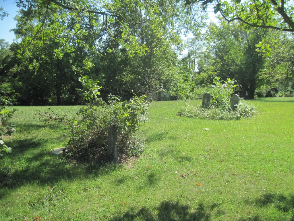
| Description | : | The cemetery is listed as Hoffman Cemetery (J. M. Hoffman) on page 41 of Small Kenton County, Kentucky, Cemeteries, published by the Kenton County Historical Society, Cemetery Committee, and on page 41 of Kenton County Cemeteries, published by the Kenton County Historical Society, Covington, Kentucky, 1981. The cemetery inscriptions were recorded in October 1978, reporting 5 graves identifiable by inscription and no unidentifiable graves. The cemetery location is given as latitude 38° 54’ 10” and longitude 84° 31’ 10” in the Independence Quadrangle. The cemetery location is described as “Riggs Rd .5 mi SE of Rt 16”. The... Read More |
frequently asked questions (FAQ):
-
Where is Hoffman Cemetery?
Hoffman Cemetery is located at 12001 – 12043 Riggs Road Independence, Kenton County ,Kentucky , 41051USA.
-
Hoffman Cemetery cemetery's updated grave count on graveviews.com?
0 memorials
-
Where are the coordinates of the Hoffman Cemetery?
Latitude: 38.9102777
Longitude: -84.5200000
Nearby Cemetories:
1. Faulkner Cemetery
Independence, Kenton County, USA
Coordinate: 38.9166670, -84.5333330
2. Bird Cemetery
Independence, Kenton County, USA
Coordinate: 38.9027780, -84.5327780
3. Armstrong Cemetery #1
Nicholson, Kenton County, USA
Coordinate: 38.8961111, -84.5338889
4. Grizzell Family Cemetery
Independence, Kenton County, USA
Coordinate: 38.9260320, -84.5089030
5. Callen Cemetery
Independence, Kenton County, USA
Coordinate: 38.8850000, -84.5266670
6. Adams Cemetery
Visalia, Kenton County, USA
Coordinate: 38.9088889, -84.4861111
7. Independence Cemetery
Independence, Kenton County, USA
Coordinate: 38.9364014, -84.5419006
8. Rector Cemetery
Atwood, Kenton County, USA
Coordinate: 38.8822900, -84.5001830
9. Stephens Cemetery
Ryland Heights, Kenton County, USA
Coordinate: 38.9374570, -84.4977570
10. Bravard Cemetery
Independence, Kenton County, USA
Coordinate: 38.8780560, -84.5100000
11. McCollum Cemetery
Independence, Kenton County, USA
Coordinate: 38.9431490, -84.5350520
12. Saint Cecilias Cemetery
Independence, Kenton County, USA
Coordinate: 38.9397011, -84.5466995
13. Petty Cemetery
Ryland, Kenton County, USA
Coordinate: 38.9391000, -84.4847100
14. Simmons Cemetery
Visalia, Kenton County, USA
Coordinate: 38.9069440, -84.4677780
15. Young Cemetery
Morning View, Kenton County, USA
Coordinate: 38.8664017, -84.5239029
16. Pruett - Mardis Cemetery
Independence, Kenton County, USA
Coordinate: 38.9463900, -84.4817100
17. Rapp Cemetery
Visalia, Kenton County, USA
Coordinate: 38.8869440, -84.4677780
18. Ashford Road Cemetery
Independence, Kenton County, USA
Coordinate: 38.9528850, -84.4892100
19. Schwall Cemetery
Morning View, Kenton County, USA
Coordinate: 38.8875000, -84.4633330
20. Cruises Creek Baptist Church Cemetery
Kenton County, USA
Coordinate: 38.8788730, -84.5694070
21. B'Hymer Cemetery
Independence, Kenton County, USA
Coordinate: 38.9525000, -84.5575000
22. Pelly Cemetery
Latonia Lakes, Kenton County, USA
Coordinate: 38.9611110, -84.5294440
23. Klette Cemetery
Latonia Lakes, Kenton County, USA
Coordinate: 38.9616670, -84.4944400
24. Minter Cemetery
Covington, Kenton County, USA
Coordinate: 38.9642300, -84.5055100