
| Memorials | : | 15 |
| Location | : | Lick Skillet, Decatur County, USA |
| Coordinate | : | 35.4700840, -88.1787990 |
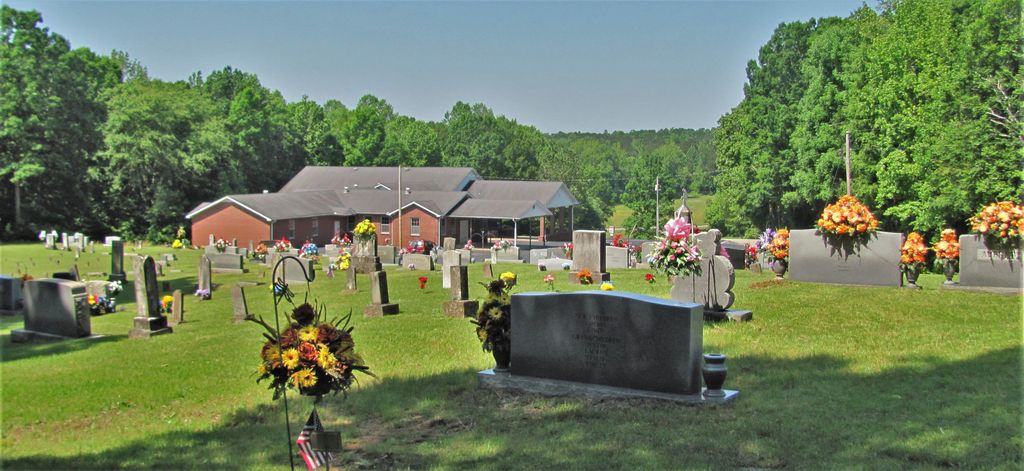
| Description | : | From intersection of US-641 & W. Main St., SW of Decaturville, Travel south on US-641 for 3.4 mi.; turning west (right) onto TN-202 S/Brooksie Thompson Rd, then south (left), going 5.1 mi.; turning west (right) onto TN-114 S, going 1.5 mi.; turning north (right) onto Red Walnut Rd., going 0.2 mi. to the cemetery on the east (right), just past the Red Walnut Ch. of Christ. This is a well maintained cemetery located just off State Highway 114 between Scotts Hill and Bath Springs. It was listed as "unnamed" cemetery indicated on the U.S.G.S. Thurman quadrangle (1972) just west of... Read More |
frequently asked questions (FAQ):
-
Where is Red Walnut Church Cemetery?
Red Walnut Church Cemetery is located at Red Walnut Road Lick Skillet, Decatur County ,Tennessee ,USA.
-
Red Walnut Church Cemetery cemetery's updated grave count on graveviews.com?
15 memorials
-
Where are the coordinates of the Red Walnut Church Cemetery?
Latitude: 35.4700840
Longitude: -88.1787990
Nearby Cemetories:
1. Murphy Cemetery
Lick Skillet, Decatur County, USA
Coordinate: 35.4806930, -88.1983720
2. Pleasant Hill Church Cemetery
Bath Springs, Decatur County, USA
Coordinate: 35.4839610, -88.1511390
3. Montgomery Family Cemetery
Pleasant Hill, Decatur County, USA
Coordinate: 35.4833090, -88.1495630
4. Lafferty Cemetery
Bath Springs, Decatur County, USA
Coordinate: 35.4673620, -88.1414970
5. Patterson Cemetery
Lick Skillet, Decatur County, USA
Coordinate: 35.4383800, -88.1979020
6. Gray's Chapel Cemetery
Decaturville, Decatur County, USA
Coordinate: 35.5019030, -88.1590860
7. Liberty Church Cemetery
Scotts Hill, Decatur County, USA
Coordinate: 35.4466050, -88.2146570
8. Gardner - Wylie Cemetery
Bath Springs, Decatur County, USA
Coordinate: 35.4370190, -88.1558690
9. Decatur County Farm Cemetery
Scotts Hill, Decatur County, USA
Coordinate: 35.5078697, -88.1940994
10. Johnston Cemetery
Bath Springs, Decatur County, USA
Coordinate: 35.4735080, -88.1287780
11. Butler Cemetery
Bath Springs, Decatur County, USA
Coordinate: 35.4525690, -88.1296430
12. Martin Family Cemetery
Decaturville, Decatur County, USA
Coordinate: 35.5139160, -88.1882440
13. Crawford Cemetery
Scotts Hill, Decatur County, USA
Coordinate: 35.5141550, -88.1882830
14. Keeton Cemetery
Dunbar, Decatur County, USA
Coordinate: 35.4644650, -88.1232290
15. Bethel Cemetery
Scotts Hill, Decatur County, USA
Coordinate: 35.4963690, -88.2320790
16. Simmons Cemetery
Bath Springs, Decatur County, USA
Coordinate: 35.4608130, -88.1171330
17. Brasher Cemetery
Bath Springs, Decatur County, USA
Coordinate: 35.4432640, -88.1192950
18. Doe Creek Cemetery
Scotts Hill, Henderson County, USA
Coordinate: 35.4692990, -88.2474350
19. Averett Cemetery
Decatur County, USA
Coordinate: 35.5247002, -88.1594009
20. Ivey Cemetery
Decaturville, Decatur County, USA
Coordinate: 35.4930320, -88.1142620
21. Slater Cemetery
Decatur County, USA
Coordinate: 35.4874992, -88.1117020
22. Scotts Hill Pentecostal Church Cemetery
Scotts Hill, Decatur County, USA
Coordinate: 35.5065610, -88.2336080
23. Lowery-Doe Creek Cemetery
Decatur County, USA
Coordinate: 35.4483120, -88.2468900
24. Corinth Church Cemetery
Decatur County, USA
Coordinate: 35.4126020, -88.2056180