
| Memorials | : | 398 |
| Location | : | Decatur County, USA |
| Coordinate | : | 35.4126020, -88.2056180 |
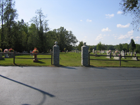
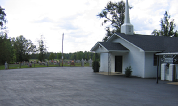
| Description | : | From the intersection of Liberty Rd. & TN-69, near Saltillo, travel north on Liberty Rd. for 2.1 mi.; turning southwest (hard left) onto Kincannon Rd., going 0.6 mi., turning south (left) onto Corinth Church Rd. going 0.4 mi., passing the Corinth Methodist Church & to the cemetery behind. Corinth Cemetery is located on Corinth Church Lane off Kincannon Rd. in the Doe Creek watershed in southwestern Decatur County. The cemetery is shown on the U.S.G.S. Thurman quadrangle (1972). The cemetery is well maintained. Concrete blocks mark graves without inscribed markers. |
frequently asked questions (FAQ):
-
Where is Corinth Church Cemetery?
Corinth Church Cemetery is located at Corinth Church Road Decatur County ,Tennessee ,USA.
-
Corinth Church Cemetery cemetery's updated grave count on graveviews.com?
398 memorials
-
Where are the coordinates of the Corinth Church Cemetery?
Latitude: 35.4126020
Longitude: -88.2056180
Nearby Cemetories:
1. Patterson Cemetery
Lick Skillet, Decatur County, USA
Coordinate: 35.4383800, -88.1979020
2. Shannon Cemetery
Decatur County, USA
Coordinate: 35.3916230, -88.1832190
3. Liberty Church Cemetery
Scotts Hill, Decatur County, USA
Coordinate: 35.4466050, -88.2146570
4. Kelley Cemetery
Bath Springs, Decatur County, USA
Coordinate: 35.4037640, -88.1532630
5. Gardner - Wylie Cemetery
Bath Springs, Decatur County, USA
Coordinate: 35.4370190, -88.1558690
6. Carter Cemetery
Hardin County, USA
Coordinate: 35.3731003, -88.2407990
7. Lowery-Doe Creek Cemetery
Decatur County, USA
Coordinate: 35.4483120, -88.2468900
8. Red Walnut Church Cemetery
Lick Skillet, Decatur County, USA
Coordinate: 35.4700840, -88.1787990
9. Altom Cemetery
Decatur County, USA
Coordinate: 35.4169006, -88.1280975
10. Doe Creek Cemetery
Scotts Hill, Henderson County, USA
Coordinate: 35.4692990, -88.2474350
11. Sardis Cemetery
Sardis, Henderson County, USA
Coordinate: 35.4366020, -88.2833100
12. Murphy Cemetery
Lick Skillet, Decatur County, USA
Coordinate: 35.4806930, -88.1983720
13. Prospect Church Cemetery
Sardis, Henderson County, USA
Coordinate: 35.4584950, -88.2683120
14. Union Cemetery
Decatur County, USA
Coordinate: 35.4150009, -88.1213989
15. Butler Cemetery
Bath Springs, Decatur County, USA
Coordinate: 35.4525690, -88.1296430
16. Cawthon Cemetery
Hookers Bend, Hardin County, USA
Coordinate: 35.3403550, -88.2329100
17. Lafferty Cemetery
Bath Springs, Decatur County, USA
Coordinate: 35.4673620, -88.1414970
18. Brasher Cemetery
Bath Springs, Decatur County, USA
Coordinate: 35.4432640, -88.1192950
19. Hanna Cemetery
Hinkle, Hardin County, USA
Coordinate: 35.3991600, -88.3006680
20. Connelly Cemetery
Grandview, Hardin County, USA
Coordinate: 35.3733560, -88.1203440
21. Oakland Cemetery
Hookers Bend, Hardin County, USA
Coordinate: 35.3298870, -88.2166980
22. Pleasant Hill Church Cemetery
Bath Springs, Decatur County, USA
Coordinate: 35.4839610, -88.1511390
23. McCall Cemetery
Hardin County, USA
Coordinate: 35.3838997, -88.1085968
24. Montgomery Family Cemetery
Pleasant Hill, Decatur County, USA
Coordinate: 35.4833090, -88.1495630