
| Memorials | : | 48 |
| Location | : | Scotts Hill, Decatur County, USA |
| Coordinate | : | 35.5065610, -88.2336080 |
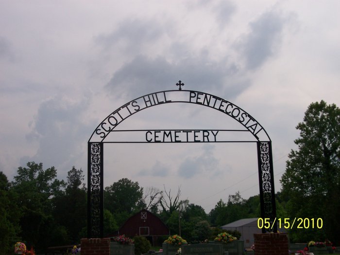
| Description | : | This cemetery was established in the 1950s. It is indicated on the U.S.G.S. Scotts Hill quadrangle (1986) as a small unnamed cemetery on to Highway 114, just southeast of Scotts Hill near the headwaters of Rushing Creek. It is maintained very well. David Donahue recorded this cemetery in 1992 and checked and updated it in 2001. An earlier record of this cemetery was made by Alexander and Tuten in 1977. |
frequently asked questions (FAQ):
-
Where is Scotts Hill Pentecostal Church Cemetery?
Scotts Hill Pentecostal Church Cemetery is located at 9317 TN-114 Scotts Hill, Decatur County ,Tennessee , 38374USA.
-
Scotts Hill Pentecostal Church Cemetery cemetery's updated grave count on graveviews.com?
48 memorials
-
Where are the coordinates of the Scotts Hill Pentecostal Church Cemetery?
Latitude: 35.5065610
Longitude: -88.2336080
Nearby Cemetories:
1. Bethel Cemetery
Scotts Hill, Decatur County, USA
Coordinate: 35.4963690, -88.2320790
2. Grandsire Holmes Cemetery
Scotts Hill, Henderson County, USA
Coordinate: 35.5140820, -88.2483620
3. Scotts Hill Church Cemetery
Scotts Hill, Henderson County, USA
Coordinate: 35.5189480, -88.2463960
4. Peace Chapel Cemetery
Scotts Hill, Decatur County, USA
Coordinate: 35.5214060, -88.2206280
5. Fellowship Church Cemetery
Scotts Hill, Henderson County, USA
Coordinate: 35.4965940, -88.2602540
6. Pafford - Scotts Hill Cemetery
Scotts Hill, Henderson County, USA
Coordinate: 35.5265450, -88.2515290
7. Decatur County Farm Cemetery
Scotts Hill, Decatur County, USA
Coordinate: 35.5078697, -88.1940994
8. Granny Austin Cemetery
Scotts Hill, Henderson County, USA
Coordinate: 35.4949850, -88.2734300
9. Pratt Cemetery
Decaturville, Decatur County, USA
Coordinate: 35.5403540, -88.2231060
10. Chumney Cemetery
Scotts Hill, Henderson County, USA
Coordinate: 35.5423140, -88.2460590
11. Martin Family Cemetery
Decaturville, Decatur County, USA
Coordinate: 35.5139160, -88.1882440
12. Crawford Cemetery
Scotts Hill, Decatur County, USA
Coordinate: 35.5141550, -88.1882830
13. Cedar Grove Pentecostal Cemetery
Sardis, Henderson County, USA
Coordinate: 35.4829530, -88.2698440
14. Cedar Grove Cemetery
Henderson County, USA
Coordinate: 35.4799600, -88.2678900
15. Murphy Cemetery
Lick Skillet, Decatur County, USA
Coordinate: 35.4806930, -88.1983720
16. Flat Creek Cemetery
Scotts Hill, Decatur County, USA
Coordinate: 35.5450790, -88.2404150
17. Doe Creek Cemetery
Scotts Hill, Henderson County, USA
Coordinate: 35.4692990, -88.2474350
18. Morgan Family Cemetery
Decaturville, Decatur County, USA
Coordinate: 35.5343740, -88.1975940
19. Ebenezer Cemetery
Henderson County, USA
Coordinate: 35.5353940, -88.2887670
20. Davis Cemetery
Decatur County, USA
Coordinate: 35.5374985, -88.1800003
21. Prospect Church Cemetery
Sardis, Henderson County, USA
Coordinate: 35.4584950, -88.2683120
22. Mount Zion Church Cemetery
Decaturville, Decatur County, USA
Coordinate: 35.5583800, -88.2029190
23. Red Walnut Church Cemetery
Lick Skillet, Decatur County, USA
Coordinate: 35.4700840, -88.1787990
24. Lowery-Doe Creek Cemetery
Decatur County, USA
Coordinate: 35.4483120, -88.2468900