
| Memorials | : | 2 |
| Location | : | Roll, Blackford County, USA |
| Coordinate | : | 40.5520287, -85.3950500 |
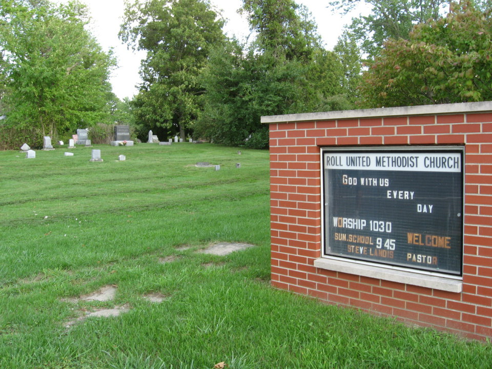
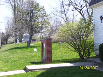
| Description | : | The Roll Cemetery is located on SR18 in Blackford County. It is just inside the city limits,on the East side. Located at the Church. It is very well kept. The cemetery is located in Washington Township (NW quadrant of the NE quadrant of the NE quadrant of Section 9 Township 24N Range 10E) on the south side of Indiana State Route 18 ( W County Road 700 N) about 0.25 miles west of its intersection with N County Road 100 W. Indiana Cemetery Locations, Volume 2, published by the Indiana Genealogical Society (01 April 2006), gives the primary... Read More |
frequently asked questions (FAQ):
-
Where is Roll Cemetery?
Roll Cemetery is located at State Road 18 Roll, Blackford County ,Indiana , 47348USA.
-
Roll Cemetery cemetery's updated grave count on graveviews.com?
1 memorials
-
Where are the coordinates of the Roll Cemetery?
Latitude: 40.5520287
Longitude: -85.3950500
Nearby Cemetories:
1. Schmidt Cemetery
Roll, Blackford County, USA
Coordinate: 40.5585136, -85.3850555
2. Lockett Cemetery
Washington Township, Blackford County, USA
Coordinate: 40.5565240, -85.3756020
3. Center Cemetery
Roll, Blackford County, USA
Coordinate: 40.5305430, -85.3895290
4. Kelly Cemetery
Washington Township, Blackford County, USA
Coordinate: 40.5342770, -85.4191110
5. Balsley Cemetery
Hartford City, Blackford County, USA
Coordinate: 40.5635750, -85.4321520
6. Asbury United Methodist Cemetery
Wells County, USA
Coordinate: 40.5816650, -85.3722229
7. Stoll Cemetery
Washington Township, Blackford County, USA
Coordinate: 40.5046980, -85.3868470
8. Oak Chapel Cemetery
Upland, Grant County, USA
Coordinate: 40.5324135, -85.4578934
9. Wright Cemetery
Jeff, Wells County, USA
Coordinate: 40.6030998, -85.3469009
10. Leffler Cemetery
Washington Township, Blackford County, USA
Coordinate: 40.4996400, -85.4454880
11. Penrod Cemetery
Montpelier, Blackford County, USA
Coordinate: 40.5161781, -85.3231201
12. Herbaugh Cemetery
Hartford City, Blackford County, USA
Coordinate: 40.5008200, -85.3390700
13. Levengood Cemetery
Upland, Grant County, USA
Coordinate: 40.5080643, -85.4653931
14. Shields Cemetery
Hartford City, Blackford County, USA
Coordinate: 40.4822830, -85.4018490
15. Farrville Cemetery
Van Buren, Grant County, USA
Coordinate: 40.5816994, -85.4803009
16. Miles Cemetery
Hartford City, Blackford County, USA
Coordinate: 40.4795303, -85.4271317
17. Miller Cemetery
Jeff, Wells County, USA
Coordinate: 40.6203000, -85.3484900
18. Doyle Cemetery
Grant County, USA
Coordinate: 40.5942400, -85.4810890
19. Brookside Cemetery
Montpelier, Blackford County, USA
Coordinate: 40.5628500, -85.2878300
20. Odd Fellows Cemetery
Montpelier, Blackford County, USA
Coordinate: 40.5650400, -85.2878760
21. Saint Johns Catholic Cemetery
Montpelier, Blackford County, USA
Coordinate: 40.5661400, -85.2876000
22. Batson Cemetery
McNatts, Wells County, USA
Coordinate: 40.6333008, -85.3644028
23. Hults Cemetery
Upland, Grant County, USA
Coordinate: 40.5224020, -85.5048540
24. Jones Cemetery
Wells County, USA
Coordinate: 40.6391983, -85.3731003