
| Memorials | : | 0 |
| Location | : | Burlington, Racine County, USA |
| Coordinate | : | 42.6974983, -88.2925034 |
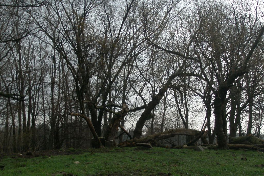
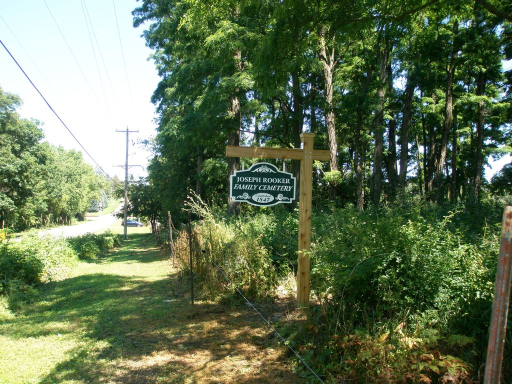
| Description | : | Rooker Cemetery is a one-acre cemetery located on Spring Prairie Road east of the Honey Creek bridge. The property was originally purchased in 1837 by Joseph C. Rooker. The first known burial took place in 1847 and the last known burial was in 1899. In 2012, ownership of the cemetery was transferred to the Burlington Historical Society. |
frequently asked questions (FAQ):
-
Where is Rooker Cemetery?
Rooker Cemetery is located at Spring Prairie Road Burlington, Racine County ,Wisconsin , 53105USA.
-
Rooker Cemetery cemetery's updated grave count on graveviews.com?
0 memorials
-
Where are the coordinates of the Rooker Cemetery?
Latitude: 42.6974983
Longitude: -88.2925034
Nearby Cemetories:
1. Frank Williams Cemetery
Spring Prairie, Walworth County, USA
Coordinate: 42.7048600, -88.3218000
2. Diener Cemetery
Spring Prairie, Walworth County, USA
Coordinate: 42.7049490, -88.3219990
3. Old Voree Cemetery
Spring Prairie, Walworth County, USA
Coordinate: 42.6767100, -88.3062000
4. Gods Acre Cemetery
Burlington, Racine County, USA
Coordinate: 42.6741982, -88.2853012
5. Saint Charles Cemetery
Burlington, Racine County, USA
Coordinate: 42.6739006, -88.3000031
6. Saint John the Divine Episcopal Church Columbarium
Burlington, Racine County, USA
Coordinate: 42.6750700, -88.2750200
7. Burlington Cemetery
Burlington, Racine County, USA
Coordinate: 42.6831017, -88.2585983
8. Mount Hope Cemetery
Spring Prairie, Walworth County, USA
Coordinate: 42.7006400, -88.3356900
9. Old Burlington Cemetery
Burlington, Racine County, USA
Coordinate: 42.6843500, -88.2522500
10. Honey Creek Cemetery
Rochester, Racine County, USA
Coordinate: 42.7478300, -88.3059200
11. Honey Creek Memorial Cemetery
Rochester, Racine County, USA
Coordinate: 42.7494800, -88.3073400
12. Rochester Cemetery
Rochester, Racine County, USA
Coordinate: 42.7444900, -88.2386800
13. Hudson Cemetery
Lyons, Walworth County, USA
Coordinate: 42.6577988, -88.3585968
14. German Settlement Cemetery
Spring Prairie, Walworth County, USA
Coordinate: 42.7413800, -88.3622200
15. West Meadows Cemetery
Rochester, Racine County, USA
Coordinate: 42.7203760, -88.2021470
16. Eagle Creek Religious Society Cemetery
Burlington, Racine County, USA
Coordinate: 42.7143500, -88.1936900
17. Lyons Quaker Cemetery
Lyons, Walworth County, USA
Coordinate: 42.6402300, -88.3577500
18. Karcher Cemetery
Burlington, Racine County, USA
Coordinate: 42.6215800, -88.2535400
19. Saint Josephs Catholic Cemetery
Lyons, Walworth County, USA
Coordinate: 42.6371994, -88.3668976
20. Saint Thomas Aquinas Cemetery
Waterford, Racine County, USA
Coordinate: 42.7564300, -88.2101400
21. Old Village Cemetery
Waterford, Racine County, USA
Coordinate: 42.7654300, -88.2152400
22. Oakwood Cemetery
Waterford, Racine County, USA
Coordinate: 42.7806015, -88.2474976
23. High Street Cemetery
Wheatland, Kenosha County, USA
Coordinate: 42.6067009, -88.2668991
24. Rosewood Cemetery
Rosewood, Racine County, USA
Coordinate: 42.6840800, -88.1650300