
| Memorials | : | 9 |
| Location | : | Kiln Pit Hill, Northumberland Unitary Authority, England |
| Coordinate | : | 54.8916000, -1.9307000 |
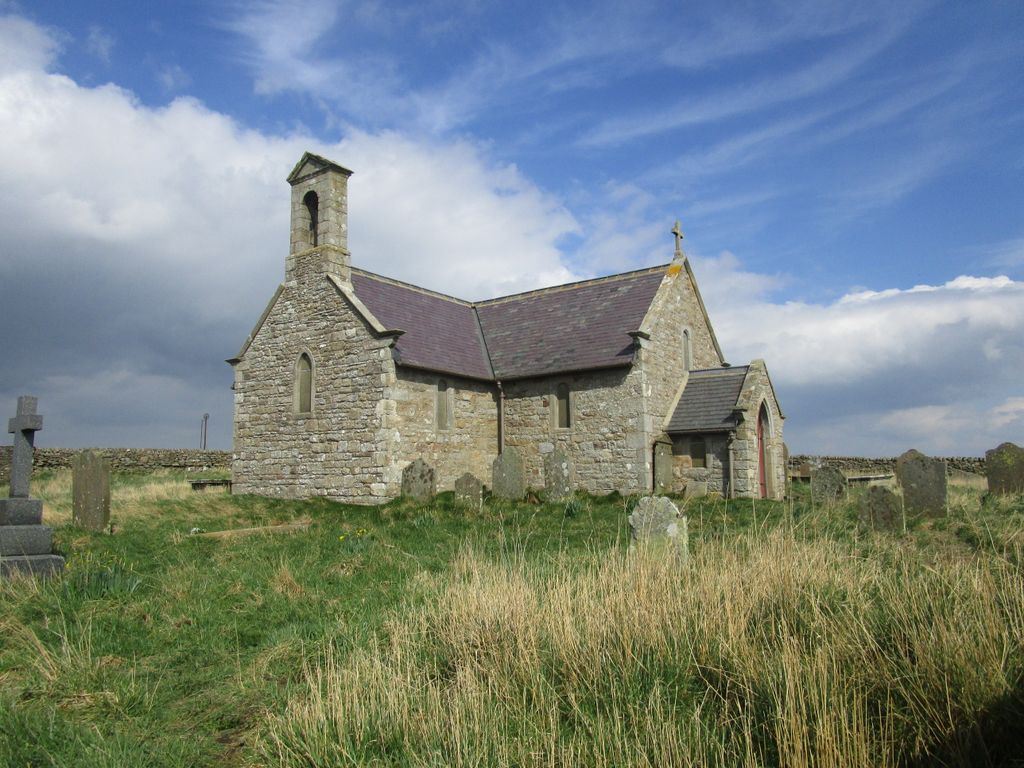
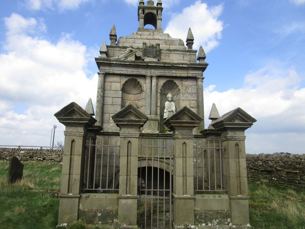
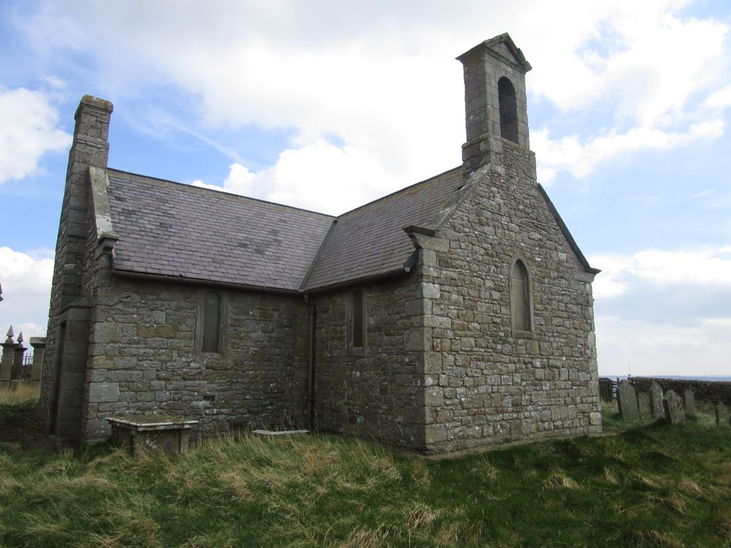
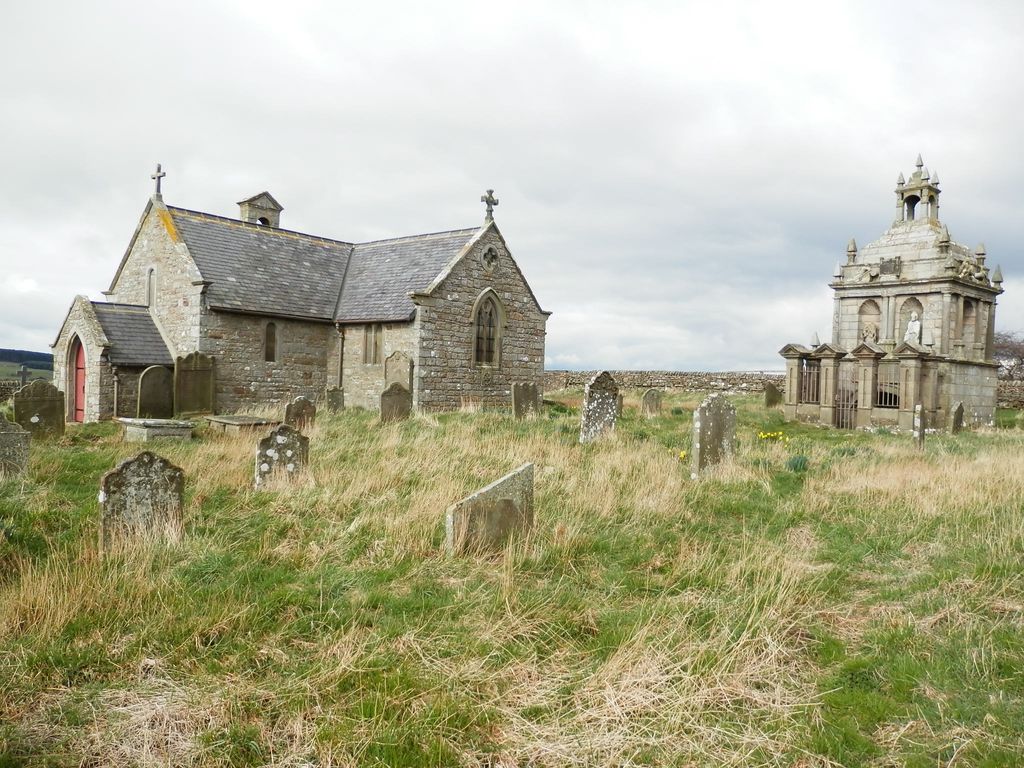
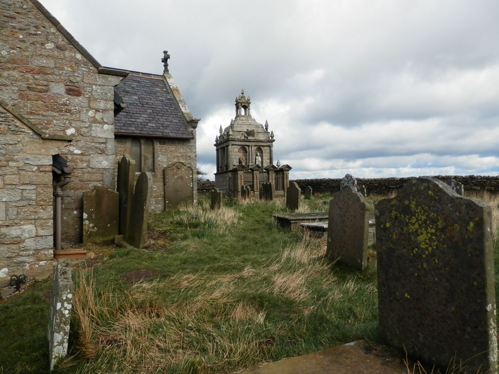
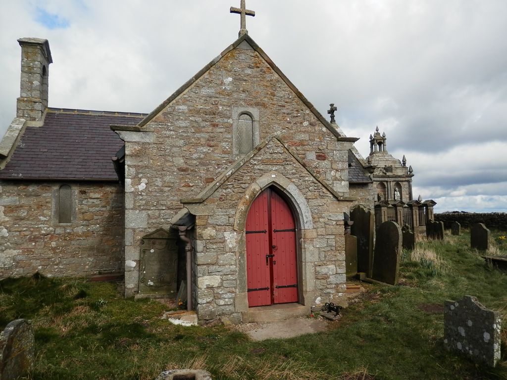
| Description | : | St Andrew's Church is a redundant Anglican church standing in an isolated position at a height of 960 feet (293 m) on Greymare Hill in Northumberland, England. It is recorded in the National Heritage List for England as a designated Grade II listed building, and is in the care of the Churches Conservation Trust. The church was built in 1769 to replace an earlier church on the site. It was replaced in 1837 by St John’s Church, Snods Edge, Shotley Bridge. In the 19th century the church suffered from subsidence due to mine workings, and it was remodelled in 1892. St Andrew's... Read More |
frequently asked questions (FAQ):
-
Where is Saint Andrew’s Churchyard?
Saint Andrew’s Churchyard is located at Kiln Pit Hill, Northumberland Unitary Authority ,Northumberland , DH8 9SJEngland.
-
Saint Andrew’s Churchyard cemetery's updated grave count on graveviews.com?
4 memorials
-
Where are the coordinates of the Saint Andrew’s Churchyard?
Latitude: 54.8916000
Longitude: -1.9307000


Nearby Cemetories:
1. Hindley and Broomley Churchyard
Broomley, Northumberland Unitary Authority, England
Coordinate: 54.9279100, -1.9339700
2. St John's Churchyard
Healey, Northumberland Unitary Authority, England
Coordinate: 54.9200850, -1.9790940
3. All Saints Churchyard
Muggleswick, Durham Unitary Authority, England
Coordinate: 54.8442600, -1.9326700
4. Winnowshill Friends' Meeting House
Healey, Northumberland Unitary Authority, England
Coordinate: 54.8706180, -2.0084840
5. St Ebba’s Churchyard
Ebchester, Durham Unitary Authority, England
Coordinate: 54.8938660, -1.8401650
6. St. Edmunds Churchyard
Edmundbyers, Durham Unitary Authority, England
Coordinate: 54.8440300, -1.9790400
7. St. Peter's Churchyard
Bywell, Northumberland Unitary Authority, England
Coordinate: 54.9476800, -1.9249700
8. St Andrew's Churchyard
Bywell, Northumberland Unitary Authority, England
Coordinate: 54.9482010, -1.9258340
9. Blackhill Cemetery
Consett, Durham Unitary Authority, England
Coordinate: 54.8609100, -1.8451580
10. Sacred Heart Roman Catholic Cemetery
Low Westwood, Durham Unitary Authority, England
Coordinate: 54.9009080, -1.8258350
11. Low Westwood Cemetery
Low Westwood, Durham Unitary Authority, England
Coordinate: 54.9008900, -1.8257700
12. Moorside Cemetery
Consett, Durham Unitary Authority, England
Coordinate: 54.8409330, -1.8709330
13. Low Westwood Christ Churchyard
Low Westwood, Durham Unitary Authority, England
Coordinate: 54.9030390, -1.8246450
14. St George's Churchyard
Mickley, Northumberland Unitary Authority, England
Coordinate: 54.9498300, -1.8831900
15. St. Mary Magdalene Churchyard
Medomsley, Durham Unitary Authority, England
Coordinate: 54.8839400, -1.8161700
16. Castleside Cemetery
Consett, Durham Unitary Authority, England
Coordinate: 54.8300800, -1.8834900
17. Rowley Burial Ground
Consett, Durham Unitary Authority, England
Coordinate: 54.8262177, -1.8656499
18. St John the Evangelist Churchyard
Chopwell, Metropolitan Borough of Gateshead, England
Coordinate: 54.9236780, -1.8093620
19. St. Ives Churchyard
Leadgate, Durham Unitary Authority, England
Coordinate: 54.8610940, -1.7987850
20. St Ives Churchyard
Iveston, Durham Unitary Authority, England
Coordinate: 54.8609250, -1.7985710
21. Church of Saint Mary
Blanchland, Northumberland Unitary Authority, England
Coordinate: 54.8484000, -2.0541000
22. Our Blessed Lady and St Joseph Churchyard
Leadgate, Durham Unitary Authority, England
Coordinate: 54.8642660, -1.7891290
23. St Matthew Churchyard
Consett, Durham Unitary Authority, England
Coordinate: 54.8040630, -1.9239040
24. St Patricks Cemetery
High Spen, Metropolitan Borough of Gateshead, England
Coordinate: 54.9215030, -1.7744860