
| Memorials | : | 1 |
| Location | : | Hartford, Van Buren County, USA |
| Coordinate | : | 42.2357340, -86.2058600 |
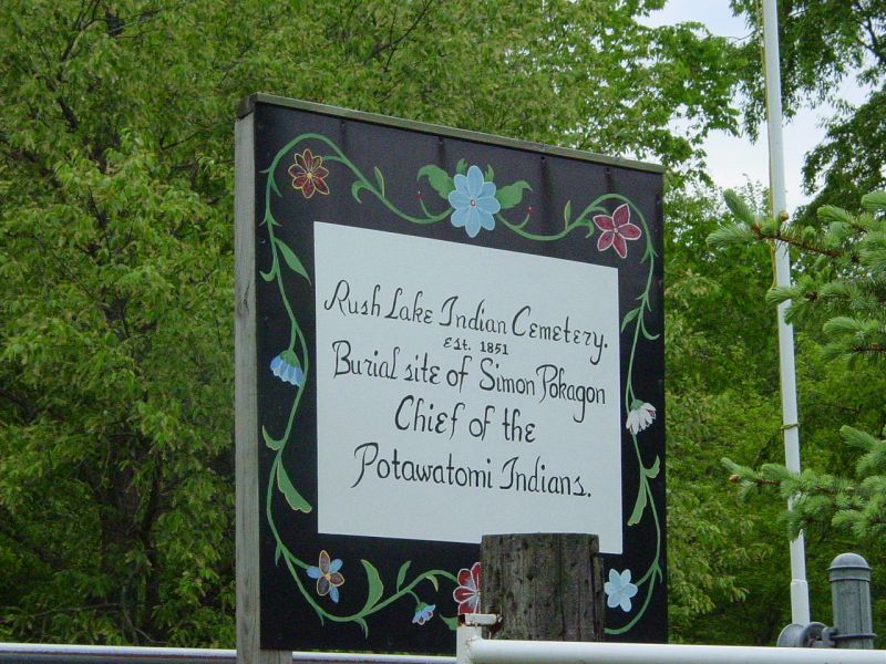
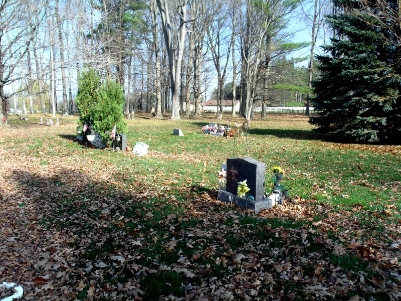
| Description | : | Surronded by a white picket fence the Rush Lake Indian Cemetery occupies 6 acres and holds 40 graves, a third of which date from the nineteenth century. The most prominent headstones mark the grave of Chief Simon Pokagon and his wife Lonidaw who are interred side by side. Standing fieldstone markers note the burial sites of military veterans from the Spanish-American War and World War I. The cemetery accepted burials from 1882 until 1934. |
frequently asked questions (FAQ):
-
Where is Rush Lake Indian Cemetery?
Rush Lake Indian Cemetery is located at Rush Lake Road Hartford, Van Buren County ,Michigan ,USA.
-
Rush Lake Indian Cemetery cemetery's updated grave count on graveviews.com?
1 memorials
-
Where are the coordinates of the Rush Lake Indian Cemetery?
Latitude: 42.2357340
Longitude: -86.2058600
Nearby Cemetories:
1. Main Family Cemetery
Hartford, Van Buren County, USA
Coordinate: 42.2299530, -86.1575240
2. Pioneer Cemetery
Hartford, Van Buren County, USA
Coordinate: 42.2052200, -86.1769400
3. Van Auken Cemetery
Van Buren County, USA
Coordinate: 42.2586100, -86.1644400
4. Fairview Memorial Cemetery
Watervliet, Berrien County, USA
Coordinate: 42.1969440, -86.2236110
5. Emmanuel Home Cemetery
Covert, Van Buren County, USA
Coordinate: 42.2508253, -86.2624946
6. Maple Hill Cemetery
Hartford, Van Buren County, USA
Coordinate: 42.1980600, -86.1683300
7. Thomas Cemetery
Bangor, Van Buren County, USA
Coordinate: 42.2869987, -86.1871338
8. Watervliet Cemetery
Watervliet, Berrien County, USA
Coordinate: 42.1886110, -86.2536110
9. Saint Josephs Catholic Cemetery
Watervliet, Berrien County, USA
Coordinate: 42.1852989, -86.2722015
10. Van Buren County Poorhouse Cemetery
Hartford, Van Buren County, USA
Coordinate: 42.2139800, -86.1127400
11. Covert Cemetery
Covert, Van Buren County, USA
Coordinate: 42.2970000, -86.2600000
12. Fish Cemetery
Covert, Van Buren County, USA
Coordinate: 42.2655983, -86.2981033
13. Southard Cemetery
Bangor, Van Buren County, USA
Coordinate: 42.2584724, -86.1088562
14. Taylor Cemetery
Bangor, Van Buren County, USA
Coordinate: 42.3027649, -86.1284180
15. Coloma Cemetery
Coloma, Berrien County, USA
Coordinate: 42.1860008, -86.3119965
16. Hill Cemetery
Lawrence, Van Buren County, USA
Coordinate: 42.2202988, -86.0791702
17. Colburn Cemetery
Lawrence, Van Buren County, USA
Coordinate: 42.2649994, -86.0702972
18. Saint Pauls United Church of Christ Cemetery
Watervliet, Berrien County, USA
Coordinate: 42.1447222, -86.2819444
19. Harris Cemetery
Lake Michigan Beach, Berrien County, USA
Coordinate: 42.2144012, -86.3482971
20. Saint Marys Catholic Church Cemetery
Watervliet, Berrien County, USA
Coordinate: 42.1450000, -86.2916670
21. Baptist Cemetery
Bainbridge Center, Berrien County, USA
Coordinate: 42.1455600, -86.2947300
22. New Hope United Methodist Church Cemetery
Bainbridge Center, Berrien County, USA
Coordinate: 42.1380530, -86.2812620
23. Kniebes Cemetery
Coloma, Berrien County, USA
Coordinate: 42.1511002, -86.3071976
24. Lawrence Village Pioneer Cemetery
Lawrence, Van Buren County, USA
Coordinate: 42.2200000, -86.0540000