
| Memorials | : | 0 |
| Location | : | Wappenbury, Warwick District, England |
| Coordinate | : | 52.3200340, -1.4458580 |
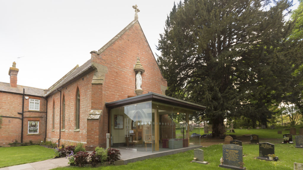
| Description | : | A Roman Catholic Church in the Archdiocese of Birmingham, England. In 1795 the Wappenbury estate came into the hands of the Lord Clifford of Chudleigh in Devon. The Cliffords built a priest’s house with a small chapel. The present small brick church was built by Dom Richard Austin Marsh OSB, a monk of Douai (then still in France), who came to Wappenbury in 1831, and remained until 1856. The new church, dedicated to St Anne, was opened by Bishop (later Cardinal) Wiseman in October 1849. The architect is not recorded; there is no basis for the attribution in some... Read More |
frequently asked questions (FAQ):
-
Where is Saint Anne Churchyard?
Saint Anne Churchyard is located at Wappenbury, Warwick District ,Warwickshire , CV33 9DWEngland.
-
Saint Anne Churchyard cemetery's updated grave count on graveviews.com?
0 memorials
-
Where are the coordinates of the Saint Anne Churchyard?
Latitude: 52.3200340
Longitude: -1.4458580
Nearby Cemetories:
1. St John the Baptist Churchyard
Wappenbury, Warwick District, England
Coordinate: 52.3204330, -1.4467410
2. Saint Margaret's Churchyard
Hunningham, Warwick District, England
Coordinate: 52.3098800, -1.4551000
3. St. Michael's Churchyard
Weston under Wetherley, Warwick District, England
Coordinate: 52.3201580, -1.4728890
4. Princethorpe Cemetery
Princethorpe, Rugby Borough, England
Coordinate: 52.3340670, -1.4232840
5. Princethorpe Priory Nun's Cemetery
Princethorpe, Rugby Borough, England
Coordinate: 52.3360620, -1.4216400
6. St Esprit Churchyard
Marton, Rugby Borough, England
Coordinate: 52.3167730, -1.4043900
7. St Mary's Churchyard
Cubbington, Warwick District, England
Coordinate: 52.3122830, -1.4972400
8. St Giles Churchyard
Bubbenhall, Warwick District, England
Coordinate: 52.3501940, -1.4730830
9. St. Gregory's Churchyard
Leamington Spa, Warwick District, England
Coordinate: 52.2878560, -1.4763950
10. All Saints Churchyard
Stretton-on-Dunsmore, Rugby Borough, England
Coordinate: 52.3495500, -1.4042900
11. St. Nicholas Churchyard
Frankton, Rugby Borough, England
Coordinate: 52.3277230, -1.3796870
12. Long Itchington Cemetery
Long Itchington, Stratford-on-Avon District, England
Coordinate: 52.2840190, -1.3980140
13. Holy Trinity Churchyard
Long Itchington, Stratford-on-Avon District, England
Coordinate: 52.2828775, -1.3971052
14. St Leonard's Churchyard
Ryton-on-Dunsmore, Rugby Borough, England
Coordinate: 52.3674940, -1.4338580
15. St Leonard's Churchyard
Birdingbury, Rugby Borough, England
Coordinate: 52.3141340, -1.3675630
16. War Memorial
Lillington, Warwick District, England
Coordinate: 52.3031870, -1.5251730
17. St Nicholas' Churchyard
Radford Semele, Warwick District, England
Coordinate: 52.2799730, -1.4986880
18. St Mary Magdalene Churchyard
Lillington, Warwick District, England
Coordinate: 52.3031200, -1.5254140
19. Brethren's Burial Ground
Leamington Spa, Warwick District, England
Coordinate: 52.3100860, -1.5287881
20. St Peters Churchyard
Bourton on Dunsmore, Rugby Borough, England
Coordinate: 52.3285270, -1.3612930
21. St Mary's Churchyard
Stoneleigh, Warwick District, England
Coordinate: 52.3504620, -1.5161400
22. Saint John the Baptist Church
Baginton, Warwick District, England
Coordinate: 52.3698000, -1.4969000
23. St Mary
Leamington Spa, Warwick District, England
Coordinate: 52.2836150, -1.5216220
24. Assumption Of Our Lady Churchyard
Ashow, Warwick District, England
Coordinate: 52.3291370, -1.5431300