
| Memorials | : | 10 |
| Location | : | Weston, Wood County, USA |
| Coordinate | : | 41.3578700, -83.7905600 |
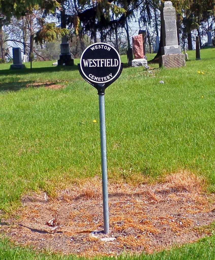
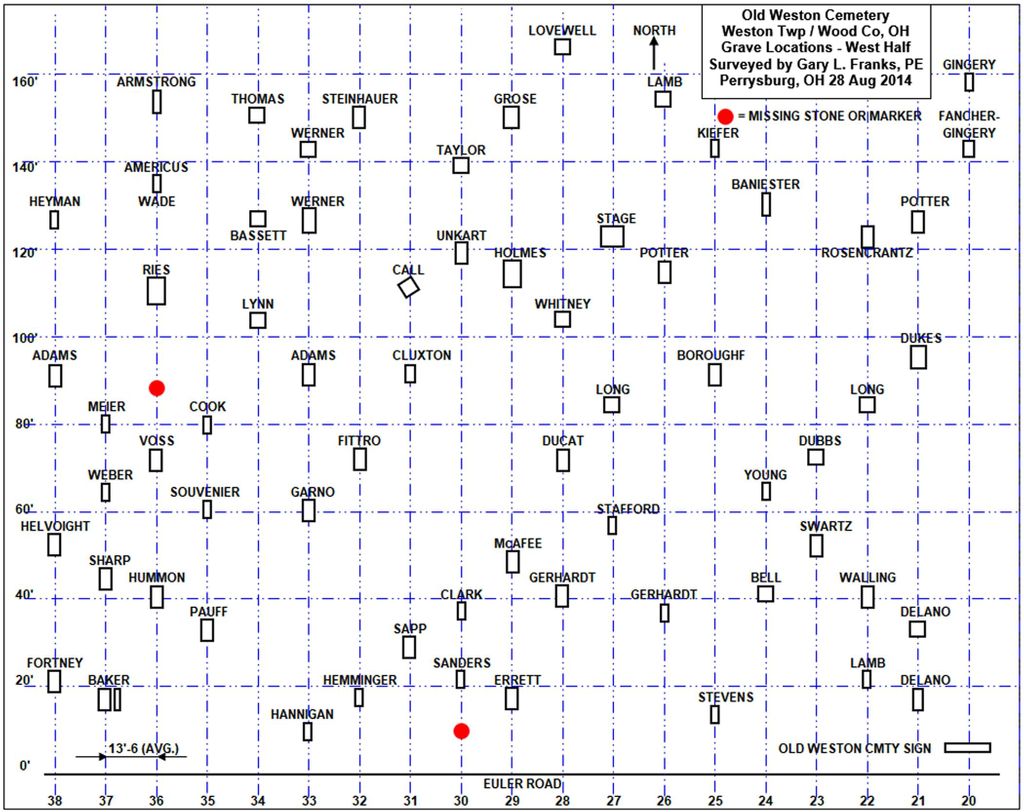
| Description | : | Old Weston Cemetery is located along Euler Road, just west of OH-235, in Weston, Ohio (Weston Township, Wood County). The cemetery sits about 4 feet higher than the road (Euler Road). There are no driveways within the Old Weston Cemetery. The cemetery can easily be accessed by parking along side the road and walking the slight incline to the cemetery grounds. This small cemetery is commonly known as the "Old" section of Weston Cemetery. It is located on the North side of Euler Road just West of Silver Street and East of Van Tassel Road. The Original Name for this Cemetery... Read More |
frequently asked questions (FAQ):
-
Where is Old Weston Cemetery?
Old Weston Cemetery is located at Euler Road (County Road 23) Weston, Wood County ,Ohio , 43569USA.
-
Old Weston Cemetery cemetery's updated grave count on graveviews.com?
10 memorials
-
Where are the coordinates of the Old Weston Cemetery?
Latitude: 41.3578700
Longitude: -83.7905600


Nearby Cemetories:
1. New Weston Cemetery
Weston, Wood County, USA
Coordinate: 41.3575800, -83.7923300
2. Beaver Creek Cemetery
Grand Rapids, Wood County, USA
Coordinate: 41.3883018, -83.8463974
3. Pottertown Cemetery
Weston, Wood County, USA
Coordinate: 41.3499985, -83.8696976
4. Wood County Memory Gardens
Bowling Green, Wood County, USA
Coordinate: 41.3763800, -83.7083930
5. Plain Township Cemetery
Bowling Green, Wood County, USA
Coordinate: 41.3861600, -83.7104900
6. Washington Cemetery
Tontogany, Wood County, USA
Coordinate: 41.4227982, -83.7675018
7. Milton Township Cemetery
Custar, Wood County, USA
Coordinate: 41.2922700, -83.8416100
8. Howard Cemetery
Grand Rapids, Wood County, USA
Coordinate: 41.4128342, -83.8638992
9. Tontogany Cemetery
Tontogany, Wood County, USA
Coordinate: 41.4294014, -83.7427979
10. Saint Louis Cemetery
Custar, Wood County, USA
Coordinate: 41.2839012, -83.8332977
11. Saint Patricks Cemetery
Providence, Lucas County, USA
Coordinate: 41.4268990, -83.8469009
12. Saint Louis Cemetery Old
Custar, Wood County, USA
Coordinate: 41.2854660, -83.8388800
13. Showman Cemetery
Napoleon, Henry County, USA
Coordinate: 41.4101260, -83.8778690
14. Angel Cemetery
Richfield Township, Henry County, USA
Coordinate: 41.3177986, -83.8902969
15. Otsego Cemetery
Tontogany, Wood County, USA
Coordinate: 41.4444008, -83.7827988
16. Wingston Cemetery
Weston, Wood County, USA
Coordinate: 41.2747002, -83.7256012
17. Sargent Cemetery
Rudolph, Wood County, USA
Coordinate: 41.3342018, -83.6643982
18. Mercer Cemetery
Mermill, Wood County, USA
Coordinate: 41.3040860, -83.6770250
19. Richfield Cemetery
Henry County, USA
Coordinate: 41.2977982, -83.8985977
20. Bethel Cemetery
Rudolph, Wood County, USA
Coordinate: 41.3003300, -83.6685400
21. Hockman Cemetery
McClure, Henry County, USA
Coordinate: 41.3792240, -83.9333470
22. Old Oak Grove Cemetery
Bowling Green, Wood County, USA
Coordinate: 41.3786100, -83.6475000
23. Wood County Mausoleum (Defunct)
Bowling Green, Wood County, USA
Coordinate: 41.3784760, -83.6406650
24. Union Hill Cemetery
Bowling Green, Wood County, USA
Coordinate: 41.4239006, -83.6632996