
| Memorials | : | 0 |
| Location | : | Harborough Magna, Rugby Borough, England |
| Coordinate | : | 52.4094260, -1.3021660 |
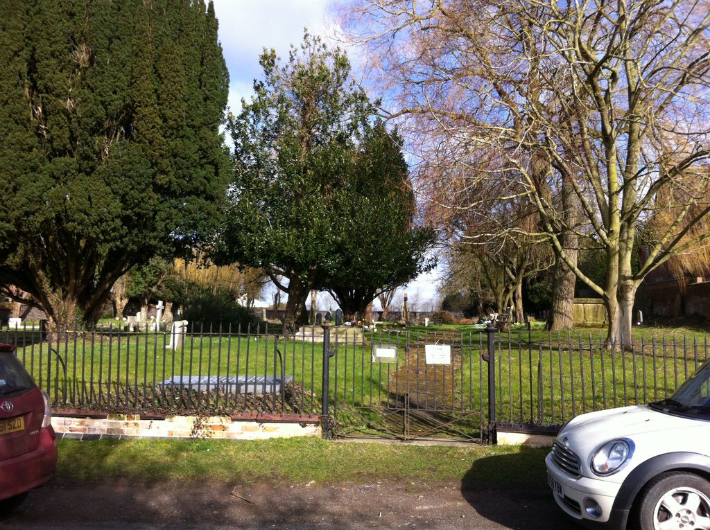
| Description | : | This cemetery is a few yards from All Saints Church, in Harborough Magna. The church has it's own churchyard, so this is possibly an overflow cemetery for the church. |
frequently asked questions (FAQ):
-
Where is Harborough Magna Cemetery?
Harborough Magna Cemetery is located at Main Street Harborough Magna, Rugby Borough ,Warwickshire , CV23 0JPEngland.
-
Harborough Magna Cemetery cemetery's updated grave count on graveviews.com?
0 memorials
-
Where are the coordinates of the Harborough Magna Cemetery?
Latitude: 52.4094260
Longitude: -1.3021660
Nearby Cemetories:
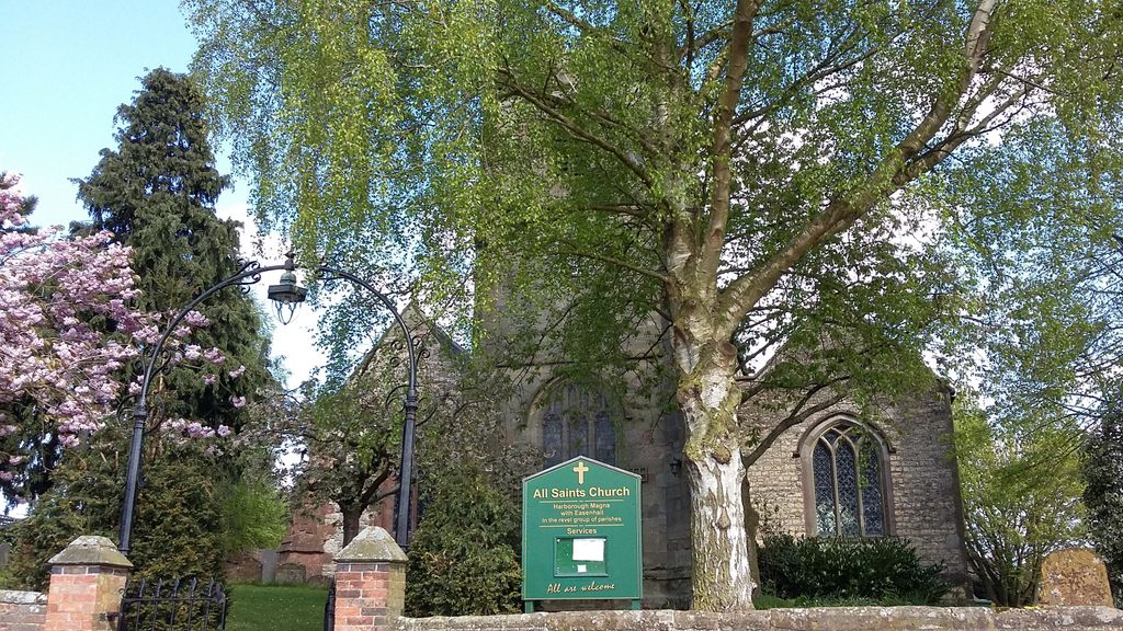
1. All Saints Church
Harborough Magna, Rugby Borough, England
Coordinate: 52.4092160, -1.3007650
2. St Botolph's Churchyard
Rugby, Rugby Borough, England
Coordinate: 52.3895850, -1.2864420
3. St. John's Churchyard
Long Lawford, Rugby Borough, England
Coordinate: 52.3835940, -1.3071930
4. Congregational Chapel Burial Ground
Stretton under Fosse, Rugby Borough, England
Coordinate: 52.4290070, -1.3381370
5. St Peter's Churchyard
Church Lawford, Rugby Borough, England
Coordinate: 52.3832600, -1.3355600
6. Brinklow Cemetery
Brinklow, Rugby Borough, England
Coordinate: 52.4161320, -1.3556710
7. St. Michael & All Angels Churchyard
Rugby Borough, England
Coordinate: 52.3920240, -1.2540180
8. Holy Trinity Churchyard
Churchover, Rugby Borough, England
Coordinate: 52.4229460, -1.2506850
9. St John the Baptist Churchyard
Brinklow, Rugby Borough, England
Coordinate: 52.4130320, -1.3590600
10. St. Edith Churchyard
Monks Kirby, Rugby Borough, England
Coordinate: 52.4439800, -1.3192500
11. St Edith's Churchyard
Monks Kirby, Rugby Borough, England
Coordinate: 52.4444360, -1.3195900
12. St Joseph's Roman Catholic Cemetery
Monks Kirby, Rugby Borough, England
Coordinate: 52.4479540, -1.3111280
13. Croop Hill Cemetery
Rugby, Rugby Borough, England
Coordinate: 52.3701510, -1.2829420
14. St. Andrew's Churchyard
Rugby, Rugby Borough, England
Coordinate: 52.3726220, -1.2612630
15. Rugby School Chapel
Rugby, Rugby Borough, England
Coordinate: 52.3703890, -1.2639150
16. St. Marie's Roman Catholic Church
Rugby, Rugby Borough, England
Coordinate: 52.3666391, -1.2642307
17. Saint Marks Churchyard
Bilton, Rugby Borough, England
Coordinate: 52.3611920, -1.2854120
18. Clifton Road Cemetery
Rugby, Rugby Borough, England
Coordinate: 52.3722330, -1.2483020
19. St Leonard's churchyard
Willey, Rugby Borough, England
Coordinate: 52.4589200, -1.2705800
20. Whinfield Cemetery
Rugby, Rugby Borough, England
Coordinate: 52.3718560, -1.2353290
21. Clifton-Upon-Dunsmore Cemetery
Clifton upon Dunsmore, Rugby Borough, England
Coordinate: 52.3857800, -1.2197400
22. St. Mary's Churchyard
Clifton upon Dunsmore, Rugby Borough, England
Coordinate: 52.3830220, -1.2208600
23. All Saints Churchyard
Shawell, Harborough District, England
Coordinate: 52.4123910, -1.2055290
24. All Saints Churchyard
Withybrook, Rugby Borough, England
Coordinate: 52.4574170, -1.3626220