
| Memorials | : | 0 |
| Location | : | Wasdale, Copeland Borough, England |
| Coordinate | : | 54.4670350, -3.2535080 |
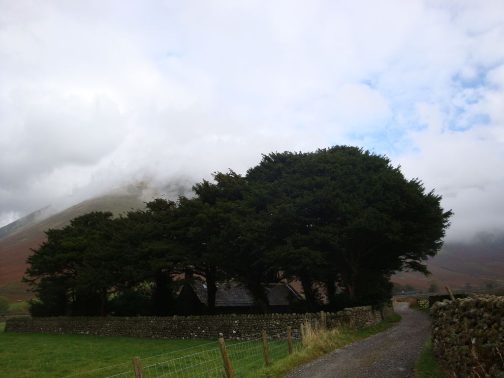
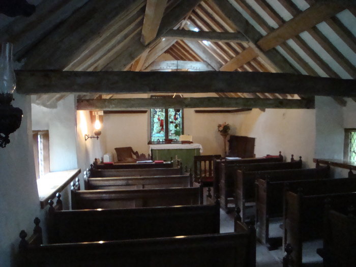
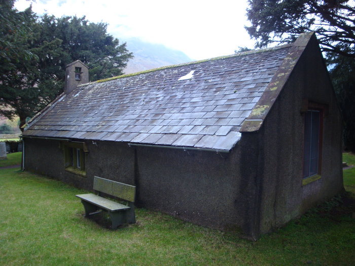
| Description | : | The church was built around 1550 and restored in 1892. Prior to the restoration the floor would have been earthen and there would have been no windows or even seating. St.Olaf's is the smallest church in England near the deepest lake in England, Wastwater and next to the highest mountain in England, Scafell Pike. The churchyard has many graves of climbers who died on the surrounding fells,The church stands amongst ancient yew trees in Viking fields. It is said that the church roof timbers are made from Viking ships. The original inhabitants of Wasdale were certainly of Viking descent. The churchyard was consecrated... Read More |
frequently asked questions (FAQ):
-
Where is Saint Olaf's Churchyard?
Saint Olaf's Churchyard is located at St Olaf, Wasdale Head Wasdale, Copeland Borough ,Cumbria , CA201EXEngland.
-
Saint Olaf's Churchyard cemetery's updated grave count on graveviews.com?
0 memorials
-
Where are the coordinates of the Saint Olaf's Churchyard?
Latitude: 54.4670350
Longitude: -3.2535080
Nearby Cemetories:
1. Nether Wasdale Cemetery
Nether Wasdale, Copeland Borough, England
Coordinate: 54.4242140, -3.3463910
2. St Michael and All Angels Churchyard
Nether Wasdale, Copeland Borough, England
Coordinate: 54.4245000, -3.3508600
3. Saint Catherine's Churchyard
Eskdale, Copeland Borough, England
Coordinate: 54.3911910, -3.2706530
4. St. Andrew's Churchyard
Borrowdale, Allerdale Borough, England
Coordinate: 54.5160010, -3.1473890
5. Newlands Churchyard
Above Derwent, Allerdale Borough, England
Coordinate: 54.5636000, -3.1924900
6. St Mary's Churchyard
Gosforth, Copeland Borough, England
Coordinate: 54.4192540, -3.4313680
7. St Paul Churchyard
Irton, Copeland Borough, England
Coordinate: 54.3915480, -3.4006870
8. Saint Bartholomew's Churchyard
Loweswater, Allerdale Borough, England
Coordinate: 54.5763680, -3.3296150
9. Holy Trinity Church
Duddon, South Lakeland District, England
Coordinate: 54.3549054, -3.1877149
10. Langdale Cemetery
Chapel Stile, South Lakeland District, England
Coordinate: 54.4377600, -3.0500180
11. Holy Trinity Churchyard
Chapel Stile, South Lakeland District, England
Coordinate: 54.4402700, -3.0486090
12. St Mary's Church Extension
Ennerdale, Copeland Borough, England
Coordinate: 54.5293120, -3.4414480
13. Calder Abbey
Copeland Borough, England
Coordinate: 54.4441670, -3.4661110
14. St Mary's Churchyard
Ennerdale, Copeland Borough, England
Coordinate: 54.5294970, -3.4416310
15. Wythburn Churchyard
Keswick, Allerdale Borough, England
Coordinate: 54.5131190, -3.0451030
16. Kelbarrow
Grasmere, South Lakeland District, England
Coordinate: 54.4550290, -3.0314230
17. Saint Michael and All Angels
Muncaster, Copeland Borough, England
Coordinate: 54.3567850, -3.3802270
18. St Oswald Churchyard
Grasmere, South Lakeland District, England
Coordinate: 54.4574260, -3.0237290
19. Ponsonby Parish Churchyard
Ponsonby, Copeland Borough, England
Coordinate: 54.4367970, -3.4782480
20. Grasmere Cemetery
Grasmere, South Lakeland District, England
Coordinate: 54.4659020, -3.0221410
21. St. Peter Churchyard
Drigg, Copeland Borough, England
Coordinate: 54.3796400, -3.4328800
22. St. John the Baptist Churchyard
Ulpha, Copeland Borough, England
Coordinate: 54.3285020, -3.2349130
23. Ulpha Churchyard Extension
Ulpha, Copeland Borough, England
Coordinate: 54.3282170, -3.2350270
24. Saint Michael's Churchyard
Lamplugh, Copeland Borough, England
Coordinate: 54.5741040, -3.4111740