
| Memorials | : | 0 |
| Location | : | Church Creek, Dorchester County, USA |
| Coordinate | : | 38.3798570, -76.2504790 |
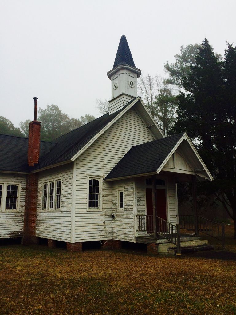
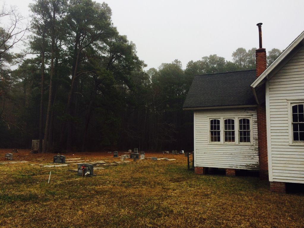
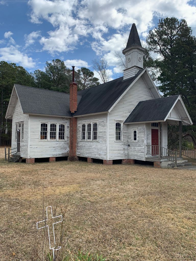
| Description | : | From the Maryland Historical Trust: St. Peter's M. E. Church Meekins Neck 1923 Private Located on the roadside between Dunnock's crossroads and the Fishing Creek bridge is St. Peter's Methodist Episcopal Church, an ell-shaped frame chapel erected in 1923 for this Meekins Neck congregation. The well-built weatherboard frame structure was infused with finely detailed decoration in the gable-front porch to the subtle refinement in the six-over-six sash that have segmental arched window heads. Fixed atop the rectangular main block is a finely detailed tower with woodwork decoration in the form of a classical pediment in pilasters that embellish each face of the octagonal... Read More |
frequently asked questions (FAQ):
-
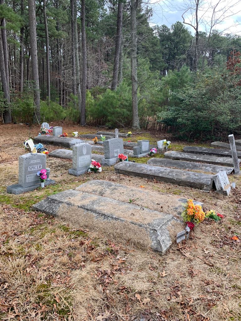
Where is Saint Peters Methodist Episcopal Church Cemetery?
Saint Peters Methodist Episcopal Church Cemetery is located at Church Creek, Dorchester County ,Maryland ,USA.
-
Saint Peters Methodist Episcopal Church Cemetery cemetery's updated grave count on graveviews.com?
0 memorials
-
Where are the coordinates of the Saint Peters Methodist Episcopal Church Cemetery?
Latitude: 38.3798570
Longitude: -76.2504790

Nearby Cemetories:
1. Saint Mary Star of the Sea Cemetery
Hooper Islands, Dorchester County, USA
Coordinate: 38.3856010, -76.2491989
2. Oak Grove Methodist Episcopal Church Cemetery
Dorchester County, USA
Coordinate: 38.4134554, -76.2341108
3. Old Hoopers Island Graveyard
Dorchester County, USA
Coordinate: 38.3468159, -76.2297535
4. Saint Johns United Methodist Church Cemetery
Church Creek, Dorchester County, USA
Coordinate: 38.3821983, -76.1936035
5. Gootee Cemetery
Dorchester County, USA
Coordinate: 38.3793983, -76.1718979
6. Blackwater National Wildlife Refuge Cemetery
Church Creek, Dorchester County, USA
Coordinate: 38.4239450, -76.1752370
7. John Wesley United Methodist Church Cemetery
Church Creek, Dorchester County, USA
Coordinate: 38.3823200, -76.1472800
8. George Carroll Insley Farm Cemetery
Lakesville, Dorchester County, USA
Coordinate: 38.3414270, -76.1497050
9. Smithville Cemetery
Smithville, Dorchester County, USA
Coordinate: 38.4740000, -76.2753700
10. Grace Cemetery
Taylors Island, Dorchester County, USA
Coordinate: 38.4707985, -76.3091965
11. Wyville Andrews Farm Cemetery
Lakesville, Dorchester County, USA
Coordinate: 38.3548210, -76.1241990
12. Harrisville Malone Cemetery
Harrisville, Dorchester County, USA
Coordinate: 38.4914100, -76.2169200
13. Bethlehem Cemetery
Taylors Island, Dorchester County, USA
Coordinate: 38.4824982, -76.3167038
14. Roberts Home Cemetery
Andrews, Dorchester County, USA
Coordinate: 38.3552120, -76.1024980
15. Ebenezer Cemetery
Dorchester County, USA
Coordinate: 38.3168983, -76.1153030
16. Middle Hooper Island Cemetery
Fishing Creek, Dorchester County, USA
Coordinate: 38.2680180, -76.1832290
17. William Andrews Family Cemetery
Crapo, Dorchester County, USA
Coordinate: 38.3188400, -76.1105500
18. Gethsemane-Madison Cemetery
Madison, Dorchester County, USA
Coordinate: 38.5076000, -76.2210600
19. Joppa Cemetery
Madison, Dorchester County, USA
Coordinate: 38.5078011, -76.2200012
20. Charles Wingate Home Cemetery
Wingate, Dorchester County, USA
Coordinate: 38.3058520, -76.1047080
21. Frank Hayward Home Cemetery
Toddville, Dorchester County, USA
Coordinate: 38.3119990, -76.0953300
22. Kirwan-Tall Graveyard
Taylors Island, Dorchester County, USA
Coordinate: 38.2428898, -76.2845090
23. Old Trinity Episcopal Church Cemetery
Church Creek, Dorchester County, USA
Coordinate: 38.5040070, -76.1660580
24. Zebidee Hayward Home Cemetery
Toddville, Dorchester County, USA
Coordinate: 38.3188700, -76.0882200