
| Memorials | : | 0 |
| Location | : | Sedgefield, Durham Unitary Authority, England |
| Coordinate | : | 54.6527050, -1.4416632 |
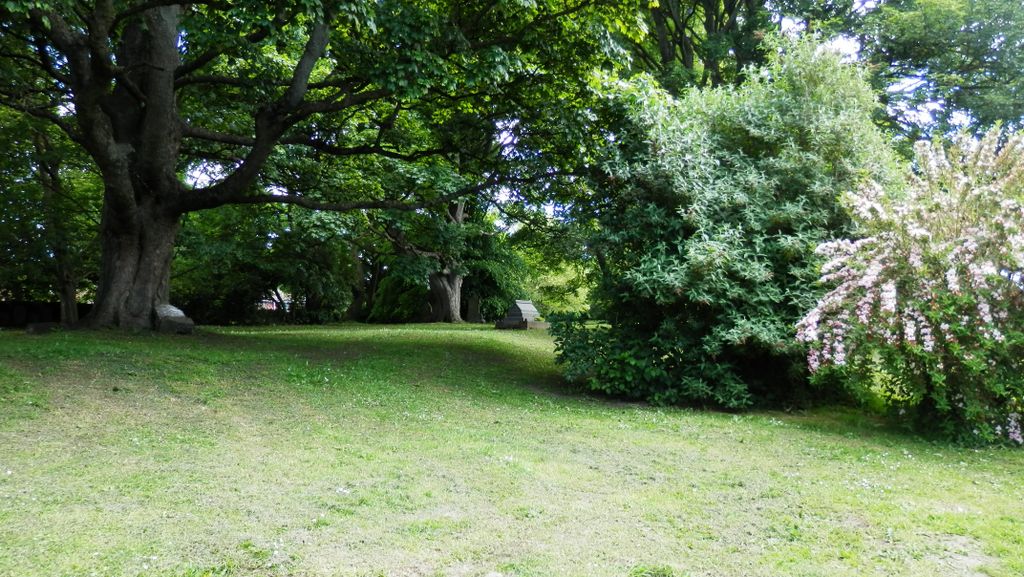
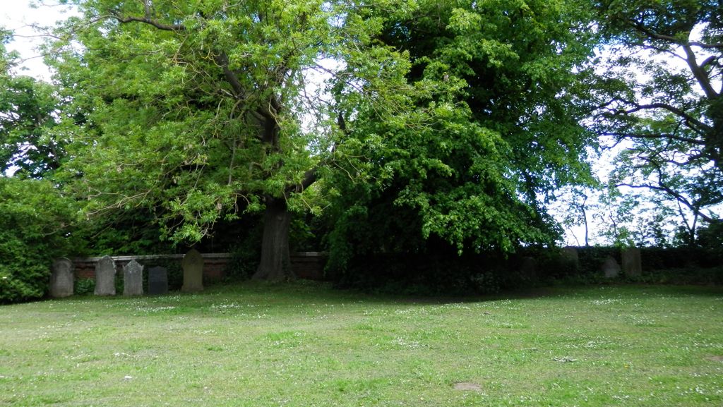
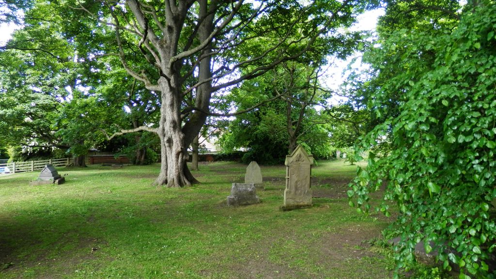
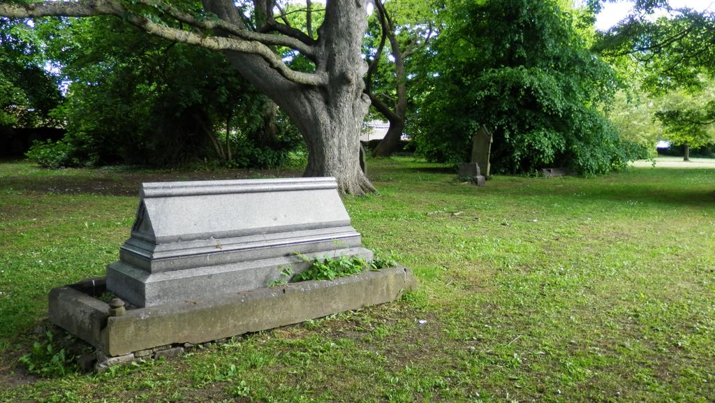
| Description | : | The cemetery in Beacon Lane was opened on 5th January 1862, though funeral services were still held at the parish church and entered in its burial registers. From 1862-64 and again from 1876-80 the burial registers indicate that the actual burial place was Beacon Lane Cemetery rather than St Edmund's Churchyard. The burial place was not indicated in other years, but the churchyard was almost full and the vast majority of burials until 1909 took place at Beacon Lane Cemetery. By 1908 Beacon Lane cemetery was almost full, so another new burial ground, Sedgefield New Cemetery, in Butterwick Road, was... Read More |
frequently asked questions (FAQ):
-
Where is Sedgefield Old Cemetery?
Sedgefield Old Cemetery is located at Beacon Lane Sedgefield, Durham Unitary Authority ,County Durham ,England.
-
Sedgefield Old Cemetery cemetery's updated grave count on graveviews.com?
0 memorials
-
Where are the coordinates of the Sedgefield Old Cemetery?
Latitude: 54.6527050
Longitude: -1.4416632
Nearby Cemetories:
1. Sedgefield New Cemetery
Sedgefield, Durham Unitary Authority, England
Coordinate: 54.6557900, -1.4447300
2. St Edmund Churchyard
Sedgefield, Durham Unitary Authority, England
Coordinate: 54.6532480, -1.4485160
3. Winterton Hospital Cemetery
Sedgefield, Durham Unitary Authority, England
Coordinate: 54.6677800, -1.4471800
4. Fishburn Cemetery
Fishburn, Durham Unitary Authority, England
Coordinate: 54.6847100, -1.4397300
5. Saint Michael Churchyard
Bishop Middleham, Durham Unitary Authority, England
Coordinate: 54.6754810, -1.4931890
6. St. Thomas a Becket Churchyard
Thorpe Thewles, Stockton-on-Tees Unitary Authority, England
Coordinate: 54.6224980, -1.3854178
7. St John's Churchyard
Stillington, Stockton-on-Tees Unitary Authority, England
Coordinate: 54.6064000, -1.4173000
8. St. James' Churchyard
Thorpe Thewles, Stockton-on-Tees Unitary Authority, England
Coordinate: 54.6051920, -1.3790430
9. Duncombe Cemetery
Ferryhill, Durham Unitary Authority, England
Coordinate: 54.6845340, -1.5337440
10. All Saints Churchyard
Great Stainton, Darlington Unitary Authority, England
Coordinate: 54.5936200, -1.4818800
11. Holy Trinity Churchyard
Cornforth, Durham Unitary Authority, England
Coordinate: 54.7043960, -1.5164580
12. St. Peter's Churchyard
Bishopton, Darlington Unitary Authority, England
Coordinate: 54.5852070, -1.4368680
13. Chilton Cemetery
Chilton, Durham Unitary Authority, England
Coordinate: 54.6668800, -1.5559400
14. St Helen Churchyard
Kelloe, Durham Unitary Authority, England
Coordinate: 54.7226280, -1.4658430
15. Saint Cuthbert's Churchyard
Redmarshall, Stockton-on-Tees Unitary Authority, England
Coordinate: 54.5840600, -1.4037700
16. St. Helen's Churchyard Extension
Kelloe, Durham Unitary Authority, England
Coordinate: 54.7240310, -1.4667760
17. St. Mary's Parish Churchyard
Coxhoe, Durham Unitary Authority, England
Coordinate: 54.7163790, -1.5045050
18. St Luke's Churchyard
Ferryhill, Durham Unitary Authority, England
Coordinate: 54.6886870, -1.5534980
19. Cornforth Roman Catholic Cemetery
Cornforth, Durham Unitary Authority, England
Coordinate: 54.7084230, -1.5392620
20. Hutton Henry Cemetery
Hutton Henry, Durham Unitary Authority, England
Coordinate: 54.7171700, -1.3607100
21. St Paul's Churchyard
Cassop-cum-Quarrington, Durham Unitary Authority, England
Coordinate: 54.7351390, -1.4816110
22. St. Peter's Churchyard
Wolviston, Stockton-on-Tees Unitary Authority, England
Coordinate: 54.6250820, -1.2977740
23. St Peter's Churchyard
Elwick, Hartlepool Unitary Authority, England
Coordinate: 54.6813620, -1.2982740
24. Stephenson Way Cemetery
Newton Aycliffe, Durham Unitary Authority, England
Coordinate: 54.6234700, -1.5875600