
| Memorials | : | 0 |
| Location | : | Settrington, Ryedale District, England |
| Coordinate | : | 54.1254200, -0.7221700 |
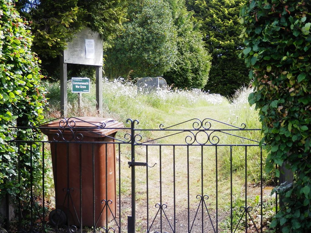
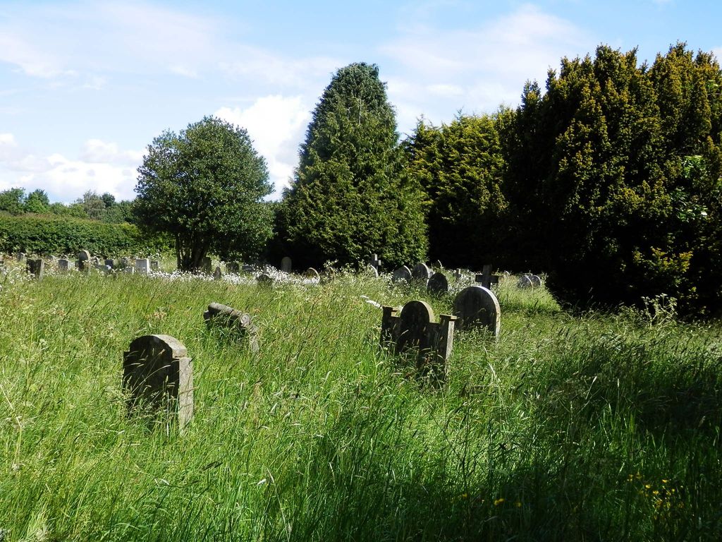
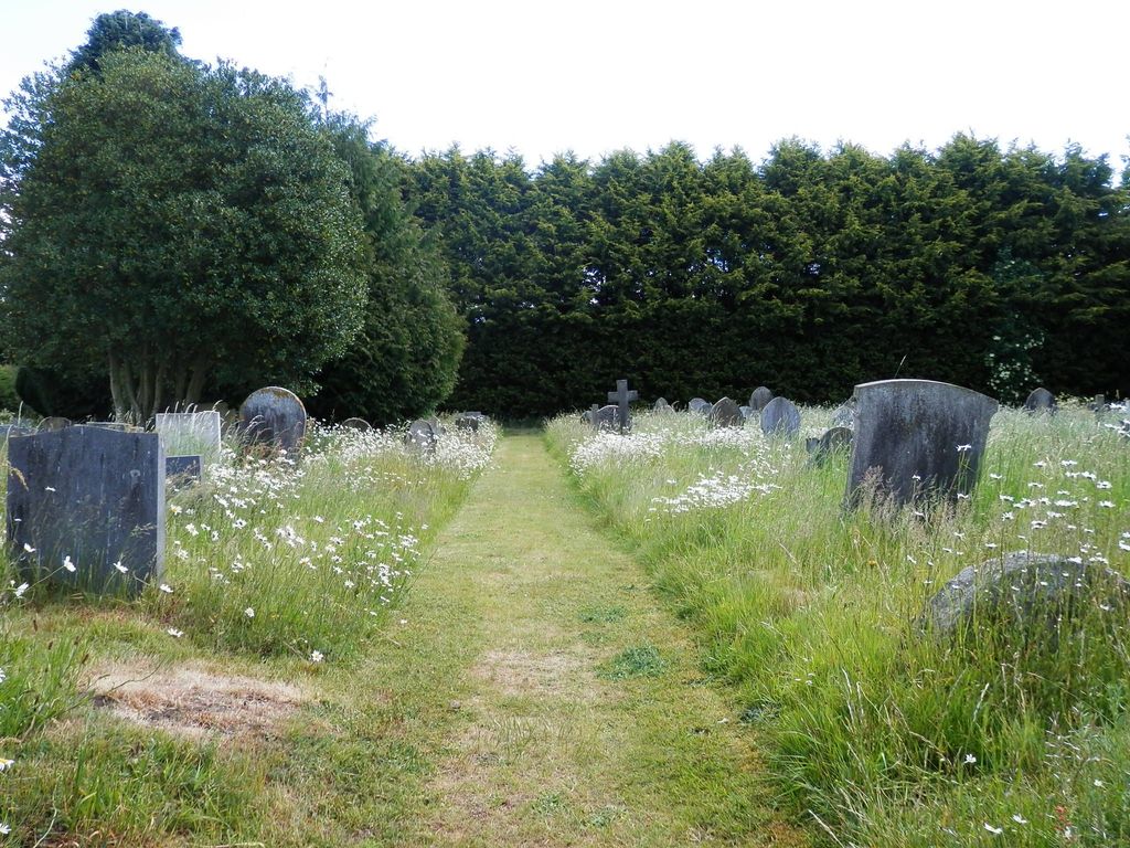
| Description | : | Formerly known as Settrington Church Cemetery, this small cemetery is a small distance north of the church and churchyard, near the turning of Church Lane towards Scagglethorpe. Much of it is overgrown, making access to headstones problematic. |
frequently asked questions (FAQ):
-
Where is Settrington Cemetery?
Settrington Cemetery is located at Church Lane Settrington, Ryedale District ,North Yorkshire ,England.
-
Settrington Cemetery cemetery's updated grave count on graveviews.com?
0 memorials
-
Where are the coordinates of the Settrington Cemetery?
Latitude: 54.1254200
Longitude: -0.7221700

Nearby Cemetories:
1. All Saints Churchyard
Settrington, Ryedale District, England
Coordinate: 54.1212780, -0.7178830
2. St. Nicholas Churchyard
North Grimston, Ryedale District, England
Coordinate: 54.0989220, -0.7148680
3. All Saints' Churchyard
Thorpe Bassett, Ryedale District, England
Coordinate: 54.1496503, -0.6875921
4. St. Andrew’s Churchyard Extension
Rillington, Ryedale District, England
Coordinate: 54.1558500, -0.6926500
5. St. Andrew's Churchyard
Rillington, Ryedale District, England
Coordinate: 54.1579700, -0.6959800
6. Norton Cemetery
Norton, Ryedale District, England
Coordinate: 54.1306400, -0.7834200
7. St Mary the Virgin Priory Churchyard
Malton, Ryedale District, England
Coordinate: 54.1427520, -0.7786450
8. St Peter Churchyard
Norton, Ryedale District, England
Coordinate: 54.1289040, -0.7861910
9. Old Malton Cemetery
Malton, Ryedale District, England
Coordinate: 54.1443200, -0.7808900
10. St. Leonard with St. Mary Churchyard
Malton, Ryedale District, England
Coordinate: 54.1348110, -0.7946110
11. Malton Cemetery
Malton, Ryedale District, England
Coordinate: 54.1392670, -0.7980300
12. St Andrew Churchyard
Langton, Ryedale District, England
Coordinate: 54.0934510, -0.7834680
13. St. Mary's Churchyard
Wharram le Street, Ryedale District, England
Coordinate: 54.0820040, -0.6810779
14. St Mary Churchyard
Birdsall, Ryedale District, England
Coordinate: 54.0780000, -0.7508000
15. St Peter Churchyard
Wintringham, Ryedale District, England
Coordinate: 54.1467660, -0.6431680
16. St. Martin Churchyard
Wharram Percy, Ryedale District, England
Coordinate: 54.0665700, -0.6901300
17. Burythorpe Churchyard
Burythorpe, Ryedale District, England
Coordinate: 54.0752951, -0.7955984
18. St. Andrew's Churchyard
Kirby Grindalythe, Ryedale District, England
Coordinate: 54.0955440, -0.6200050
19. St. Margaret's Churchyard
Huttons Ambo, Ryedale District, England
Coordinate: 54.1066490, -0.8490640
20. St Helen Churchyard
Amotherby, Ryedale District, England
Coordinate: 54.1512000, -0.8521000
21. St. Mary's Churchyard
Westow, Ryedale District, England
Coordinate: 54.0846190, -0.8406850
22. All Saints Churchyard
West Heslerton, Ryedale District, England
Coordinate: 54.1704100, -0.6057100
23. St. Mary's Church Luttons Ambo
West Lutton, Ryedale District, England
Coordinate: 54.1105340, -0.5779463
24. St. Mary's Churchyard
Thixendale, Ryedale District, England
Coordinate: 54.0387360, -0.7154888