
| Memorials | : | 0 |
| Location | : | Rutherford, Russell County, USA |
| Coordinate | : | 32.1561950, -85.3079400 |
frequently asked questions (FAQ):
-
Where is Shady Grove Baptist Church Cemetery?
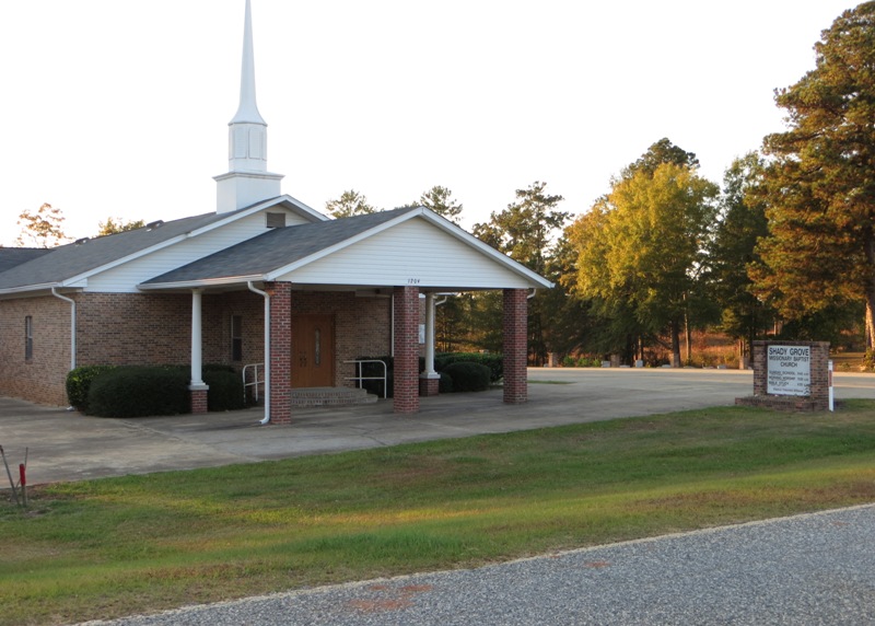
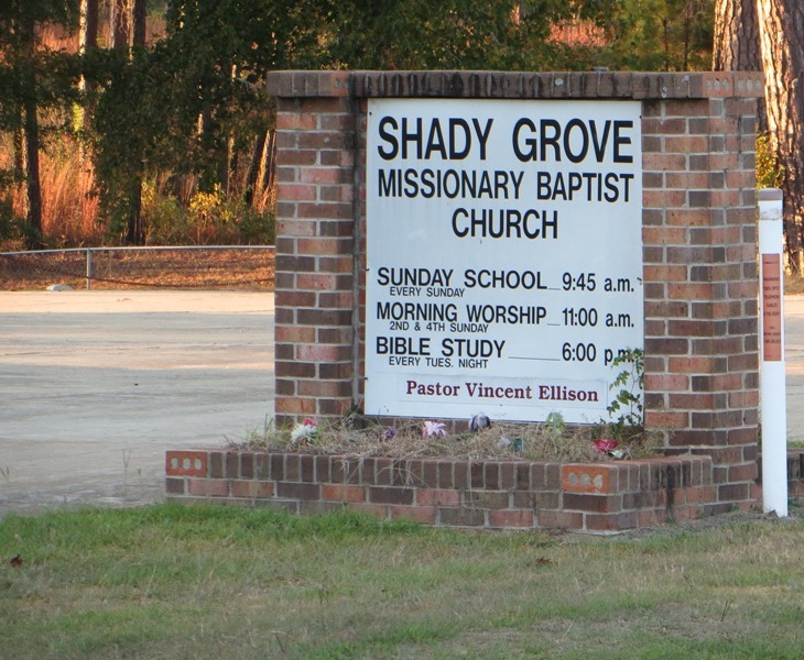
Shady Grove Baptist Church Cemetery is located at 1204 Rutherford Road Rutherford, Russell County ,Alabama , 36860USA.
-
Shady Grove Baptist Church Cemetery cemetery's updated grave count on graveviews.com?
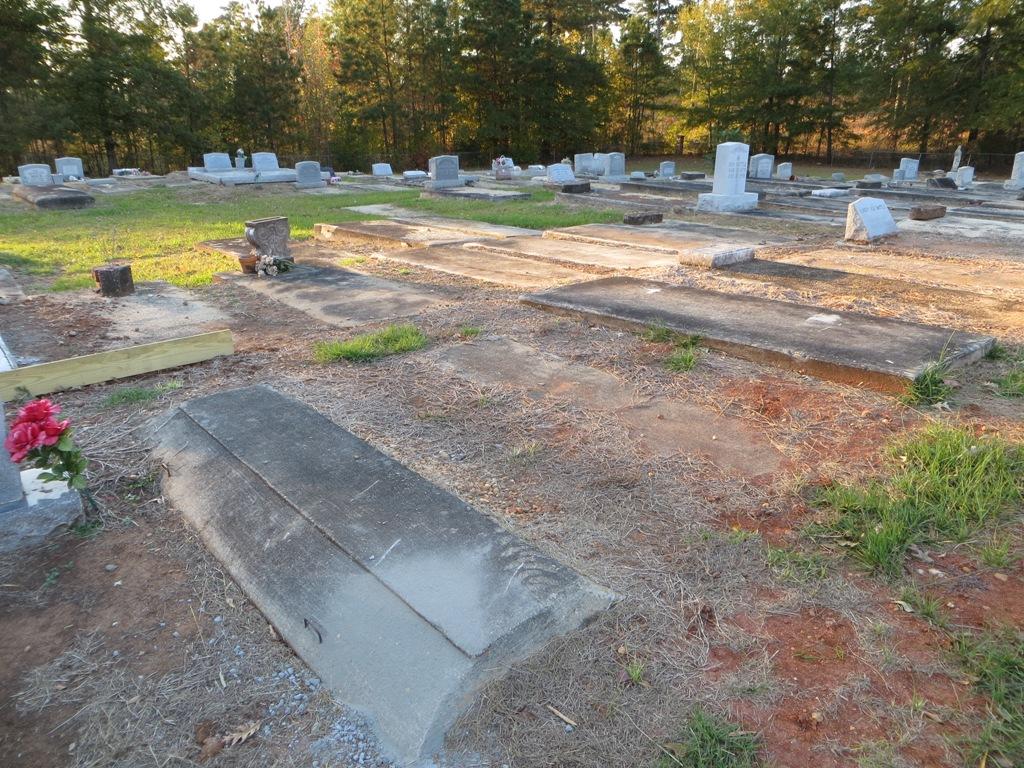
0 memorials
-
Where are the coordinates of the Shady Grove Baptist Church Cemetery?
Latitude: 32.1561950
Longitude: -85.3079400

Nearby Cemetories:
1. Battle Cemetery
Rutherford, Russell County, USA
Coordinate: 32.1723300, -85.3044800
2. Mount Missouri Baptist Church Cemetery
Rutherford, Russell County, USA
Coordinate: 32.1938210, -85.3149720
3. Antioch Missionary Baptist Church Cemetery
Pittsview, Russell County, USA
Coordinate: 32.1937180, -85.2585410
4. Hurts African Methodist Episcopal Chapel
Hurtsboro, Russell County, USA
Coordinate: 32.2110670, -85.3582230
5. Olivet Methodist Cemetery
Hurtsboro, Russell County, USA
Coordinate: 32.2121570, -85.3583410
6. Benevolent Grove Baptist Church Cemetery
Pittsview, Russell County, USA
Coordinate: 32.1954250, -85.2326310
7. Humble Zion Baptist Church Cemetery
Spring Hill, Barbour County, USA
Coordinate: 32.0911780, -85.3524530
8. Zion Hill Baptist Church Cemetery
Hatchechubbee, Russell County, USA
Coordinate: 32.2289200, -85.2851820
9. Nero Baptist Church Cemetery
Spring Hill, Barbour County, USA
Coordinate: 32.1192210, -85.3854150
10. Ebenezer Baptist Church Cemetery
Hurtsboro, Russell County, USA
Coordinate: 32.2026900, -85.3800100
11. Spring Hill United Methodist Church Cemetery
Spring Hill, Barbour County, USA
Coordinate: 32.0801353, -85.3389969
12. Springhill Zion Baptist Church Cemetery
Eufaula, Barbour County, USA
Coordinate: 32.0746000, -85.3271600
13. Friendship Baptist Church Cemetery
Hurtsboro, Russell County, USA
Coordinate: 32.2428670, -85.3293680
14. Mount Gilead Cemetery
Barbour County, USA
Coordinate: 32.0891991, -85.2394028
15. Ramah Baptist Church Cemetery
Barbour County, USA
Coordinate: 32.1058006, -85.3985977
16. Mount Olive Missionary Baptist Church Cemetery
Comer, Barbour County, USA
Coordinate: 32.0734878, -85.3827183
17. Brown Road Cemetery
Russell County, USA
Coordinate: 32.1897011, -85.4302979
18. Bethel Christian Fellowship Cemetery
Pittsview, Russell County, USA
Coordinate: 32.2054160, -85.1902530
19. Old Nero Baptist Church Cemetery
Hurtsboro, Russell County, USA
Coordinate: 32.2349380, -85.4009450
20. Milligan Cemetery
Hatchechubbee, Russell County, USA
Coordinate: 32.1618500, -85.1713200
21. Glenville Cemetery
Russell County, USA
Coordinate: 32.1244011, -85.1731033
22. Mount Mariah Baptist Church Cemetery
Pittsview, Russell County, USA
Coordinate: 32.2410180, -85.2094780
23. Hatchechubbee United Methodist Church Cemetery
Hatchechubbee, Russell County, USA
Coordinate: 32.2725440, -85.2738180
24. Mount Olive Baptist Cemetery
Glenville, Russell County, USA
Coordinate: 32.1224270, -85.1695820