
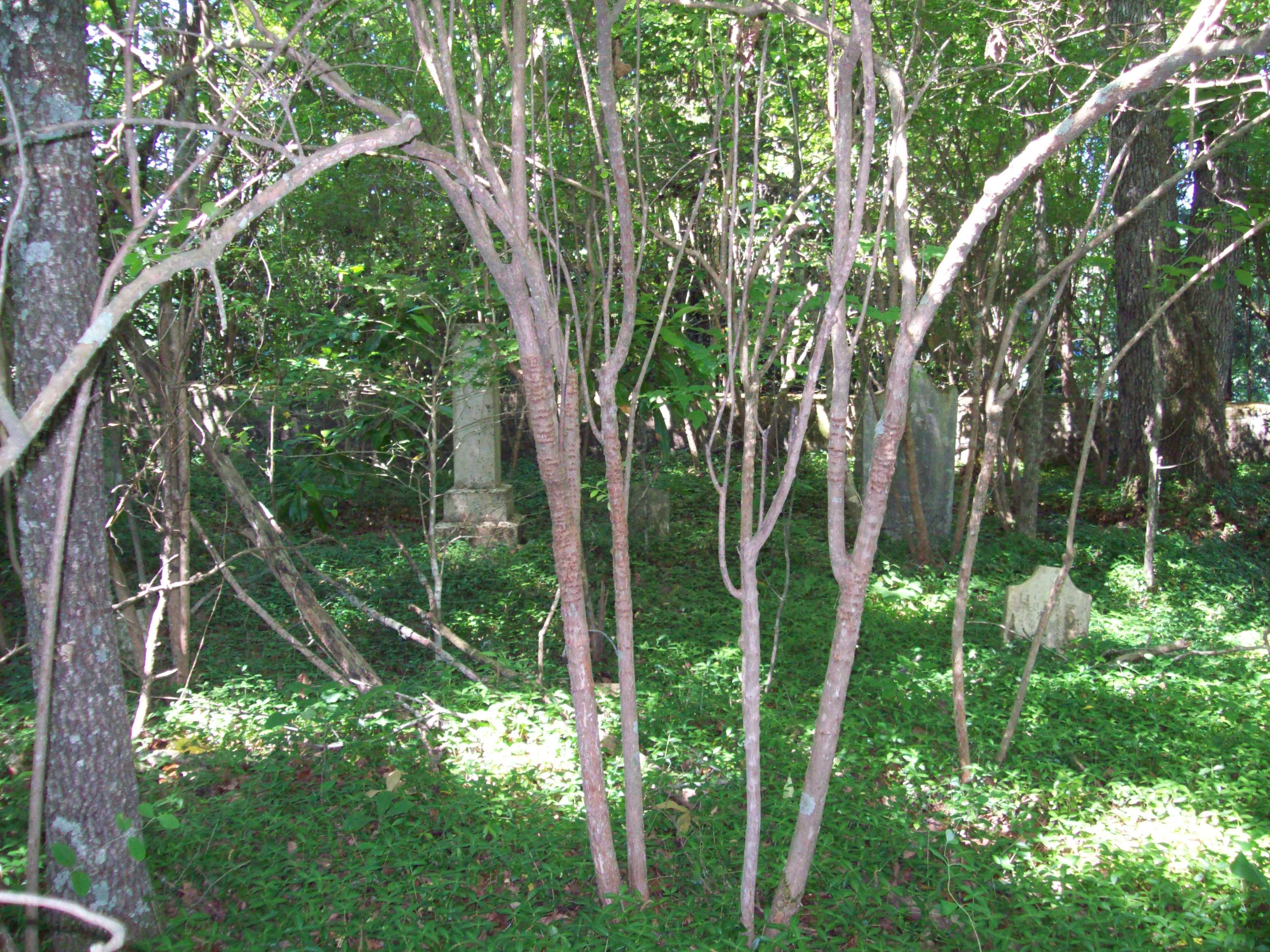
| Memorials | : | 4 |
| Location | : | Moore County, USA |
| Coordinate | : | 35.4533005, -79.7300034 |
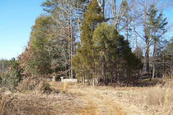
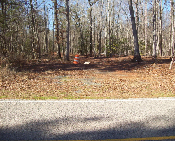
| Description | : | From I-73 take Exit 58 to Black Ankle/Echols Road. Turn right on US 220 Alternate to Steeds, NC. From Steeds turn left on Steed Road which turns to Davis Road and then turns to Adams Road. At the T-intersection of Adams and Willie roads turn right onto Willie Road (1403). From the intersection to the cemetery path is 2.1 miles. Cemetery path is on the right. The area has recently been logged and the cemetery path no longer looks like the photo shown. It is a wide open trail now and it is marked by No Trespassing signs. |
frequently asked questions (FAQ):
-
Where is Shamburger Cemetery?
Shamburger Cemetery is located at Moore County ,North Carolina ,USA.
-
Shamburger Cemetery cemetery's updated grave count on graveviews.com?
4 memorials
-
Where are the coordinates of the Shamburger Cemetery?
Latitude: 35.4533005
Longitude: -79.7300034


Nearby Cemetories:
1. Dover Baptist Church Cemetery
Moore County, USA
Coordinate: 35.4381670, -79.7322950
2. Davis Family Cemetery
Dover, Moore County, USA
Coordinate: 35.4298300, -79.7088600
3. Mount Zion Wesleyan Church Cemetery
Moore County, USA
Coordinate: 35.4838290, -79.7376190
4. Archibald Freeman Family Cemetery
Star, Montgomery County, USA
Coordinate: 35.4300259, -79.7675443
5. Owen/Brewer camp meeting cemetery
Robbins, Moore County, USA
Coordinate: 35.4408422, -79.6820429
6. Melton family cemetery
Robbins, Moore County, USA
Coordinate: 35.4404412, -79.6787718
7. White Oak Springs Baptist Church Cemetery
Star, Montgomery County, USA
Coordinate: 35.4339943, -79.7816391
8. Guiding Light Baptist Church Cemetery
Robbins, Moore County, USA
Coordinate: 35.4202520, -79.6899960
9. Bascom Chapel United Methodist Church Cemetery
Robbins, Moore County, USA
Coordinate: 35.4393080, -79.6755880
10. Lassiter Cemetery
Montgomery County, USA
Coordinate: 35.4132350, -79.7614400
11. Ether United Methodist Church Cemetery
Star, Montgomery County, USA
Coordinate: 35.4418250, -79.7890830
12. Cagle Cemetery
Moore County, USA
Coordinate: 35.5007090, -79.7518280
13. Little Oak Church of God Cemetery
Robbins, Moore County, USA
Coordinate: 35.4773960, -79.6720470
14. Asbury Baptist Church Cemetery
Montgomery County, USA
Coordinate: 35.4904900, -79.7765990
15. Allred Family Cemetery
Westmore, Moore County, USA
Coordinate: 35.4769500, -79.6687400
16. New Hope Baptist Church Cemetery
Star, Montgomery County, USA
Coordinate: 35.4023520, -79.7590360
17. Star House of Praise Cemetery
Star, Montgomery County, USA
Coordinate: 35.4137600, -79.7848290
18. Deaton-Lamonds Cemetery
Star, Montgomery County, USA
Coordinate: 35.3978454, -79.7593053
19. Union Grove Baptist Church Cemetery
Seagrove, Randolph County, USA
Coordinate: 35.5137430, -79.7224430
20. New Hope Cemetery
Star, Montgomery County, USA
Coordinate: 35.3950005, -79.7561035
21. Hursey-Freeman Cemetery
Star, Montgomery County, USA
Coordinate: 35.4092130, -79.7847950
22. Allen Family Cemetery
Eagle Springs, Moore County, USA
Coordinate: 35.3922500, -79.7005300
23. Tucker - Freeman Cemetery
Star, Montgomery County, USA
Coordinate: 35.4118070, -79.7953790
24. Leach Cemetery
Star, Montgomery County, USA
Coordinate: 35.4022500, -79.7862400