
| Memorials | : | 0 |
| Location | : | Westmore, Moore County, USA |
| Coordinate | : | 35.4769500, -79.6687400 |
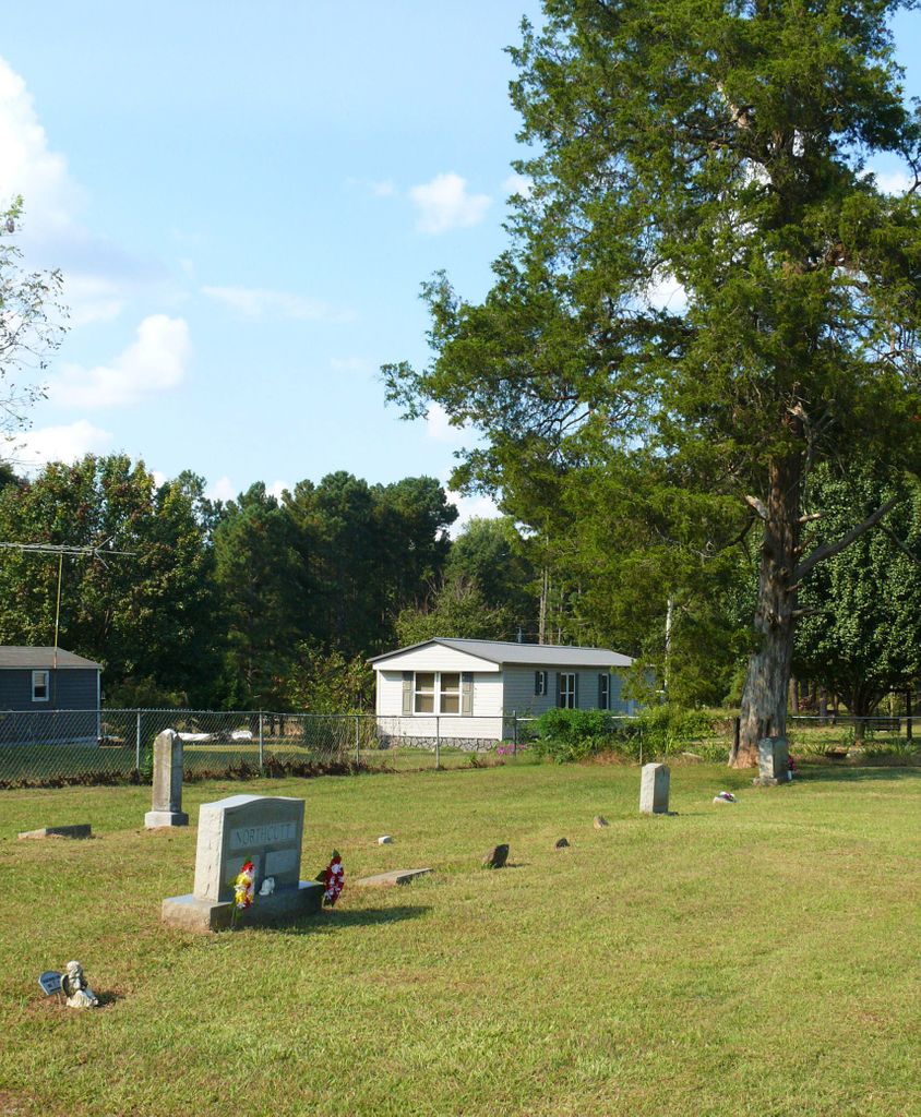
| Description | : | The first burial in this cemetery was Fred Allred in February 1919. Directions: Going southeast on Highway 705, turn left on Emily Lane which is .1 mile past Dan Road which intersects on the right. The cemetery is fenced in on the left side of Emily Lane with a large cedar tree at the far end. |
frequently asked questions (FAQ):
-
Where is Allred Family Cemetery?
Allred Family Cemetery is located at Westmore, Moore County ,North Carolina ,USA.
-
Allred Family Cemetery cemetery's updated grave count on graveviews.com?
0 memorials
-
Where are the coordinates of the Allred Family Cemetery?
Latitude: 35.4769500
Longitude: -79.6687400
Nearby Cemetories:
1. Little Oak Church of God Cemetery
Robbins, Moore County, USA
Coordinate: 35.4773960, -79.6720470
2. Melton family cemetery
Robbins, Moore County, USA
Coordinate: 35.4404412, -79.6787718
3. Owen/Brewer camp meeting cemetery
Robbins, Moore County, USA
Coordinate: 35.4408422, -79.6820429
4. Bascom Chapel United Methodist Church Cemetery
Robbins, Moore County, USA
Coordinate: 35.4393080, -79.6755880
5. Needham's Grove Baptist Church Cemetery
Robbins, Moore County, USA
Coordinate: 35.5069240, -79.6398630
6. Community Independent Baptist Church Cemetery
Seagrove, Randolph County, USA
Coordinate: 35.5187880, -79.6816070
7. Acorn Ridge Baptist Church Cemetery
Robbins, Moore County, USA
Coordinate: 35.4623750, -79.6120810
8. Browns Chapel Christian Church Cemetery
Robbins, Moore County, USA
Coordinate: 35.4284520, -79.6502140
9. Smyrna United Methodist Church Cemetery
Robbins, Moore County, USA
Coordinate: 35.4940200, -79.6097400
10. New Zion Hill Cemetery
Moore County, USA
Coordinate: 35.4743996, -79.6031036
11. Shamburger Cemetery
Moore County, USA
Coordinate: 35.4533005, -79.7300034
12. Mount Zion Wesleyan Church Cemetery
Moore County, USA
Coordinate: 35.4838290, -79.7376190
13. Union Grove Baptist Church Cemetery
Seagrove, Randolph County, USA
Coordinate: 35.5137430, -79.7224430
14. Davis Family Cemetery
Dover, Moore County, USA
Coordinate: 35.4298300, -79.7088600
15. Guiding Light Baptist Church Cemetery
Robbins, Moore County, USA
Coordinate: 35.4202520, -79.6899960
16. Dover Baptist Church Cemetery
Moore County, USA
Coordinate: 35.4381670, -79.7322950
17. New Center Christian Church Cemetery
Seagrove, Randolph County, USA
Coordinate: 35.5335110, -79.7077100
18. Maness Family Cemetery
Coleridge, Randolph County, USA
Coordinate: 35.5315700, -79.6235700
19. Trinity Wesleyan Church Cemetery
Seagrove, Randolph County, USA
Coordinate: 35.5439660, -79.6777180
20. Cagle Cemetery
Moore County, USA
Coordinate: 35.5007090, -79.7518280
21. Morgan Family Cemetery
Robbins, Moore County, USA
Coordinate: 35.4054490, -79.6552348
22. Riverside Baptist Church Cemetery
Seagrove, Randolph County, USA
Coordinate: 35.5337430, -79.6099330
23. Mount Olivet United Methodist Church Cemetery
Coleridge, Randolph County, USA
Coordinate: 35.5527400, -79.6593200
24. Hardy Sanders Gravesite
Robbins, Moore County, USA
Coordinate: 35.4015758, -79.6445489