
| Memorials | : | 1 |
| Location | : | Hernando, DeSoto County, USA |
| Coordinate | : | 34.8165870, -90.0020220 |
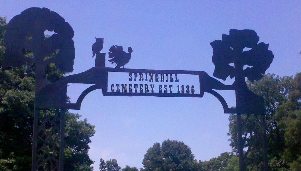
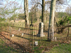
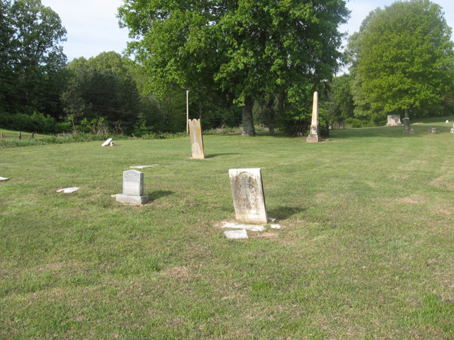
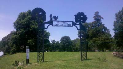
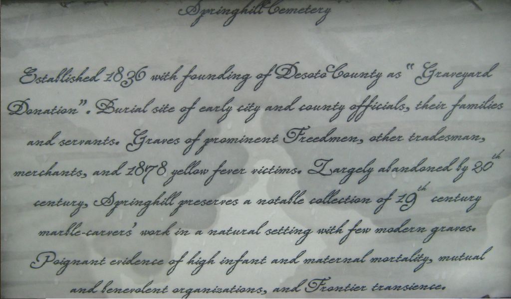
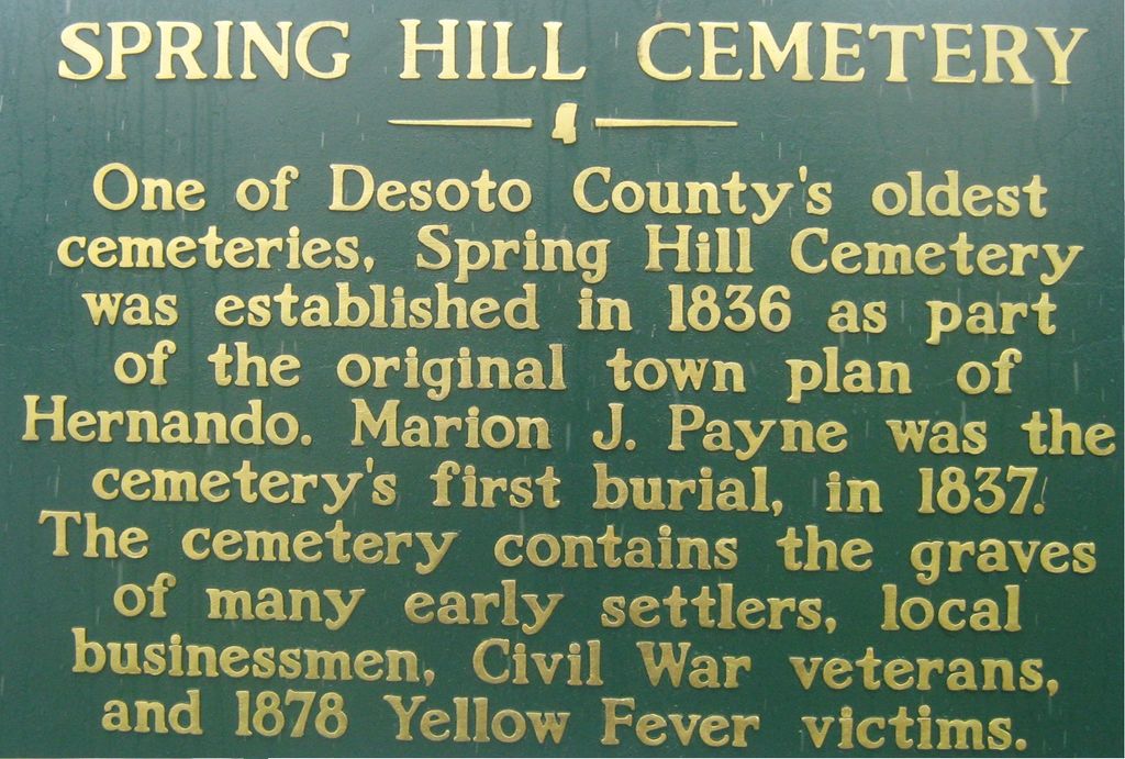
| Description | : | From the intersection of US-51 S & MS-305/Commerce St., in Hernando, travel south on US-51 S for 0.5 mi.; turning west (right) onto W. Oak Grove Rd., going 0.4 mi.; turning north (right) onto College St., going about 25 yards; turning west (left) into the parking area at the entrance gate to the cemetery. This is one of the oldest cemetery in the county, dating from 1837, and containing many of the early city leaders & pioneers. |
frequently asked questions (FAQ):
-
Where is Springhill Cemetery?
Springhill Cemetery is located at 671 W Oak Grove Road Hernando, DeSoto County ,Mississippi ,USA.
-
Springhill Cemetery cemetery's updated grave count on graveviews.com?
0 memorials
-
Where are the coordinates of the Springhill Cemetery?
Latitude: 34.8165870
Longitude: -90.0020220

Nearby Cemetories:
1. Hernando Memorial Park
Hernando, DeSoto County, USA
Coordinate: 34.8175080, -89.9909620
2. Vance Family Cemetery
Hernando, DeSoto County, USA
Coordinate: 34.8285220, -89.9993010
3. Wheeler Cemetery
Hernando, DeSoto County, USA
Coordinate: 34.7984270, -89.9801780
4. Oliver Family Cemetery
Hernando, DeSoto County, USA
Coordinate: 34.8280460, -90.0427010
5. Robertson Family Cemetery
Hernando, DeSoto County, USA
Coordinate: 34.7850740, -90.0318010
6. Forrest Family Cemetery
Hernando, DeSoto County, USA
Coordinate: 34.8170000, -89.9530000
7. Farley Cemetery
DeSoto County, USA
Coordinate: 34.7841988, -89.9721985
8. Banks Family Cemetery
Hernando, DeSoto County, USA
Coordinate: 34.8487500, -89.9628060
9. Huddleston Family Cemetery
Hernando, DeSoto County, USA
Coordinate: 34.8535000, -90.0426000
10. Knights Chapel CME Church Cemetery
Hernando, DeSoto County, USA
Coordinate: 34.8171990, -89.9371210
11. New Bethany Cemetery
Hernando, DeSoto County, USA
Coordinate: 34.8531000, -89.9547000
12. Zion Hill Missionary Baptist Church Cemetery
Robinson Gin, DeSoto County, USA
Coordinate: 34.7655260, -90.0242000
13. Saint Mary MB Church Cemetery
Hernando, DeSoto County, USA
Coordinate: 34.8672700, -90.0287500
14. Rising Sun Road Cemetery
Hernando, DeSoto County, USA
Coordinate: 34.8231110, -90.0694400
15. Bethlehem Cemetery
Nesbit, DeSoto County, USA
Coordinate: 34.8742630, -89.9898520
16. Bethlehem Baptist Church Cemetery
Hernando, DeSoto County, USA
Coordinate: 34.8747700, -89.9929200
17. Love Cemetery
Hernando, DeSoto County, USA
Coordinate: 34.7600740, -89.9697020
18. Grays Creek Cemetery
Hernando, DeSoto County, USA
Coordinate: 34.7869240, -89.9350850
19. Oak Grove Church Cemetery
Hernando, DeSoto County, USA
Coordinate: 34.8092190, -90.0782130
20. Brown Family Cemetery
Hernando, DeSoto County, USA
Coordinate: 34.7933040, -90.0769560
21. Christian Church Cemetery
Hernando, DeSoto County, USA
Coordinate: 34.8608930, -89.9374030
22. Nesbit Cemetery
Hernando, DeSoto County, USA
Coordinate: 34.8872010, -90.0108340
23. Robinson Family Cemetery
Nesbit, DeSoto County, USA
Coordinate: 34.8876620, -90.0070020
24. Morgan Grove M.B. Church Cemetery
Alphaba, DeSoto County, USA
Coordinate: 34.7918180, -89.9196900