
| Memorials | : | 327 |
| Location | : | Little Gaddesden, Dacorum Borough, England |
| Coordinate | : | 51.8140340, -0.5538550 |
| Description | : | Little Gaddesden is a village and civil parish in the English county of Hertfordshire three miles north of Berkhamsted. As well as Little Gaddesden village the parish contains the settlements of Ashridge, Hudnall, and part of Ringshall. Part of the parish was formerly in Buckinghamshire. This includes Witchcraft Bottom, notable as the alleged location where the last witch in Buckinghamshire was tried and hanged. The village of Little Gaddesden borders both Buckinghamshire and Bedfordshire, whilst being situated in the county of Hertfordshire. (Text added by Wertypop) |
frequently asked questions (FAQ):
-
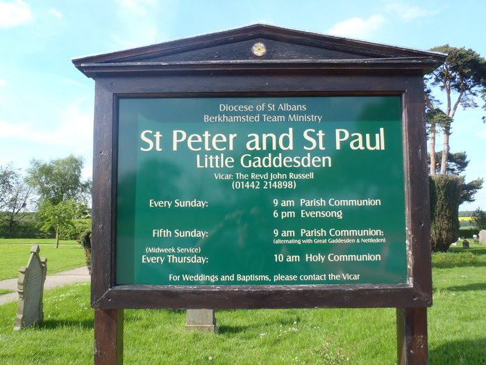
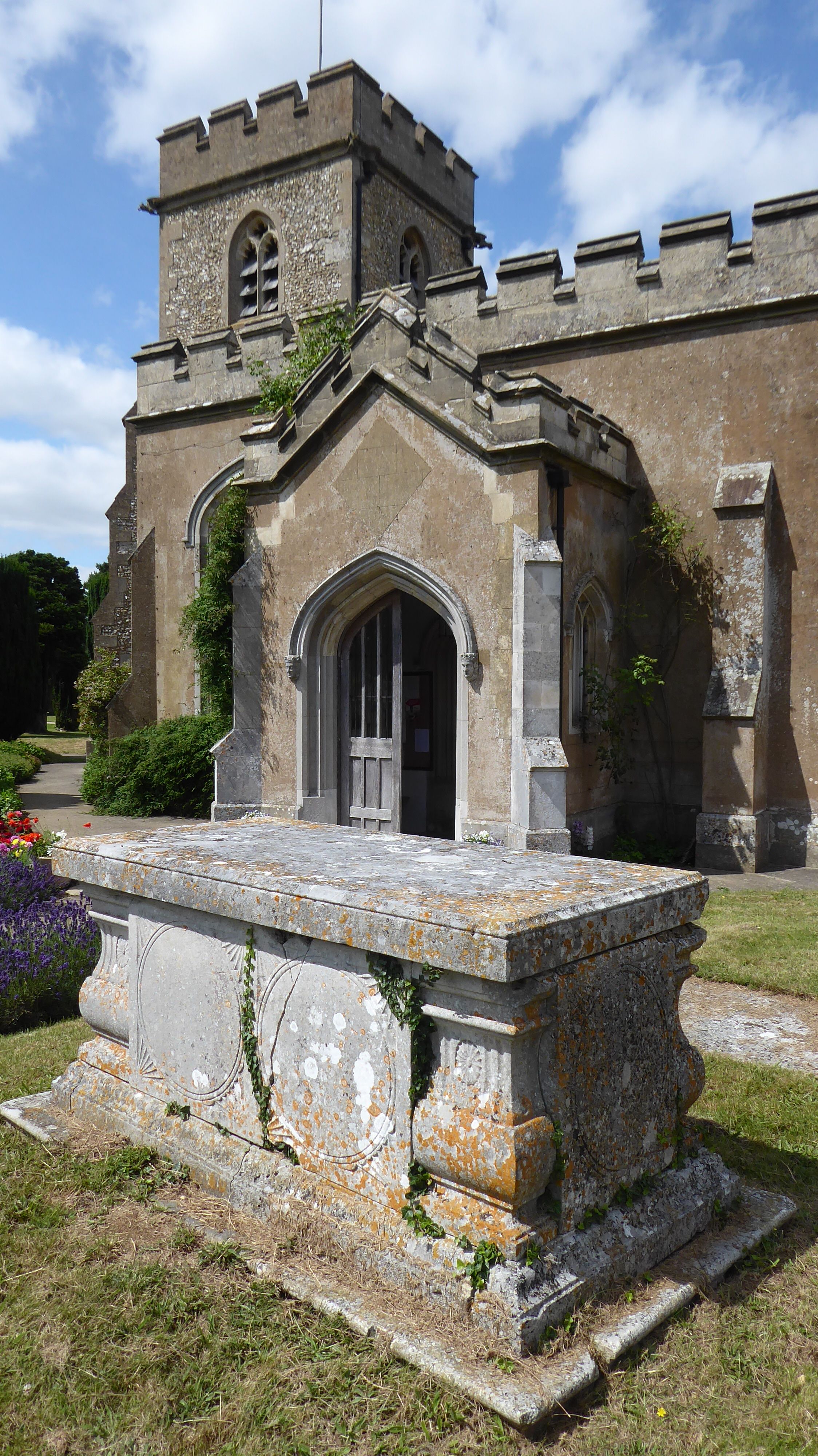
Where is SS Peter & Paul Churchyard?
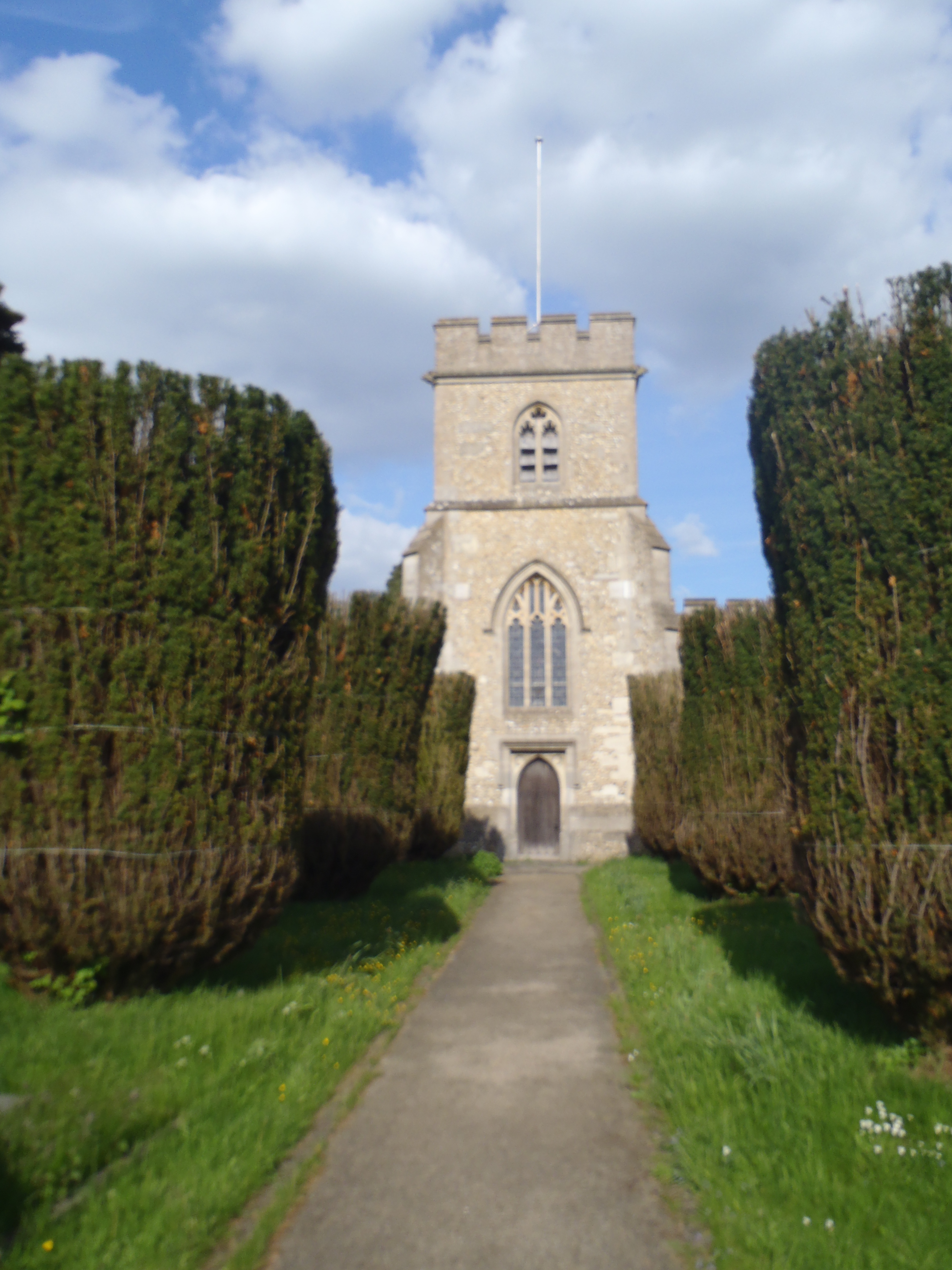
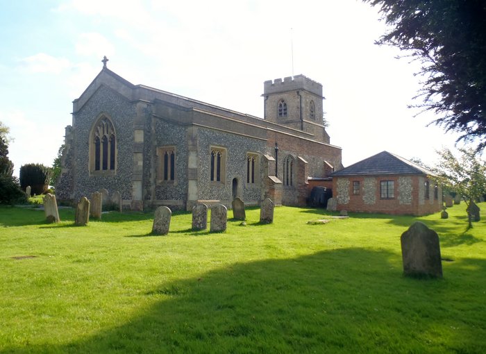
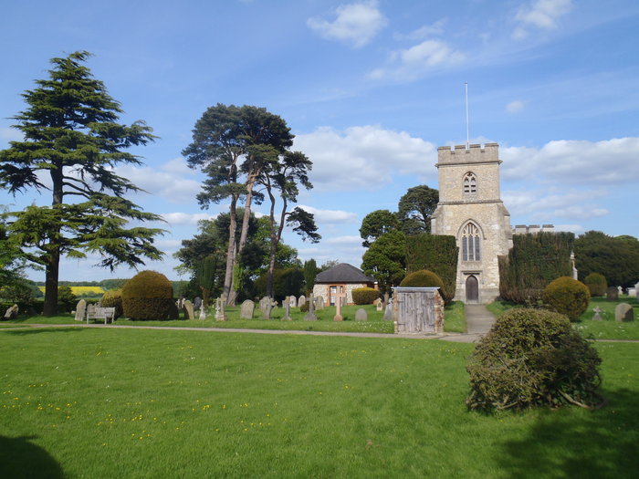
SS Peter & Paul Churchyard is located at Church Lane Little Gaddesden, Dacorum Borough ,Hertfordshire , HP4 1NXEngland.
-
SS Peter & Paul Churchyard cemetery's updated grave count on graveviews.com?
327 memorials
-
Where are the coordinates of the SS Peter & Paul Churchyard?
Latitude: 51.8140340
Longitude: -0.5538550
Nearby Cemetories:
1. Ashridge Priory
Little Gaddesden, Dacorum Borough, England
Coordinate: 51.7990000, -0.5600000
2. St John the Baptist Churchyard
Aldbury, Dacorum Borough, England
Coordinate: 51.8025650, -0.6040510
3. St. Mary Magdalene Churchyard
Whipsnade, Central Bedfordshire Unitary Authority, England
Coordinate: 51.8510078, -0.5324191
4. St. Mary's Churchyard
Northchurch, Dacorum Borough, England
Coordinate: 51.7697820, -0.5891900
5. St. Mary's Churchyard
Pitstone, Aylesbury Vale District, England
Coordinate: 51.8251170, -0.6341170
6. Baptist Chapel Burial Ground
Northchurch, Dacorum Borough, England
Coordinate: 51.7680500, -0.5895400
7. St Mary the Virgin Churchyard
Edlesborough, Aylesbury Vale District, England
Coordinate: 51.8617700, -0.5918500
8. Saint Peters Church
Berkhamsted, Dacorum Borough, England
Coordinate: 51.7595990, -0.5616600
9. St. Michael and all Angels Churchyard
Berkhamsted, Dacorum Borough, England
Coordinate: 51.7590820, -0.5501120
10. St Mary the Virgin, Kensworth
Kensworth, Central Bedfordshire Unitary Authority, England
Coordinate: 51.8602233, -0.5037911
11. Rectory Lane Cemetery
Berkhamsted, Dacorum Borough, England
Coordinate: 51.7577780, -0.5607880
12. St Bartholomew Churchyard
Wigginton, Dacorum Borough, England
Coordinate: 51.7835990, -0.6351040
13. St. John the Baptist Churchyard
Markyate, Dacorum Borough, England
Coordinate: 51.8391900, -0.4658200
14. Kingshill Cemetery
Berkhamsted, Dacorum Borough, England
Coordinate: 51.7512770, -0.5743220
15. St Mary the Virgin Churchyard
Eaton Bray, Central Bedfordshire Unitary Authority, England
Coordinate: 51.8776980, -0.5655540
16. St Giles of Provence churchyard
Totternhoe, Central Bedfordshire Unitary Authority, England
Coordinate: 51.8778108, -0.5656137
17. New Mill Baptist Church Cemetery
Tring, Dacorum Borough, England
Coordinate: 51.8048400, -0.6604100
18. St. John the Evangelist Churchyard
Bourne End, Dacorum Borough, England
Coordinate: 51.7481590, -0.5296080
19. Akeman Street Baptist Churchyard
Tring, Dacorum Borough, England
Coordinate: 51.7929500, -0.6624700
20. Dunstable Cemetery
Dunstable, Central Bedfordshire Unitary Authority, England
Coordinate: 51.8831062, -0.5316300
21. St. Giles in the Woods Priory
Flamstead, Dacorum Borough, England
Coordinate: 51.8187400, -0.4374400
22. St. Mary's Churchyard
Hemel Hempstead, Dacorum Borough, England
Coordinate: 51.7590330, -0.4722730
23. Aley Green Cemetery
Slip End, Central Bedfordshire Unitary Authority, England
Coordinate: 51.8522500, -0.4496420
24. Burma Star Association Memorial
Hemel Hempstead, Dacorum Borough, England
Coordinate: 51.7583610, -0.4727390