
| Memorials | : | 0 |
| Location | : | Whipsnade, Central Bedfordshire Unitary Authority, England |
| Coordinate | : | 51.8510078, -0.5324191 |
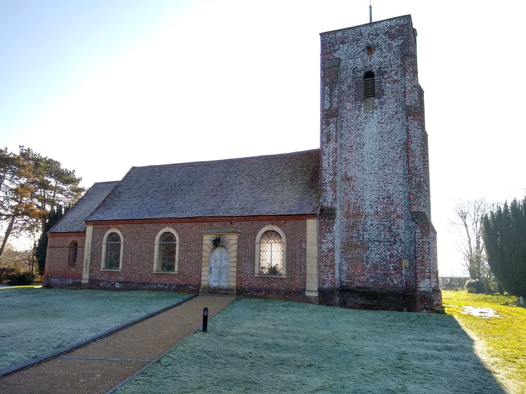
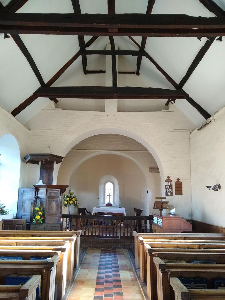
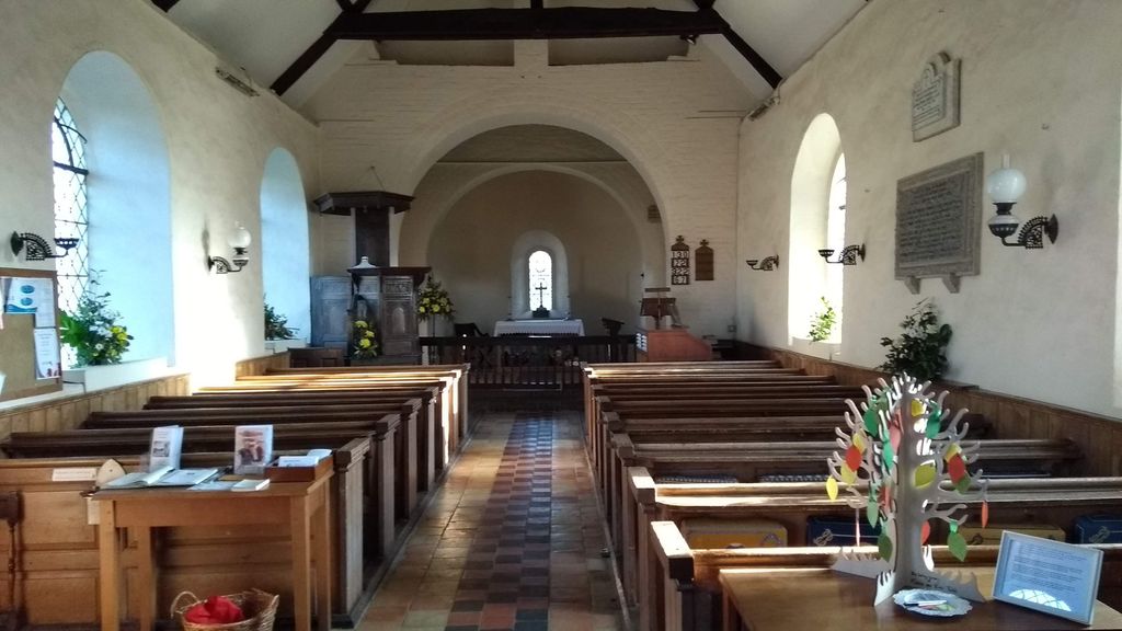
| Description | : | The building is simple, built of brick with a 16th century tower. The pulpit and altar rail are Jacobean, from the previous church. The interior is light and well maintained. It is set at the back of the village green. |
frequently asked questions (FAQ):
-
Where is St. Mary Magdalene Churchyard?
St. Mary Magdalene Churchyard is located at Whipsnade, Central Bedfordshire Unitary Authority ,Bedfordshire , LU6 2LLEngland.
-
St. Mary Magdalene Churchyard cemetery's updated grave count on graveviews.com?
0 memorials
-
Where are the coordinates of the St. Mary Magdalene Churchyard?
Latitude: 51.8510078
Longitude: -0.5324191

Nearby Cemetories:
1. St Mary the Virgin, Kensworth
Kensworth, Central Bedfordshire Unitary Authority, England
Coordinate: 51.8602233, -0.5037911
2. Dunstable Cemetery
Dunstable, Central Bedfordshire Unitary Authority, England
Coordinate: 51.8831062, -0.5316300
3. St Mary the Virgin Churchyard
Eaton Bray, Central Bedfordshire Unitary Authority, England
Coordinate: 51.8776980, -0.5655540
4. St Giles of Provence churchyard
Totternhoe, Central Bedfordshire Unitary Authority, England
Coordinate: 51.8778108, -0.5656137
5. Dunstable Priory
Dunstable, Central Bedfordshire Unitary Authority, England
Coordinate: 51.8859940, -0.5177920
6. St Mary the Virgin Churchyard
Edlesborough, Aylesbury Vale District, England
Coordinate: 51.8617700, -0.5918500
7. SS Peter & Paul Churchyard
Little Gaddesden, Dacorum Borough, England
Coordinate: 51.8140340, -0.5538550
8. St. John the Baptist Churchyard
Markyate, Dacorum Borough, England
Coordinate: 51.8391900, -0.4658200
9. All Saints Churchyard
Caddington, Central Bedfordshire Unitary Authority, England
Coordinate: 51.8670460, -0.4561910
10. Aley Green Cemetery
Slip End, Central Bedfordshire Unitary Authority, England
Coordinate: 51.8522500, -0.4496420
11. Houghton Regis Cemetery
Houghton Regis, Central Bedfordshire Unitary Authority, England
Coordinate: 51.9019710, -0.5229130
12. All Saints Churchyard
Houghton Regis, Central Bedfordshire Unitary Authority, England
Coordinate: 51.9048640, -0.5212930
13. Ashridge Priory
Little Gaddesden, Dacorum Borough, England
Coordinate: 51.7990000, -0.5600000
14. St Andrew Woodside Churchyard
Slip End, Central Bedfordshire Unitary Authority, England
Coordinate: 51.8577160, -0.4306600
15. All Saints Churchyard
Tilsworth, Central Bedfordshire Unitary Authority, England
Coordinate: 51.9083138, -0.5837350
16. St John the Baptist Churchyard
Aldbury, Dacorum Borough, England
Coordinate: 51.8025650, -0.6040510
17. St. Giles in the Woods Priory
Flamstead, Dacorum Borough, England
Coordinate: 51.8187400, -0.4374400
18. St. Mary's Churchyard
Pitstone, Aylesbury Vale District, England
Coordinate: 51.8251170, -0.6341170
19. St. Leonard's Churchyard
Flamstead, Dacorum Borough, England
Coordinate: 51.8199400, -0.4326800
20. Holy Cross
Slapton, Aylesbury Vale District, England
Coordinate: 51.8768800, -0.6401000
21. Luton General Cemetery
Luton, Luton Borough, England
Coordinate: 51.8773780, -0.4242060
22. Friend's Burial Ground
Luton, Luton Borough, England
Coordinate: 51.8738060, -0.4170870
23. St. Michael and All Angels Churchyard
Billington, Central Bedfordshire Unitary Authority, England
Coordinate: 51.8936510, -0.6347710
24. Holy Trinity Churchyard
Biscot, Luton Borough, England
Coordinate: 51.9028700, -0.4375560