
| Memorials | : | 0 |
| Location | : | Chartham, City of Canterbury, England |
| Coordinate | : | 51.2480170, 1.0342770 |
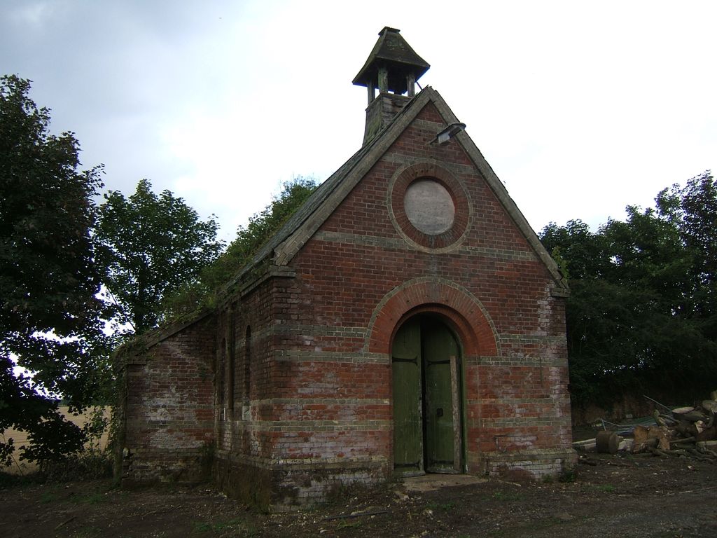
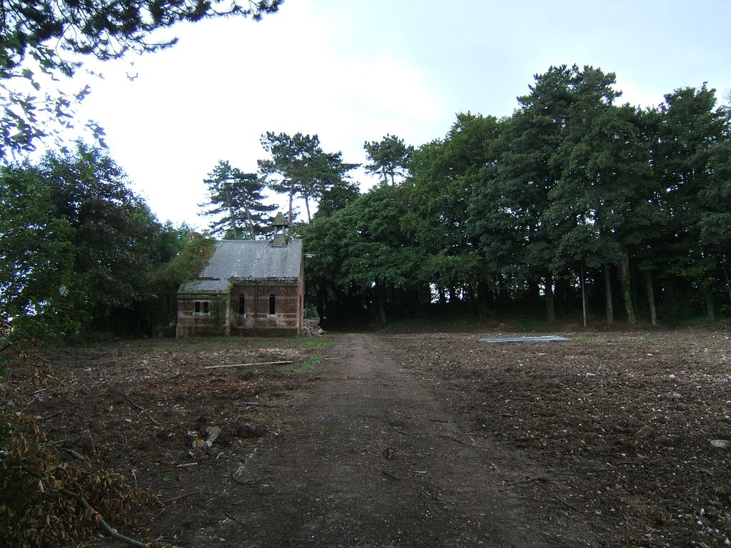
| Description | : | St Augustine's Hospital Burial Ground stands within the 120 acre former Hospital's Estate in Chartham Kent. The Hospital was known by a number of names throughout it's history: Kent County Lunatic Asylum 1875-1920 and Kent County Mental Hospital 1920-1948, it then became part of the National Health Service in 1948 and was re-named St Augustine's Hospital until it closed in 1993. Work commenced in 1997 and much of the old Hospital was demolished or redeveloped for housing. The area was then renamed again, and is now known as St Augustine's Estate. The Burial Ground was used to inter... Read More |
frequently asked questions (FAQ):
-
Where is St Augustine Hospital Burial Ground?
St Augustine Hospital Burial Ground is located at Beech Road Chartham, City of Canterbury ,Kent ,England.
-
St Augustine Hospital Burial Ground cemetery's updated grave count on graveviews.com?
0 memorials
-
Where are the coordinates of the St Augustine Hospital Burial Ground?
Latitude: 51.2480170
Longitude: 1.0342770
Nearby Cemetories:
1. St. Mary the Virgin Churchyard
Chartham, City of Canterbury, England
Coordinate: 51.2558720, 1.0180810
2. Chartham Cemetery
Chartham, City of Canterbury, England
Coordinate: 51.2600890, 1.0068260
3. St Nicholas Churchyard
Thanington-Without, City of Canterbury, England
Coordinate: 51.2703550, 1.0544190
4. All Saints Churchyard
Petham, City of Canterbury, England
Coordinate: 51.2206030, 1.0496330
5. Wincheap Non-Conformist Burial Ground
Canterbury, City of Canterbury, England
Coordinate: 51.2718430, 1.0672940
6. St Mary's Churchyard
Lower Hardres, City of Canterbury, England
Coordinate: 51.2371410, 1.0821320
7. St. Mary's Churchyard
Nackington, City of Canterbury, England
Coordinate: 51.2498670, 1.0892370
8. St Nicholas Hospital Church
Harbledown, City of Canterbury, England
Coordinate: 51.2828200, 1.0536580
9. St Michael and All Angels Church
Harbledown, City of Canterbury, England
Coordinate: 51.2824590, 1.0556800
10. St. Mildred with St. Mary de Castro Church
Canterbury, City of Canterbury, England
Coordinate: 51.2764810, 1.0743320
11. St Mary de Castro Churchyard
Canterbury, City of Canterbury, England
Coordinate: 51.2762400, 1.0766820
12. Dane John Gardens
Canterbury, City of Canterbury, England
Coordinate: 51.2754210, 1.0780390
13. Canterbury City Cemetery
Canterbury, City of Canterbury, England
Coordinate: 51.2843285, 1.0637640
14. Westgate Gardens
Canterbury, City of Canterbury, England
Coordinate: 51.2805250, 1.0745040
15. St Mary Bredin Old Church (Defunct)
Canterbury, City of Canterbury, England
Coordinate: 51.2773455, 1.0803962
16. St Margaret's Churchyard
Canterbury, City of Canterbury, England
Coordinate: 51.2781780, 1.0795840
17. St Peters Methodist Church
Canterbury, City of Canterbury, England
Coordinate: 51.2801720, 1.0771480
18. Holy Cross Church
Canterbury, City of Canterbury, England
Coordinate: 51.2811350, 1.0755710
19. St Mary Breadman Church Demolished
Canterbury, City of Canterbury, England
Coordinate: 51.2798870, 1.0784520
20. St George's Church Demolished
Canterbury, City of Canterbury, England
Coordinate: 51.2773770, 1.0827380
21. St. Dunstan Churchyard
Canterbury, City of Canterbury, England
Coordinate: 51.2836820, 1.0707800
22. All Saints Church Demolished
Canterbury, City of Canterbury, England
Coordinate: 51.2802800, 1.0783450
23. St Peter the Apostle Churchyard
Canterbury, City of Canterbury, England
Coordinate: 51.2807260, 1.0775370
24. St Mary Magdalene Church Demolished
Canterbury, City of Canterbury, England
Coordinate: 51.2784510, 1.0830170