
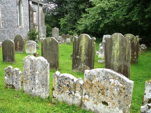
| Memorials | : | 324 |
| Location | : | Lower Hardres, City of Canterbury, England |
| Coordinate | : | 51.2371410, 1.0821320 |
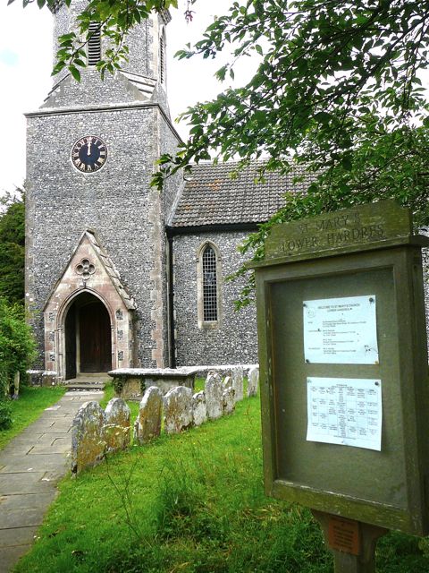
| Description | : | Lower Hardres (pronounced 'Hards') is a small village lying just off the Roman Stone Street, near Canterbury. The church is at the bend of a narrow country lane, with little parking space, and fields on two sides. According to the Parish records there have been churches on the site at least since 1226; the current one dating from Victorian times. It replaced a building that had become dangerously dilapidated. One of the few surviving relics of the earlier churches is the font, dating from the early 13th century. The newer extension to the churchyard requires a scramble down the hill... Read More |
frequently asked questions (FAQ):
-
Where is St Mary's Churchyard?
St Mary's Churchyard is located at School Lane Lower Hardres, City of Canterbury ,Kent , CT4 5NSEngland.
-
St Mary's Churchyard cemetery's updated grave count on graveviews.com?
324 memorials
-
Where are the coordinates of the St Mary's Churchyard?
Latitude: 51.2371410
Longitude: 1.0821320
Nearby Cemetories:
1. St. Mary's Churchyard
Nackington, City of Canterbury, England
Coordinate: 51.2498670, 1.0892370
2. St Peter and St Paul Churchyard
Upper Hardres, City of Canterbury, England
Coordinate: 51.2152380, 1.0811020
3. All Saints Churchyard
Petham, City of Canterbury, England
Coordinate: 51.2206030, 1.0496330
4. St Peter Churchyard
Bridge, City of Canterbury, England
Coordinate: 51.2443730, 1.1271000
5. St Augustine Hospital Burial Ground
Chartham, City of Canterbury, England
Coordinate: 51.2480170, 1.0342770
6. St Mary Churchyard
Bishopsbourne, City of Canterbury, England
Coordinate: 51.2307620, 1.1323170
7. Wincheap Non-Conformist Burial Ground
Canterbury, City of Canterbury, England
Coordinate: 51.2718430, 1.0672940
8. St Nicholas Churchyard
Thanington-Without, City of Canterbury, England
Coordinate: 51.2703550, 1.0544190
9. St Mary Churchyard
Patrixbourne, City of Canterbury, England
Coordinate: 51.2534430, 1.1364840
10. Dane John Gardens
Canterbury, City of Canterbury, England
Coordinate: 51.2754210, 1.0780390
11. St Mary de Castro Churchyard
Canterbury, City of Canterbury, England
Coordinate: 51.2762400, 1.0766820
12. St. Mildred with St. Mary de Castro Church
Canterbury, City of Canterbury, England
Coordinate: 51.2764810, 1.0743320
13. St Mary Bredin Old Church (Defunct)
Canterbury, City of Canterbury, England
Coordinate: 51.2773455, 1.0803962
14. St George's Church Demolished
Canterbury, City of Canterbury, England
Coordinate: 51.2773770, 1.0827380
15. St Paul Without the Walls
Canterbury, City of Canterbury, England
Coordinate: 51.2779380, 1.0853180
16. St Margaret's Churchyard
Canterbury, City of Canterbury, England
Coordinate: 51.2781780, 1.0795840
17. St Augustine Abbey Ruins
Canterbury, City of Canterbury, England
Coordinate: 51.2781280, 1.0882060
18. St Mary Magdalene Church Demolished
Canterbury, City of Canterbury, England
Coordinate: 51.2784510, 1.0830170
19. St Martin Churchyard
Canterbury, City of Canterbury, England
Coordinate: 51.2780170, 1.0937160
20. St Mary Churchyard
Stelling Minnis, Shepway District, England
Coordinate: 51.1963830, 1.0644830
21. Canterbury Cathedral
Canterbury, City of Canterbury, England
Coordinate: 51.2796936, 1.0826840
22. St Mary Breadman Church Demolished
Canterbury, City of Canterbury, England
Coordinate: 51.2798870, 1.0784520
23. St Peters Methodist Church
Canterbury, City of Canterbury, England
Coordinate: 51.2801720, 1.0771480
24. All Saints Church Demolished
Canterbury, City of Canterbury, England
Coordinate: 51.2802800, 1.0783450