
| Memorials | : | 0 |
| Location | : | Snarestone, North West Leicestershire District, England |
| Coordinate | : | 52.0000000, 1.0000000 |
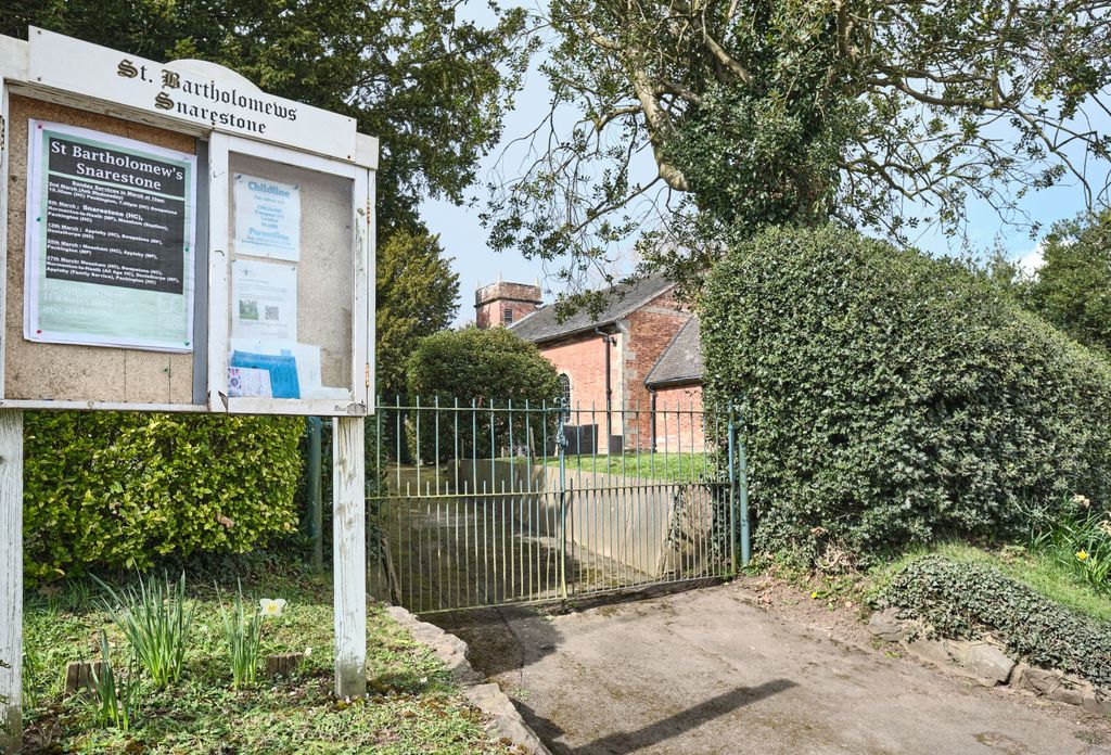
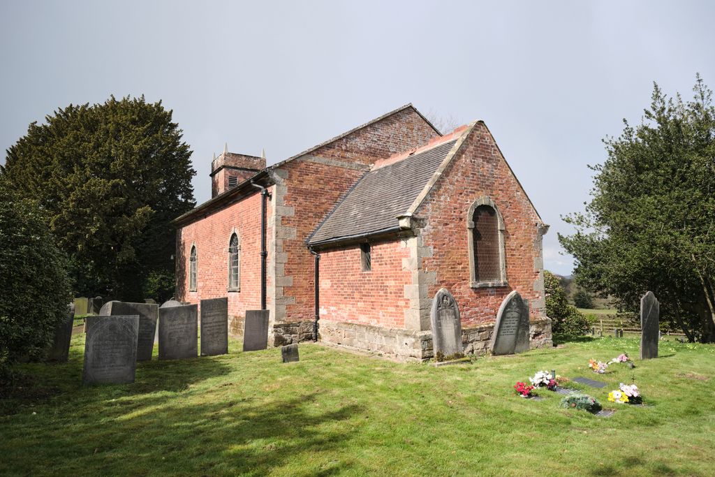
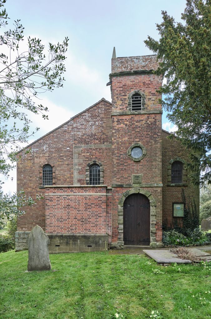
| Description | : | The village church is dedicated to St. Bartholomew and has a register dating back to 1559. The church was rebuilt of red brick in 1752 and enlarged in 1834 to a capacity of 150 sittings. A modern churchyard extension with recent burials lies to the north side of the building. |
frequently asked questions (FAQ):
-
Where is St Bartholomew's Church?
St Bartholomew's Church is located at Measham Rd, Snarestone, Swadlincote Snarestone, North West Leicestershire District ,Leicestershire , DE12 7DAEngland.
-
St Bartholomew's Church cemetery's updated grave count on graveviews.com?
0 memorials
-
Where are the coordinates of the St Bartholomew's Church?
Latitude: 52.0000000
Longitude: 1.0000000

Nearby Cemetories:
1. St. Mary's Churchyard
Holton St Mary, Babergh District, England
Coordinate: 51.9911800, 0.9982800
2. St John Church
Great Wenham (Wenham Magna), Babergh District, England
Coordinate: 52.0029360, 1.0157390
3. St. Mary Churchyard
Raydon, Babergh District, England
Coordinate: 52.0081090, 0.9847290
4. All Saints Churchyard
Little Wenham (Wenham Parva), Babergh District, England
Coordinate: 52.0119000, 1.0309000
5. St Mary the Virgin Churchyard
Capel St Mary, Babergh District, England
Coordinate: 52.0034690, 1.0370820
6. East Bergholt Congregational Churchyard
East Bergholt, Babergh District, England
Coordinate: 51.9716960, 1.0102980
7. East Bergholt Cemetery
East Bergholt, Babergh District, England
Coordinate: 51.9714670, 1.0086430
8. St Mary's Churchyard
Stratford St Mary, Babergh District, England
Coordinate: 51.9718250, 0.9862600
9. St. Mary the Virgin Churchyard
East Bergholt, Babergh District, England
Coordinate: 51.9699760, 1.0125630
10. Franciscan Cemetery
East Bergholt, Babergh District, England
Coordinate: 51.9698890, 1.0148040
11. St Mary's Church Burial Ground
Higham, Forest Heath District, England
Coordinate: 51.9782680, 0.9626690
12. St. Andrew's Churchyard
Layham, Babergh District, England
Coordinate: 52.0240520, 0.9580820
13. St. Mary the Virgin Churchyard
Dedham, Colchester Borough, England
Coordinate: 51.9586270, 0.9927610
14. Our Lady Immaculate Withermarsh Green
Stoke by Nayland, Babergh District, England
Coordinate: 51.9950800, 0.9326260
15. St Mary the Virgin Churchyard
Langham, Colchester Borough, England
Coordinate: 51.9644450, 0.9596300
16. All Saints & St Margaret Churchyard
Chattisham and Hintlesham, Babergh District, England
Coordinate: 52.0383000, 1.0492000
17. Hadleigh United Reformed Churchyard
Hadleigh, Babergh District, England
Coordinate: 52.0426790, 0.9533380
18. Hadleigh Baptist Churchyard
Hadleigh, Babergh District, England
Coordinate: 52.0444510, 0.9562658
19. St Mary's Church Burial Ground - old
Bentley, Babergh District, England
Coordinate: 52.0011990, 1.0849940
20. St. Mary's Churchyard
Hadleigh, Babergh District, England
Coordinate: 52.0436290, 0.9526880
21. St Mary's Church Burial Ground - new
Bentley, Babergh District, England
Coordinate: 52.0011070, 1.0862490
22. St Michael the Archangel Churchyard
Brantham, Babergh District, England
Coordinate: 51.9662000, 1.0733300
23. St Nicholas Churchyard
Hintlesham, Babergh District, England
Coordinate: 52.0496670, 1.0435400
24. Friars Road Cemetery
Hadleigh, Babergh District, England
Coordinate: 52.0481800, 0.9453100