
| Memorials | : | 0 |
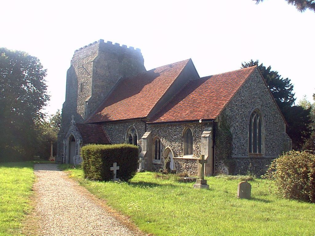
| Location | : | Holton St Mary, Babergh District, England |
| Coordinate | : | 51.9911800, 0.9982800 |
| Description | : | Holton St Mary is a village and civil parish in Suffolk, England. Located on the B1070 around five miles south-west of Ipswich and half a mile from the A12 (which forms the parish's south-east boundary), it is part ofBabergh district. The western end of the parish is part of the Dedham Vale Area of Outstanding Natural Beauty and the Higham meadow nature reserve. The church ‘opened for business’ on August 29th, 1748. |
frequently asked questions (FAQ):
-
Where is St. Mary's Churchyard?
St. Mary's Churchyard is located at Holton St Mary, Babergh District ,Suffolk , IP9 2QPEngland.
-
St. Mary's Churchyard cemetery's updated grave count on graveviews.com?
0 memorials
-
Where are the coordinates of the St. Mary's Churchyard?
Latitude: 51.9911800
Longitude: 0.9982800
Nearby Cemetories:
1. St Bartholomew's Church
Snarestone, North West Leicestershire District, England
Coordinate: 52.0000000, 1.0000000
2. St John Church
Great Wenham (Wenham Magna), Babergh District, England
Coordinate: 52.0029360, 1.0157390
3. St. Mary Churchyard
Raydon, Babergh District, England
Coordinate: 52.0081090, 0.9847290
4. East Bergholt Cemetery
East Bergholt, Babergh District, England
Coordinate: 51.9714670, 1.0086430
5. St Mary's Churchyard
Stratford St Mary, Babergh District, England
Coordinate: 51.9718250, 0.9862600
6. East Bergholt Congregational Churchyard
East Bergholt, Babergh District, England
Coordinate: 51.9716960, 1.0102980
7. St. Mary the Virgin Churchyard
East Bergholt, Babergh District, England
Coordinate: 51.9699760, 1.0125630
8. Franciscan Cemetery
East Bergholt, Babergh District, England
Coordinate: 51.9698890, 1.0148040
9. St Mary's Church Burial Ground
Higham, Forest Heath District, England
Coordinate: 51.9782680, 0.9626690
10. St Mary the Virgin Churchyard
Capel St Mary, Babergh District, England
Coordinate: 52.0034690, 1.0370820
11. All Saints Churchyard
Little Wenham (Wenham Parva), Babergh District, England
Coordinate: 52.0119000, 1.0309000
12. St. Mary the Virgin Churchyard
Dedham, Colchester Borough, England
Coordinate: 51.9586270, 0.9927610
13. St Mary the Virgin Churchyard
Langham, Colchester Borough, England
Coordinate: 51.9644450, 0.9596300
14. Our Lady Immaculate Withermarsh Green
Stoke by Nayland, Babergh District, England
Coordinate: 51.9950800, 0.9326260
15. St. Andrew's Churchyard
Layham, Babergh District, England
Coordinate: 52.0240520, 0.9580820
16. St Michael the Archangel Churchyard
Brantham, Babergh District, England
Coordinate: 51.9662000, 1.0733300
17. St Mary's Church Burial Ground - old
Bentley, Babergh District, England
Coordinate: 52.0011990, 1.0849940
18. St Mary's Church Burial Ground - new
Bentley, Babergh District, England
Coordinate: 52.0011070, 1.0862490
19. All Saints & St Margaret Churchyard
Chattisham and Hintlesham, Babergh District, England
Coordinate: 52.0383000, 1.0492000
20. Hadleigh United Reformed Churchyard
Hadleigh, Babergh District, England
Coordinate: 52.0426790, 0.9533380
21. Hadleigh Baptist Churchyard
Hadleigh, Babergh District, England
Coordinate: 52.0444510, 0.9562658
22. St. Mary's Churchyard
Hadleigh, Babergh District, England
Coordinate: 52.0436290, 0.9526880
23. Saint Peters Churchyard
Boxted, Colchester Borough, England
Coordinate: 51.9617380, 0.9072480
24. St Mary Churchyard
Polstead, Babergh District, England
Coordinate: 52.0054860, 0.8964940