
| Memorials | : | 1 |
| Location | : | Barthomley, Cheshire East Unitary Authority, England |
| Coordinate | : | 53.0681360, -2.3483600 |
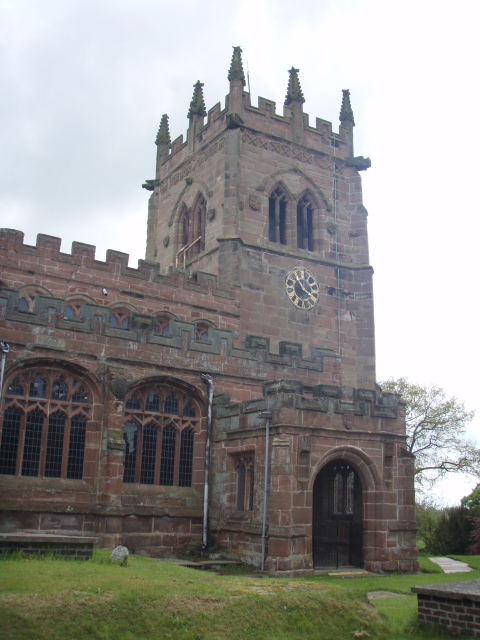
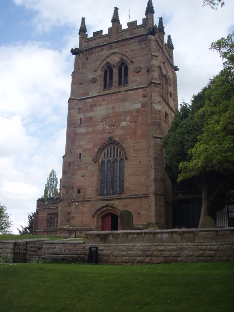
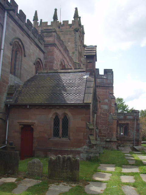
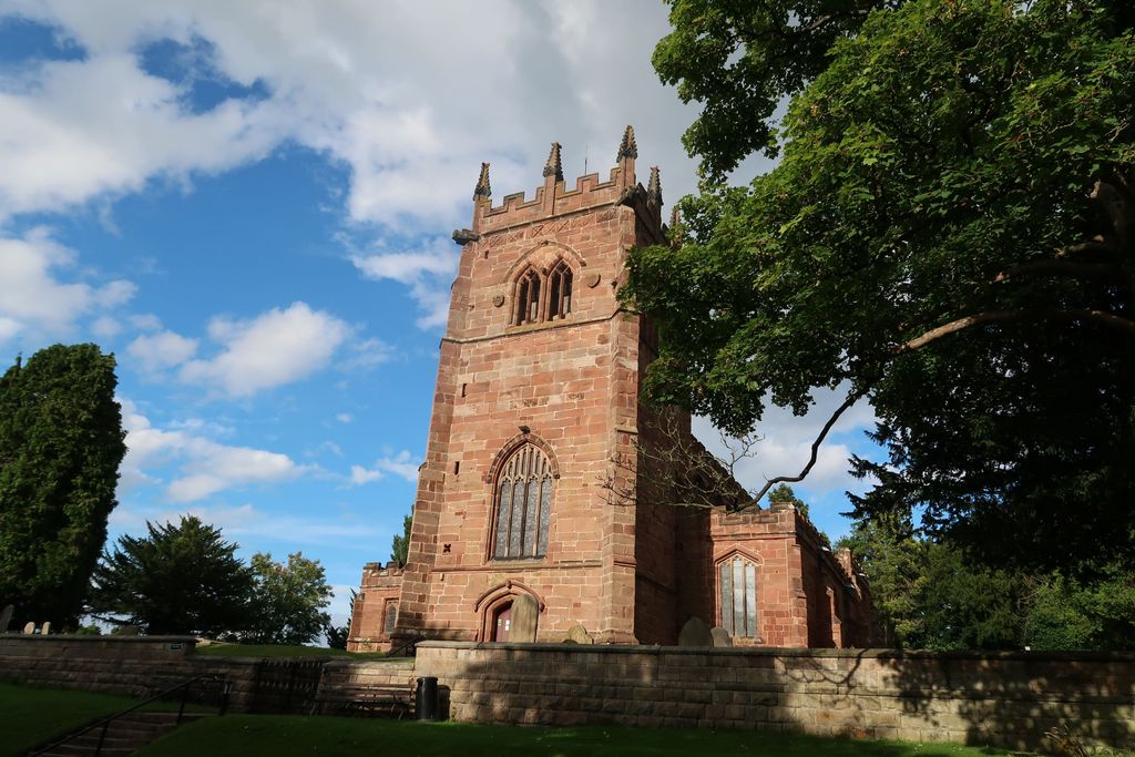
| Description | : | St Bertoline Churchyard St Bertoline's Church, Barthomley is in the village of Barthomley, Cheshire, England (grid reference SJ767524). The church is a Grade I listed building. It is an active Anglican parish church in the diocese of Chester, the archdeaconry of Macclesfield and the deanery of Congleton. The church stands in an elevated position on Barrow Hill, which was an ancient burial ground. It was the scene of a massacre in the Civil War. Richards considers it to be one of the most beautiful churches in the county and believes it is the only one in England to be dedicated to St... Read More |
frequently asked questions (FAQ):
-
Where is St Bertoline's Churchyard?
St Bertoline's Churchyard is located at Radway Green Road Barthomley, Cheshire East Unitary Authority ,Cheshire , CW2 5PGEngland.
-
St Bertoline's Churchyard cemetery's updated grave count on graveviews.com?
1 memorials
-
Where are the coordinates of the St Bertoline's Churchyard?
Latitude: 53.0681360
Longitude: -2.3483600
Nearby Cemetories:
1. Audley Cemetery
Audley, Newcastle-Under-Lyme Borough, England
Coordinate: 53.0550140, -2.3103040
2. St James the Great Churchyard
Audley, Newcastle-Under-Lyme Borough, England
Coordinate: 53.0548480, -2.3014800
3. Audley Methodist Church Cemetery
Bignall End, Newcastle-Under-Lyme Borough, England
Coordinate: 53.0574320, -2.2944720
4. Christ Church Churchyard
Alsager, Cheshire East Unitary Authority, England
Coordinate: 53.0977630, -2.3166660
5. Weston Cemetery
Weston, Cheshire East Unitary Authority, England
Coordinate: 53.0680861, -2.4095799
6. St Margaret Churchyard
Betley, Newcastle-Under-Lyme Borough, England
Coordinate: 53.0328100, -2.3658530
7. St Mary Magdalene Churchyard
Alsager, Cheshire East Unitary Authority, England
Coordinate: 53.0960640, -2.3071370
8. St. Matthew's Churchyard
Haslington, Cheshire East Unitary Authority, England
Coordinate: 53.1011010, -2.3933740
9. St Michael's
Haslington, Cheshire East Unitary Authority, England
Coordinate: 53.0946170, -2.4097820
10. St. John Churchyard
Alsagers Bank, Newcastle-Under-Lyme Borough, England
Coordinate: 53.0365350, -2.2939860
11. Wheelock Heath Baptist Chapelyard
Sandbach, Cheshire East Unitary Authority, England
Coordinate: 53.1132940, -2.3730320
12. St Martin Churchyard
Talke, Newcastle-Under-Lyme Borough, England
Coordinate: 53.0755440, -2.2618170
13. All Saints Churchyard
Church Lawton, Cheshire East Unitary Authority, England
Coordinate: 53.0987050, -2.2679300
14. Christ Church Churchyard
Wheelock, Cheshire East Unitary Authority, England
Coordinate: 53.1247500, -2.3768200
15. Holy Trinity Churchyard
Chesterton, Stratford-on-Avon District, England
Coordinate: 53.0418320, -2.2523770
16. St. Chad Churchyard
Wybunbury, Cheshire East Unitary Authority, England
Coordinate: 53.0452760, -2.4488530
17. Crewe Cemetery & Crematorium
Crewe, Cheshire East Unitary Authority, England
Coordinate: 53.1030540, -2.4415159
18. Chesterton Cemetery
Newcastle-under-Lyme, Newcastle-Under-Lyme Borough, England
Coordinate: 53.0352240, -2.2500500
19. St Luke the Evangelist Churchyard
Silverdale, Newcastle-Under-Lyme Borough, England
Coordinate: 53.0170300, -2.2736770
20. All Saints Churchyard
Odd Rode, Cheshire East Unitary Authority, England
Coordinate: 53.1142100, -2.2644690
21. St. Michael Churchyard
Crewe, Cheshire East Unitary Authority, England
Coordinate: 53.1058200, -2.4475200
22. Attwood Cemetery
Kidsgrove, Newcastle-Under-Lyme Borough, England
Coordinate: 53.0889200, -2.2350700
23. Keele Cemetery
Keele, Newcastle-Under-Lyme Borough, England
Coordinate: 53.0087192, -2.2813113
24. All Saints Churchyard
Madeley, Newcastle-Under-Lyme Borough, England
Coordinate: 52.9962463, -2.3400240