
| Memorials | : | 0 |
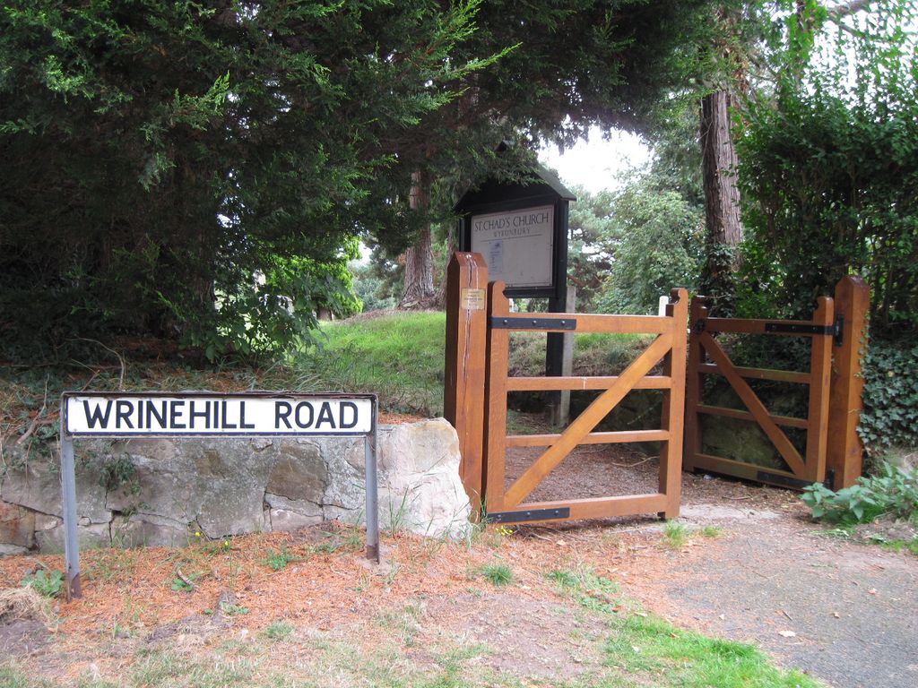
| Location | : | Wybunbury, Cheshire East Unitary Authority, England |
| Coordinate | : | 53.0452760, -2.4488530 |
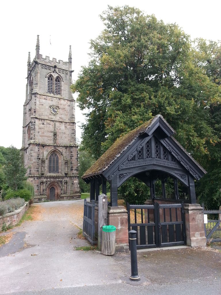
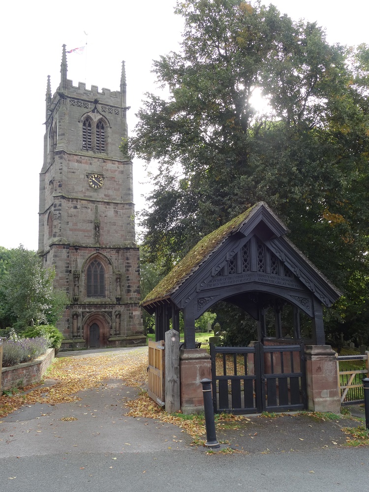
| Description | : | There have been many churches on this site, the earliest dating back to Saxon times, with the 96ft Tower being built in the 15th century. Around 1750 it was noted that its foundations were settling and the tower was beginning to lean. In the early 1790s the church was repaired or rebuilt. However, this did not last long and in 1832 Staffordshire engineer James Trubshaw was contracted to build the third major stone church on the site. In 1833 the body of the church was demolished but Trubshaw was successful in straightening the tower before rebuilding the body of... Read More |
frequently asked questions (FAQ):
-
Where is St. Chad Churchyard?
St. Chad Churchyard is located at Main Road Wybunbury, Cheshire East Unitary Authority ,Cheshire , CW5 7NAEngland.
-
St. Chad Churchyard cemetery's updated grave count on graveviews.com?
0 memorials
-
Where are the coordinates of the St. Chad Churchyard?
Latitude: 53.0452760
Longitude: -2.4488530
Nearby Cemetories:
1. Weston Cemetery
Weston, Cheshire East Unitary Authority, England
Coordinate: 53.0680861, -2.4095799
2. St Mary's Churchyard
Wistaston, Cheshire East Unitary Authority, England
Coordinate: 53.0790200, -2.4771400
3. Nantwich Quaker Burial Ground (Defunct)
Nantwich, Cheshire East Unitary Authority, England
Coordinate: 53.0645719, -2.5214206
4. St Mary's Church
Nantwich, Cheshire East Unitary Authority, England
Coordinate: 53.0671000, -2.5206000
5. Nantwich Cemetery
Nantwich, Cheshire East Unitary Authority, England
Coordinate: 53.0765120, -2.5108130
6. Barker Street Chapel Chapelyard
Nantwich, Cheshire East Unitary Authority, England
Coordinate: 53.0658770, -2.5222890
7. St Margaret Churchyard
Betley, Newcastle-Under-Lyme Borough, England
Coordinate: 53.0328100, -2.3658530
8. St Michael's
Haslington, Cheshire East Unitary Authority, England
Coordinate: 53.0946170, -2.4097820
9. Crewe Cemetery & Crematorium
Crewe, Cheshire East Unitary Authority, England
Coordinate: 53.1030540, -2.4415159
10. St. Michael Churchyard
Crewe, Cheshire East Unitary Authority, England
Coordinate: 53.1058200, -2.4475200
11. Meadow Brook Cemetery
Crewe, Cheshire East Unitary Authority, England
Coordinate: 53.1083460, -2.4690380
12. St Bertoline's Churchyard
Barthomley, Cheshire East Unitary Authority, England
Coordinate: 53.0681360, -2.3483600
13. St. Matthew's Churchyard
Haslington, Cheshire East Unitary Authority, England
Coordinate: 53.1011010, -2.3933740
14. St Mary Churchyard
Acton, Cheshire East Unitary Authority, England
Coordinate: 53.0737140, -2.5511740
15. St Oswald Churchyard
Worleston, Cheshire East Unitary Authority, England
Coordinate: 53.1072140, -2.5223120
16. All Saints Churchyard
Madeley, Newcastle-Under-Lyme Borough, England
Coordinate: 52.9962463, -2.3400240
17. Wheelock Heath Baptist Chapelyard
Sandbach, Cheshire East Unitary Authority, England
Coordinate: 53.1132940, -2.3730320
18. Audley Cemetery
Audley, Newcastle-Under-Lyme Borough, England
Coordinate: 53.0550140, -2.3103040
19. St Michael Churchyard
Baddiley, Cheshire East Unitary Authority, England
Coordinate: 53.0488780, -2.5905830
20. St Peter Churchyard
Minshull Vernon, Cheshire East Unitary Authority, England
Coordinate: 53.1308770, -2.4772320
21. Madeley Cemetery
Madeley, Newcastle-Under-Lyme Borough, England
Coordinate: 52.9878150, -2.3395660
22. Quaker Burial Ground at Stoke Nantwich
Stoke, Cheshire East Unitary Authority, England
Coordinate: 53.0989400, -2.5670000
23. St James the Great Churchyard
Audley, Newcastle-Under-Lyme Borough, England
Coordinate: 53.0548480, -2.3014800
24. Christ Church Churchyard
Wheelock, Cheshire East Unitary Authority, England
Coordinate: 53.1247500, -2.3768200