
| Memorials | : | 0 |
| Location | : | Haslington, Cheshire East Unitary Authority, England |
| Coordinate | : | 53.1011010, -2.3933740 |
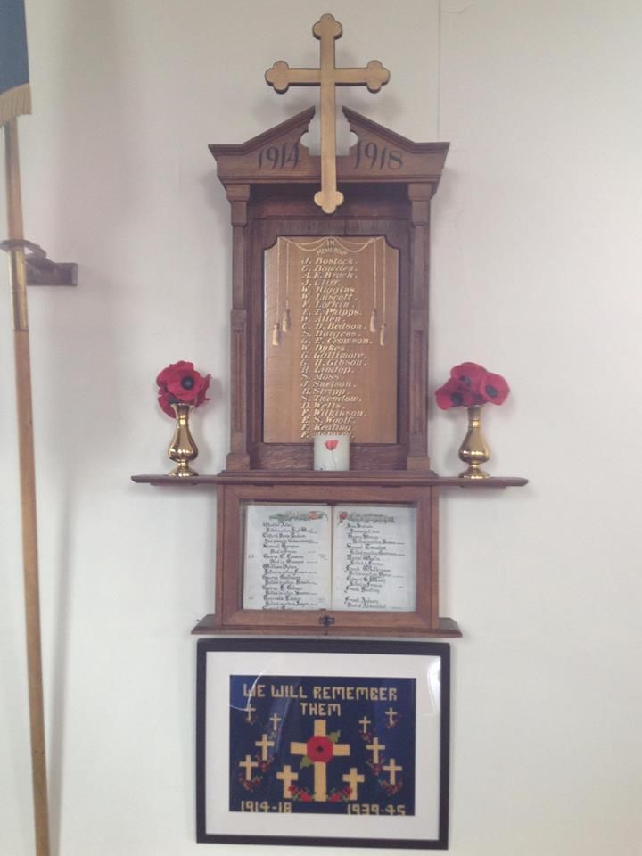
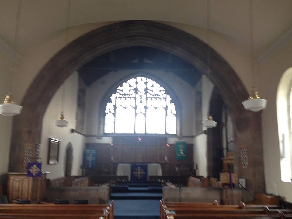
| Description | : | The Parish Church, dedicated to St. Matthew, stands in the centre of the village. Its origin is of a very early date, although there is some controversy about the exact date because reference books on the subject differ. It was originally referred to as a "Chapelry" |
frequently asked questions (FAQ):
-
Where is St. Matthew's Churchyard?
St. Matthew's Churchyard is located at Haslington, Cheshire East Unitary Authority ,Cheshire ,England.
-
St. Matthew's Churchyard cemetery's updated grave count on graveviews.com?
0 memorials
-
Where are the coordinates of the St. Matthew's Churchyard?
Latitude: 53.1011010
Longitude: -2.3933740

Nearby Cemetories:
1. St Michael's
Haslington, Cheshire East Unitary Authority, England
Coordinate: 53.0946170, -2.4097820
2. Wheelock Heath Baptist Chapelyard
Sandbach, Cheshire East Unitary Authority, England
Coordinate: 53.1132940, -2.3730320
3. Christ Church Churchyard
Wheelock, Cheshire East Unitary Authority, England
Coordinate: 53.1247500, -2.3768200
4. Crewe Cemetery & Crematorium
Crewe, Cheshire East Unitary Authority, England
Coordinate: 53.1030540, -2.4415159
5. St. Michael Churchyard
Crewe, Cheshire East Unitary Authority, England
Coordinate: 53.1058200, -2.4475200
6. Weston Cemetery
Weston, Cheshire East Unitary Authority, England
Coordinate: 53.0680861, -2.4095799
7. The Church on Ettiley Heath
Ettiley Heath, Cheshire East Unitary Authority, England
Coordinate: 53.1387412, -2.3964267
8. St Bertoline's Churchyard
Barthomley, Cheshire East Unitary Authority, England
Coordinate: 53.0681360, -2.3483600
9. Sandbach Cemetery
Sandbach, Cheshire East Unitary Authority, England
Coordinate: 53.1410080, -2.3556550
10. Meadow Brook Cemetery
Crewe, Cheshire East Unitary Authority, England
Coordinate: 53.1083460, -2.4690380
11. Christ Church Churchyard
Alsager, Cheshire East Unitary Authority, England
Coordinate: 53.0977630, -2.3166660
12. Hope Chapel
Sandbach, Cheshire East Unitary Authority, England
Coordinate: 53.1439600, -2.3643100
13. St Mary Churchyard
Sandbach, Cheshire East Unitary Authority, England
Coordinate: 53.1435380, -2.3610030
14. St Peter Churchyard
Elworth, Cheshire East Unitary Authority, England
Coordinate: 53.1485950, -2.3898080
15. St Mary Magdalene Churchyard
Alsager, Cheshire East Unitary Authority, England
Coordinate: 53.0960640, -2.3071370
16. St. Leonard's Churchyard
Warmingham, Cheshire East Unitary Authority, England
Coordinate: 53.1462213, -2.4367574
17. St Mary's Churchyard
Wistaston, Cheshire East Unitary Authority, England
Coordinate: 53.0790200, -2.4771400
18. St Peter Churchyard
Minshull Vernon, Cheshire East Unitary Authority, England
Coordinate: 53.1308770, -2.4772320
19. St. John's Churchyard
Sandbach Heath, Cheshire East Unitary Authority, England
Coordinate: 53.1506690, -2.3371800
20. St. Chad Churchyard
Wybunbury, Cheshire East Unitary Authority, England
Coordinate: 53.0452760, -2.4488530
21. Audley Cemetery
Audley, Newcastle-Under-Lyme Borough, England
Coordinate: 53.0550140, -2.3103040
22. St Margaret Churchyard
Betley, Newcastle-Under-Lyme Borough, England
Coordinate: 53.0328100, -2.3658530
23. St John the Baptist Churchyard
Smallwood, Cheshire East Unitary Authority, England
Coordinate: 53.1381700, -2.2913100
24. St James the Great Churchyard
Audley, Newcastle-Under-Lyme Borough, England
Coordinate: 53.0548480, -2.3014800