
| Memorials | : | 0 |
| Location | : | Haslington, Cheshire East Unitary Authority, England |
| Coordinate | : | 53.0946170, -2.4097820 |
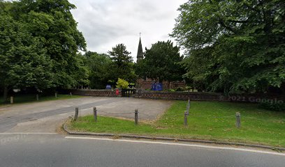
| Description | : | St Micheal's Church, Haslington is in the village of Haslington, Cheshire, England. The church has been designated by English Heritage as a Grade II listed building. It is an active Anglican parish church in the diocese of Chester, the archdeaconry of Macclesfield and the deanery of Nantwich. Its benefice is combined with that of St Michael and All Angels, Crewe Green. |
frequently asked questions (FAQ):
-
Where is St Michael's?
St Michael's is located at Narrow Lane Haslington, Cheshire East Unitary Authority ,Cheshire , CW1 5UNEngland.
-
St Michael's cemetery's updated grave count on graveviews.com?
0 memorials
-
Where are the coordinates of the St Michael's?
Latitude: 53.0946170
Longitude: -2.4097820
Nearby Cemetories:
1. St. Matthew's Churchyard
Haslington, Cheshire East Unitary Authority, England
Coordinate: 53.1011010, -2.3933740
2. Crewe Cemetery & Crematorium
Crewe, Cheshire East Unitary Authority, England
Coordinate: 53.1030540, -2.4415159
3. St. Michael Churchyard
Crewe, Cheshire East Unitary Authority, England
Coordinate: 53.1058200, -2.4475200
4. Weston Cemetery
Weston, Cheshire East Unitary Authority, England
Coordinate: 53.0680861, -2.4095799
5. Wheelock Heath Baptist Chapelyard
Sandbach, Cheshire East Unitary Authority, England
Coordinate: 53.1132940, -2.3730320
6. Christ Church Churchyard
Wheelock, Cheshire East Unitary Authority, England
Coordinate: 53.1247500, -2.3768200
7. Meadow Brook Cemetery
Crewe, Cheshire East Unitary Authority, England
Coordinate: 53.1083460, -2.4690380
8. St Mary's Churchyard
Wistaston, Cheshire East Unitary Authority, England
Coordinate: 53.0790200, -2.4771400
9. The Church on Ettiley Heath
Ettiley Heath, Cheshire East Unitary Authority, England
Coordinate: 53.1387412, -2.3964267
10. St Bertoline's Churchyard
Barthomley, Cheshire East Unitary Authority, England
Coordinate: 53.0681360, -2.3483600
11. St. Leonard's Churchyard
Warmingham, Cheshire East Unitary Authority, England
Coordinate: 53.1462213, -2.4367574
12. St Peter Churchyard
Minshull Vernon, Cheshire East Unitary Authority, England
Coordinate: 53.1308770, -2.4772320
13. St. Chad Churchyard
Wybunbury, Cheshire East Unitary Authority, England
Coordinate: 53.0452760, -2.4488530
14. St Peter Churchyard
Elworth, Cheshire East Unitary Authority, England
Coordinate: 53.1485950, -2.3898080
15. Christ Church Churchyard
Alsager, Cheshire East Unitary Authority, England
Coordinate: 53.0977630, -2.3166660
16. Hope Chapel
Sandbach, Cheshire East Unitary Authority, England
Coordinate: 53.1439600, -2.3643100
17. Sandbach Cemetery
Sandbach, Cheshire East Unitary Authority, England
Coordinate: 53.1410080, -2.3556550
18. St Mary Churchyard
Sandbach, Cheshire East Unitary Authority, England
Coordinate: 53.1435380, -2.3610030
19. St Mary Magdalene Churchyard
Alsager, Cheshire East Unitary Authority, England
Coordinate: 53.0960640, -2.3071370
20. Nantwich Cemetery
Nantwich, Cheshire East Unitary Authority, England
Coordinate: 53.0765120, -2.5108130
21. St Margaret Churchyard
Betley, Newcastle-Under-Lyme Borough, England
Coordinate: 53.0328100, -2.3658530
22. St Oswald Churchyard
Worleston, Cheshire East Unitary Authority, England
Coordinate: 53.1072140, -2.5223120
23. St. John's Churchyard
Sandbach Heath, Cheshire East Unitary Authority, England
Coordinate: 53.1506690, -2.3371800
24. Audley Cemetery
Audley, Newcastle-Under-Lyme Borough, England
Coordinate: 53.0550140, -2.3103040