
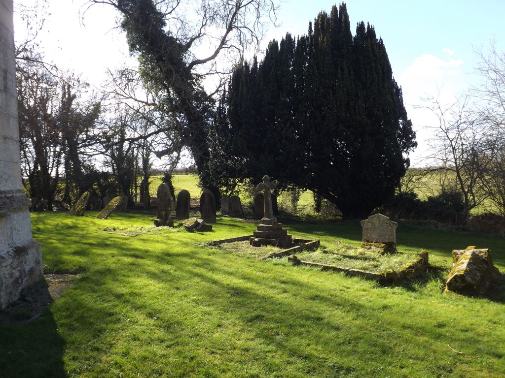
| Memorials | : | 0 |
| Location | : | Stow Longa, Huntingdonshire District, England |
| Coordinate | : | 52.3269300, -0.3766400 |
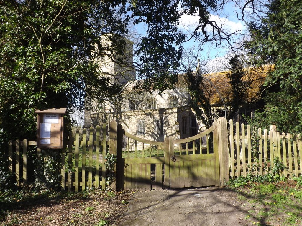
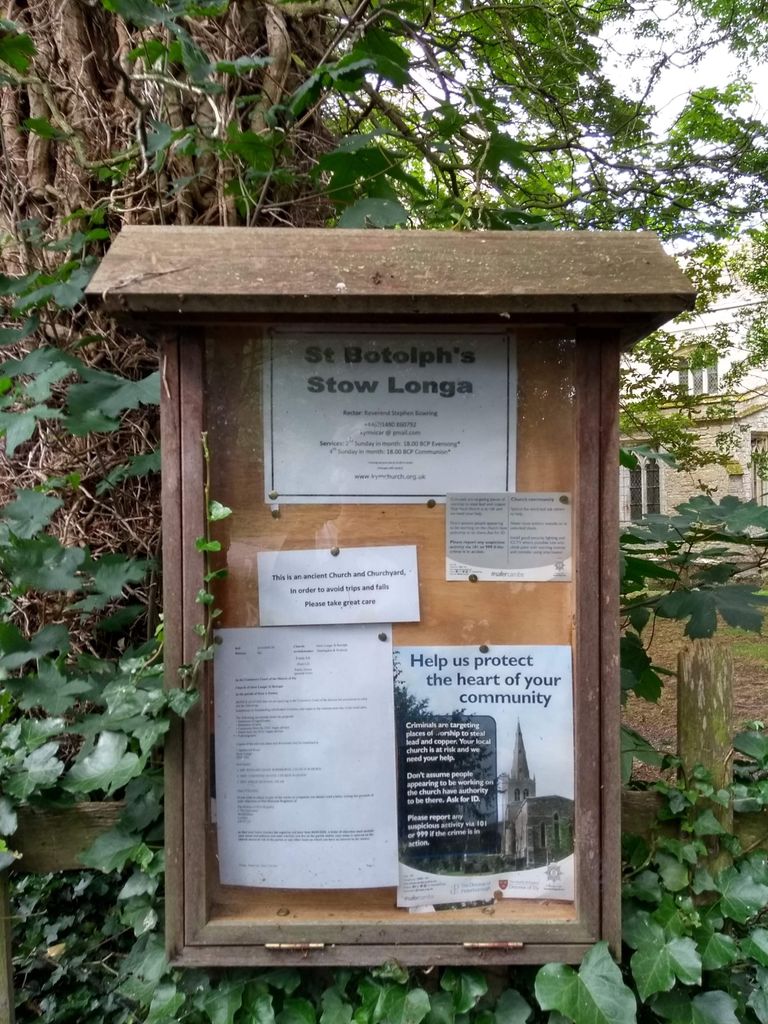
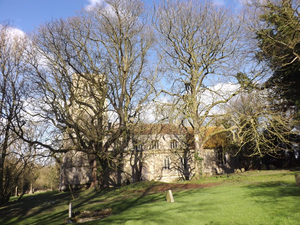
| Description | : | The Anglican church is dedicated to St Botolph, which dates to the 13th century, though a stone slab with inter-laced works (probably pre-Norman Conquest) on the south-side indicates an earlier date. |
frequently asked questions (FAQ):
-
Where is St. Botolph Churchyard?
St. Botolph Churchyard is located at Church Lane Stow Longa, Huntingdonshire District ,Cambridgeshire ,England.
-
St. Botolph Churchyard cemetery's updated grave count on graveviews.com?
0 memorials
-
Where are the coordinates of the St. Botolph Churchyard?
Latitude: 52.3269300
Longitude: -0.3766400
Nearby Cemetories:
1. St. Leonard’s Churchyard
Catworth, Huntingdonshire District, England
Coordinate: 52.3475718, -0.4029185
2. All Saints Churchyard
Tilbrook, Huntingdonshire District, England
Coordinate: 52.3105220, -0.4164860
3. St Andrew Churchyard
Kimbolton, Huntingdonshire District, England
Coordinate: 52.2978950, -0.3895660
4. St Mary's Churchyard
Leighton Bromswold, Huntingdonshire District, England
Coordinate: 52.3641002, -0.3631478
5. Covington Parish Church
Covington, Huntingdonshire District, England
Coordinate: 52.3238459, -0.4505520
6. Brington Parish Churchyard
Brington, Huntingdonshire District, England
Coordinate: 52.3686926, -0.4089893
7. St. Mary Churchyard
Woolley, Metropolitan Borough of Wakefield, England
Coordinate: 52.3565791, -0.3125185
8. Church of Saint Peter Molesworth Churchyard
Molesworth, Huntingdonshire District, England
Coordinate: 52.3700110, -0.4296580
9. St. Peter's Churchyard
Pertenhall, Bedford Borough, England
Coordinate: 52.2762000, -0.4123000
10. Old Weston Church Cemetery
Old Weston, Huntingdonshire District, England
Coordinate: 52.3819525, -0.3940217
11. Old Cemetery
Great Staughton, Huntingdonshire District, England
Coordinate: 52.2694189, -0.3546817
12. Dean URC Cemetery
Upper Dean, Bedford Borough, England
Coordinate: 52.2999756, -0.4634887
13. St Andrew Churchyard
Great Staughton, Huntingdonshire District, England
Coordinate: 52.2691765, -0.3504967
14. St. Andrew's Church Cemetery
Great Staughton, Huntingdonshire District, England
Coordinate: 52.2677700, -0.3573400
15. All Saints Churchyard
Upper Dean, Bedford Borough, England
Coordinate: 52.2969000, -0.4664000
16. All Saints Church
Buckworth, Huntingdonshire District, England
Coordinate: 52.3770200, -0.3147570
17. All Hallow's Church Hargrave Churchyard
Hargrave, East Northamptonshire Borough, England
Coordinate: 52.3242316, -0.4800580
18. St. Nicholas Churchyard
Swineshead, Bedford Borough, England
Coordinate: 52.2805558, -0.4506214
19. St Mary the Virgin Churchyard
Shelton, Bedford Borough, England
Coordinate: 52.3076000, -0.4852000
20. All Saints Churchyard
Little Staughton, Bedford Borough, England
Coordinate: 52.2539810, -0.3792070
21. Brook End Baptist Chapel Chapelyard
Bedford Borough, England
Coordinate: 52.2553182, -0.4280018
22. All Saints Churchyard
Hamerton, Huntingdonshire District, England
Coordinate: 52.4028700, -0.3308800
23. The Little Staughton cemetery burial ground
Little Staughton, Bedford Borough, England
Coordinate: 52.2450015, -0.3776441
24. St. Peter & St. Paul Churchyard
Alconbury, Huntingdonshire District, England
Coordinate: 52.3697800, -0.2610200