| Memorials | : | 0 |
| Location | : | Upper Dean, Bedford Borough, England |
| Coordinate | : | 52.2999756, -0.4634887 |
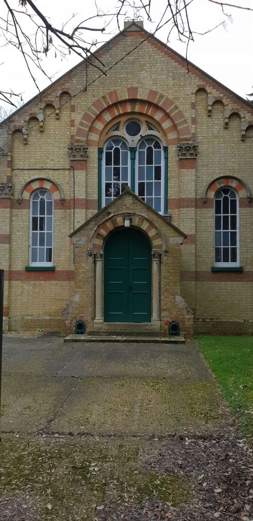
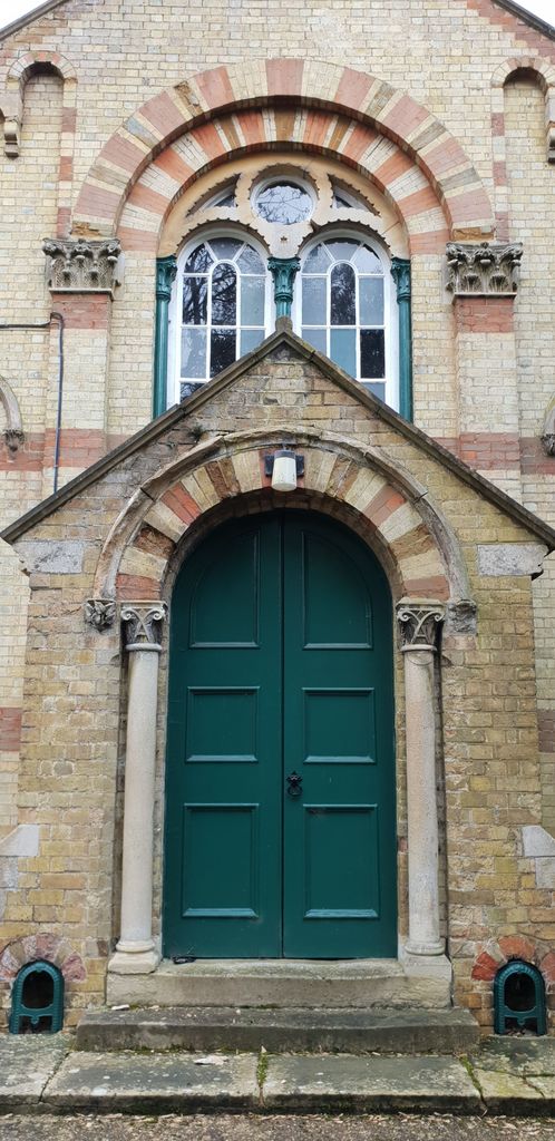
| Description | : | The chapel was listed by the former Department of Environment in August 1983 as Grade II, of special interest. It was erected in 1863 and is built of polychrome brick with some stone dressings and has a slate roof. It is built in the Italianate style with Corinthian pilasters. The chapel was built as a Congregationalist meeting. The Congregational Church of England and Wales merged with the Presbyterian church of England in 1972 to form the United Reformed Church. It is a church which allows individual congregations great scope to organise their services as they choose. Sadly Bedfordshire and Luton Archives... Read More |
frequently asked questions (FAQ):
-
Where is Dean URC Cemetery?
Dean URC Cemetery is located at High St Upper Dean, Bedford Borough ,Bedfordshire ,England.
-
Dean URC Cemetery cemetery's updated grave count on graveviews.com?
0 memorials
-
Where are the coordinates of the Dean URC Cemetery?
Latitude: 52.2999756
Longitude: -0.4634887
Nearby Cemetories:
1. All Saints Churchyard
Upper Dean, Bedford Borough, England
Coordinate: 52.2969000, -0.4664000
2. St Mary the Virgin Churchyard
Shelton, Bedford Borough, England
Coordinate: 52.3076000, -0.4852000
3. St. Nicholas Churchyard
Swineshead, Bedford Borough, England
Coordinate: 52.2805558, -0.4506214
4. Covington Parish Church
Covington, Huntingdonshire District, England
Coordinate: 52.3238459, -0.4505520
5. All Hallow's Church Hargrave Churchyard
Hargrave, East Northamptonshire Borough, England
Coordinate: 52.3242316, -0.4800580
6. St. Mary Magdalene Churchyard
Melchbourne, Bedford Borough, England
Coordinate: 52.2770600, -0.4935690
7. All Saints Churchyard
Tilbrook, Huntingdonshire District, England
Coordinate: 52.3105220, -0.4164860
8. St. Mary the Virgin Churchyard
Yelden, Bedford Borough, England
Coordinate: 52.2930600, -0.5182700
9. St. Peter's Churchyard
Pertenhall, Bedford Borough, England
Coordinate: 52.2762000, -0.4123000
10. All Saints Churchyard
Riseley, Bedford Borough, England
Coordinate: 52.2560000, -0.4785000
11. St Andrew Churchyard
Kimbolton, Huntingdonshire District, England
Coordinate: 52.2978950, -0.3895660
12. St. Peter Churchyard
Newton Bromswold, East Northamptonshire Borough, England
Coordinate: 52.2815200, -0.5376600
13. Brook End Baptist Chapel Chapelyard
Bedford Borough, England
Coordinate: 52.2553182, -0.4280018
14. St. John the Baptist Churchyard
Chelveston, East Northamptonshire Borough, England
Coordinate: 52.3112800, -0.5501200
15. St. Margaret of Antioch Churchyard
Knotting, Bedford Borough, England
Coordinate: 52.2599172, -0.5323686
16. St. Botolph Churchyard
Stow Longa, Huntingdonshire District, England
Coordinate: 52.3269300, -0.3766400
17. St. Leonard’s Churchyard
Catworth, Huntingdonshire District, England
Coordinate: 52.3475718, -0.4029185
18. Stanwick Cemetery
Stanwick, East Northamptonshire Borough, England
Coordinate: 52.3298800, -0.5531500
19. St. Albans Woodland Burial Ground
Keysoe, Bedford Borough, England
Coordinate: 52.2411411, -0.4253732
20. St. Laurence Churchyard Stanwick
Stanwick, East Northamptonshire Borough, England
Coordinate: 52.3324970, -0.5628585
21. All Saints Churchyard
Little Staughton, Bedford Borough, England
Coordinate: 52.2539810, -0.3792070
22. Raunds Cemetery
Raunds, East Northamptonshire Borough, England
Coordinate: 52.3494100, -0.5467400
23. St. Andrew's Church Cemetery
Great Staughton, Huntingdonshire District, England
Coordinate: 52.2677700, -0.3573400
24. Church of Saint Peter Molesworth Churchyard
Molesworth, Huntingdonshire District, England
Coordinate: 52.3700110, -0.4296580


