
| Memorials | : | 0 |
| Location | : | Egloshayle, Cornwall Unitary Authority, England |
| Coordinate | : | 50.4970780, -4.7714730 |
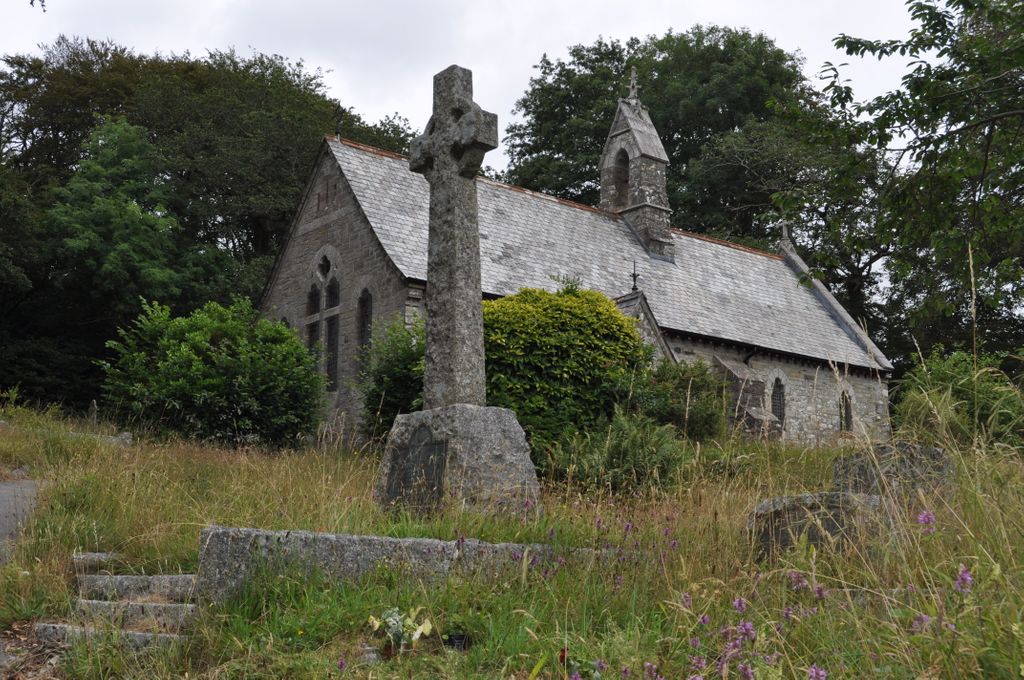
| Description | : | St Conan Church is situated on the A389 (Egloshayle Road) near Washaway, on the edge of the Pencarrow Estate. It was opened for worship on the 23rd July 1883. The font is Saxon, possibly one of the oldest in England. It was found in the rectory garden at Lanteglos by Camelford and moved to St Conan's. The church grounds were first licensed for burials by the Lord Bishop of Truro on the 13 July 1890. The first burial was William Matthews of Croan Ford on the 26 August 1890. His grave is unmarked. |
frequently asked questions (FAQ):
-
Where is St Conan Churchyard?
St Conan Churchyard is located at Egloshayle, Cornwall Unitary Authority ,Cornwall ,England.
-
St Conan Churchyard cemetery's updated grave count on graveviews.com?
0 memorials
-
Where are the coordinates of the St Conan Churchyard?
Latitude: 50.4970780
Longitude: -4.7714730
Nearby Cemetories:
1. Egloshayle Churchyard
Egloshayle, Cornwall Unitary Authority, England
Coordinate: 50.5125936, -4.8208436
2. St. Helena Churchyard
Helland, Cornwall Unitary Authority, England
Coordinate: 50.5100000, -4.7200000
3. Bodmin Jail
Bodmin, Cornwall Unitary Authority, England
Coordinate: 50.4749180, -4.7284800
4. St Lawrence Community Churchyard
Bodmin, Cornwall Unitary Authority, England
Coordinate: 50.4700220, -4.7345900
5. Bodmin New Cemetery
Bodmin, Cornwall Unitary Authority, England
Coordinate: 50.4761490, -4.7194810
6. Centenary Methodist Chapel
Bodmin, Cornwall Unitary Authority, England
Coordinate: 50.4708490, -4.7235180
7. Bodmin Old Cemetery
Bodmin, Cornwall Unitary Authority, England
Coordinate: 50.4757460, -4.7177320
8. Bodmin, Dissenters
Cornwall Unitary Authority, England
Coordinate: 50.4757031, -4.7170733
9. St Michael's Churchyard
Landrake, Cornwall Unitary Authority, England
Coordinate: 50.4747593, -4.7171859
10. Grey Friars
Bodmin, Cornwall Unitary Authority, England
Coordinate: 50.4705630, -4.7190570
11. St Petroc Churchyard
Bodmin, Cornwall Unitary Authority, England
Coordinate: 50.4713620, -4.7167860
12. St. Protus & St. Hyacinth Churchyard
Blisland, Cornwall Unitary Authority, England
Coordinate: 50.5272500, -4.6811400
13. Glynn Valley Crematorium
Bodmin, Cornwall Unitary Authority, England
Coordinate: 50.4589010, -4.6874190
14. St Hydroc Churchyard
Lanhydrock, Cornwall Unitary Authority, England
Coordinate: 50.4411580, -4.6981200
15. St. Meubred Churchyard
Cardinham, Cornwall Unitary Authority, England
Coordinate: 50.4879010, -4.6474830
16. Gunwen Methodist Chapel
Bodmin, Cornwall Unitary Authority, England
Coordinate: 50.4186600, -4.7427070
17. Lanivet Churchyard
Lanivet, Cornwall Unitary Authority, England
Coordinate: 50.4000600, -4.7038300
18. Lanlivery Churchyard
Lanlivery, Cornwall Unitary Authority, England
Coordinate: 50.3998158, -4.7030720
19. St. Petroc Minor Churchyard
Little Petherick, Cornwall Unitary Authority, England
Coordinate: 50.5119830, -4.9375840
20. Restormel Road Cemetery
Lostwithiel, Cornwall Unitary Authority, England
Coordinate: 50.4100830, -4.6693240
21. St Cyriacus and St Julitta Church Cemetery
Luxulyan, Cornwall Unitary Authority, England
Coordinate: 50.3900250, -4.7415450
22. St. Bartholomew Church Cemetery
Lostwithiel, Cornwall Unitary Authority, England
Coordinate: 50.4073690, -4.6691250
23. Lostwithiel Borough Cemetery
Lostwithiel, Cornwall Unitary Authority, England
Coordinate: 50.4028000, -4.6754800
24. Cowbridge Cemetery
Lostwithiel, Cornwall Unitary Authority, England
Coordinate: 50.4022400, -4.6732450