
| Memorials | : | 0 |
| Location | : | Bodmin, Cornwall Unitary Authority, England |
| Coordinate | : | 50.4708490, -4.7235180 |
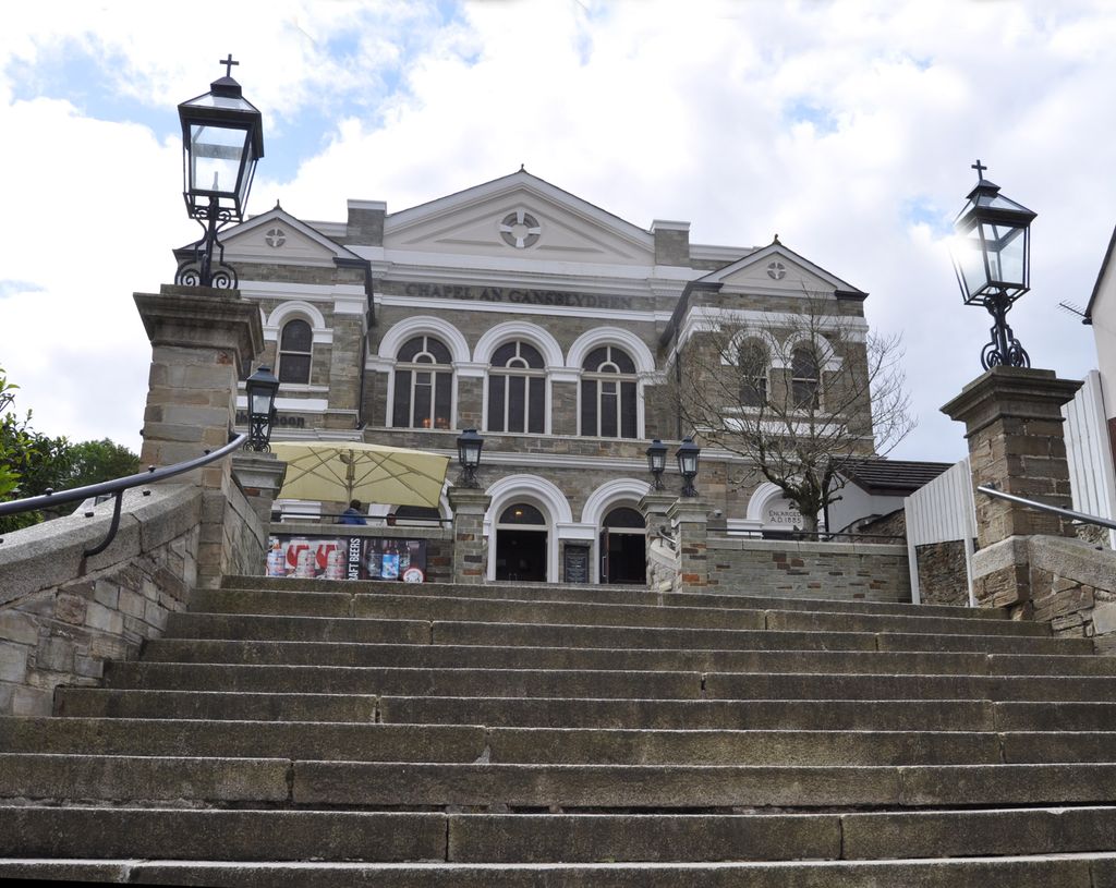
| Description | : | The Centenery Chapel was built in 1840 in the centre of Bodmin to celebrate 100 years of Methodism. It was built to seat 900 people. In 2008 it was bought by Wetherspoons and converted into a Public House. It opened in December 2008. The cemetery is to the rear and impossible to access. A survey was conducted some years ago when 17 Headstones were found and recorded. |
frequently asked questions (FAQ):
-
Where is Centenary Methodist Chapel?
Centenary Methodist Chapel is located at Fore Street Bodmin, Cornwall Unitary Authority ,Cornwall , PL31 2HREngland.
-
Centenary Methodist Chapel cemetery's updated grave count on graveviews.com?
0 memorials
-
Where are the coordinates of the Centenary Methodist Chapel?
Latitude: 50.4708490
Longitude: -4.7235180
Nearby Cemetories:
1. Grey Friars
Bodmin, Cornwall Unitary Authority, England
Coordinate: 50.4705630, -4.7190570
2. St Petroc Churchyard
Bodmin, Cornwall Unitary Authority, England
Coordinate: 50.4713620, -4.7167860
3. Bodmin Jail
Bodmin, Cornwall Unitary Authority, England
Coordinate: 50.4749180, -4.7284800
4. St Michael's Churchyard
Landrake, Cornwall Unitary Authority, England
Coordinate: 50.4747593, -4.7171859
5. Bodmin New Cemetery
Bodmin, Cornwall Unitary Authority, England
Coordinate: 50.4761490, -4.7194810
6. Bodmin Old Cemetery
Bodmin, Cornwall Unitary Authority, England
Coordinate: 50.4757460, -4.7177320
7. Bodmin, Dissenters
Cornwall Unitary Authority, England
Coordinate: 50.4757031, -4.7170733
8. St Lawrence Community Churchyard
Bodmin, Cornwall Unitary Authority, England
Coordinate: 50.4700220, -4.7345900
9. Glynn Valley Crematorium
Bodmin, Cornwall Unitary Authority, England
Coordinate: 50.4589010, -4.6874190
10. St Hydroc Churchyard
Lanhydrock, Cornwall Unitary Authority, England
Coordinate: 50.4411580, -4.6981200
11. St. Helena Churchyard
Helland, Cornwall Unitary Authority, England
Coordinate: 50.5100000, -4.7200000
12. St Conan Churchyard
Egloshayle, Cornwall Unitary Authority, England
Coordinate: 50.4970780, -4.7714730
13. St. Meubred Churchyard
Cardinham, Cornwall Unitary Authority, England
Coordinate: 50.4879010, -4.6474830
14. Gunwen Methodist Chapel
Bodmin, Cornwall Unitary Authority, England
Coordinate: 50.4186600, -4.7427070
15. St. Protus & St. Hyacinth Churchyard
Blisland, Cornwall Unitary Authority, England
Coordinate: 50.5272500, -4.6811400
16. Restormel Road Cemetery
Lostwithiel, Cornwall Unitary Authority, England
Coordinate: 50.4100830, -4.6693240
17. Lanivet Churchyard
Lanivet, Cornwall Unitary Authority, England
Coordinate: 50.4000600, -4.7038300
18. Lanlivery Churchyard
Lanlivery, Cornwall Unitary Authority, England
Coordinate: 50.3998158, -4.7030720
19. St. Bartholomew Church Cemetery
Lostwithiel, Cornwall Unitary Authority, England
Coordinate: 50.4073690, -4.6691250
20. Lostwithiel Borough Cemetery
Lostwithiel, Cornwall Unitary Authority, England
Coordinate: 50.4028000, -4.6754800
21. Egloshayle Churchyard
Egloshayle, Cornwall Unitary Authority, England
Coordinate: 50.5125936, -4.8208436
22. Cowbridge Cemetery
Lostwithiel, Cornwall Unitary Authority, England
Coordinate: 50.4022400, -4.6732450
23. St Cyriacus and St Julitta Church Cemetery
Luxulyan, Cornwall Unitary Authority, England
Coordinate: 50.3900250, -4.7415450
24. Boconnoc Parish Church
Boconnoc, Cornwall Unitary Authority, England
Coordinate: 50.4159600, -4.6094600