
| Memorials | : | 0 |
| Location | : | Bodmin, Cornwall Unitary Authority, England |
| Website | : | bodmin.gov.uk/services/cemeteries/ |
| Coordinate | : | 50.4757460, -4.7177320 |
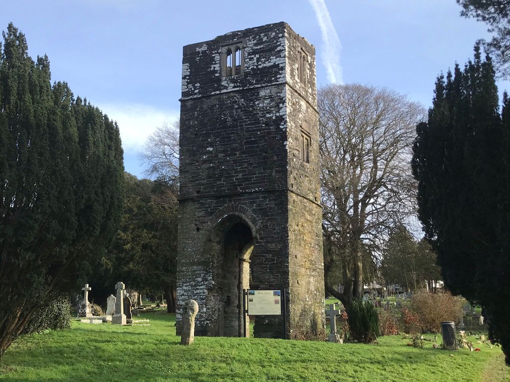
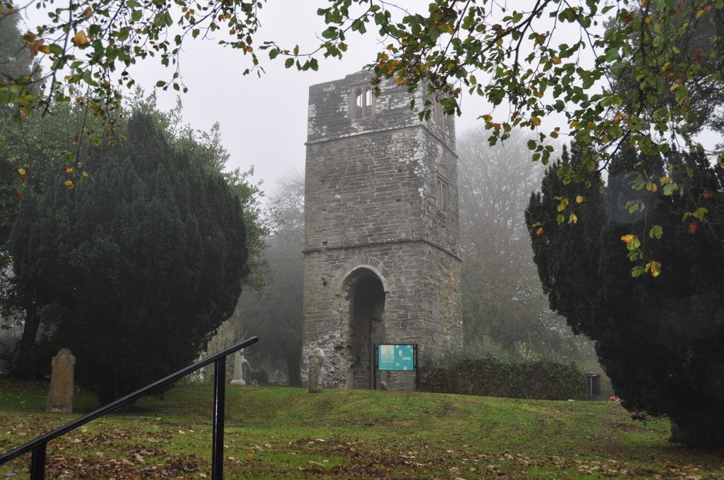
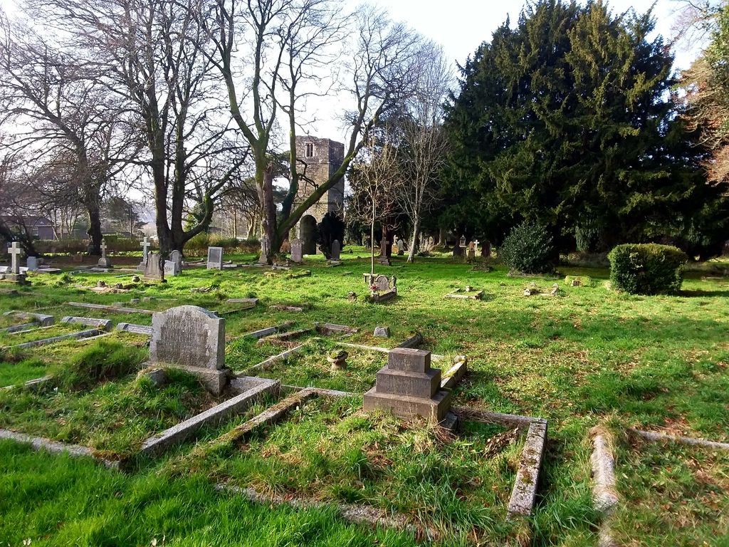
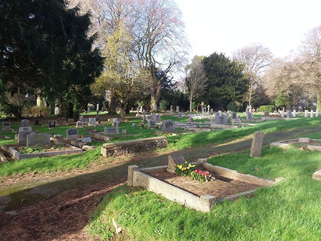
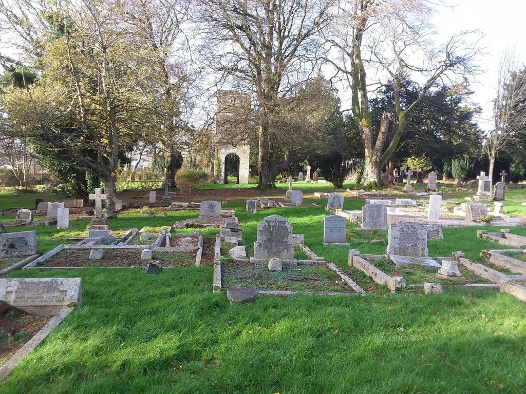
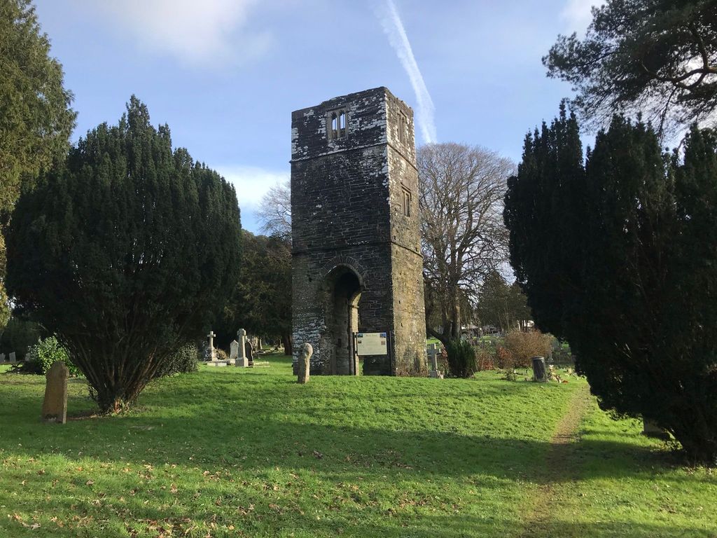
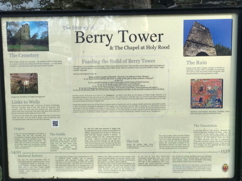
| Description | : | The old cemetery is on the east side of Berry Lane, and contains the ruined Berry Tower, the only remaining part of the 14th century Chapel of the Holy Rood. |
frequently asked questions (FAQ):
-
Where is Bodmin Old Cemetery?
Bodmin Old Cemetery is located at Bodmin, Cornwall Unitary Authority ,Cornwall ,England.
-
Bodmin Old Cemetery cemetery's updated grave count on graveviews.com?
0 memorials
-
Where are the coordinates of the Bodmin Old Cemetery?
Latitude: 50.4757460
Longitude: -4.7177320
Nearby Cemetories:
1. Bodmin, Dissenters
Cornwall Unitary Authority, England
Coordinate: 50.4757031, -4.7170733
2. St Michael's Churchyard
Landrake, Cornwall Unitary Authority, England
Coordinate: 50.4747593, -4.7171859
3. Bodmin New Cemetery
Bodmin, Cornwall Unitary Authority, England
Coordinate: 50.4761490, -4.7194810
4. St Petroc Churchyard
Bodmin, Cornwall Unitary Authority, England
Coordinate: 50.4713620, -4.7167860
5. Grey Friars
Bodmin, Cornwall Unitary Authority, England
Coordinate: 50.4705630, -4.7190570
6. Centenary Methodist Chapel
Bodmin, Cornwall Unitary Authority, England
Coordinate: 50.4708490, -4.7235180
7. Bodmin Jail
Bodmin, Cornwall Unitary Authority, England
Coordinate: 50.4749180, -4.7284800
8. St Lawrence Community Churchyard
Bodmin, Cornwall Unitary Authority, England
Coordinate: 50.4700220, -4.7345900
9. Glynn Valley Crematorium
Bodmin, Cornwall Unitary Authority, England
Coordinate: 50.4589010, -4.6874190
10. St. Helena Churchyard
Helland, Cornwall Unitary Authority, England
Coordinate: 50.5100000, -4.7200000
11. St Hydroc Churchyard
Lanhydrock, Cornwall Unitary Authority, England
Coordinate: 50.4411580, -4.6981200
12. St Conan Churchyard
Egloshayle, Cornwall Unitary Authority, England
Coordinate: 50.4970780, -4.7714730
13. St. Meubred Churchyard
Cardinham, Cornwall Unitary Authority, England
Coordinate: 50.4879010, -4.6474830
14. St. Protus & St. Hyacinth Churchyard
Blisland, Cornwall Unitary Authority, England
Coordinate: 50.5272500, -4.6811400
15. Gunwen Methodist Chapel
Bodmin, Cornwall Unitary Authority, England
Coordinate: 50.4186600, -4.7427070
16. Restormel Road Cemetery
Lostwithiel, Cornwall Unitary Authority, England
Coordinate: 50.4100830, -4.6693240
17. St. Bartholomew Church Cemetery
Lostwithiel, Cornwall Unitary Authority, England
Coordinate: 50.4073690, -4.6691250
18. Egloshayle Churchyard
Egloshayle, Cornwall Unitary Authority, England
Coordinate: 50.5125936, -4.8208436
19. Lanivet Churchyard
Lanivet, Cornwall Unitary Authority, England
Coordinate: 50.4000600, -4.7038300
20. Lanlivery Churchyard
Lanlivery, Cornwall Unitary Authority, England
Coordinate: 50.3998158, -4.7030720
21. Lostwithiel Borough Cemetery
Lostwithiel, Cornwall Unitary Authority, England
Coordinate: 50.4028000, -4.6754800
22. Cowbridge Cemetery
Lostwithiel, Cornwall Unitary Authority, England
Coordinate: 50.4022400, -4.6732450
23. St Cyriacus and St Julitta Church Cemetery
Luxulyan, Cornwall Unitary Authority, England
Coordinate: 50.3900250, -4.7415450
24. Boconnoc Parish Church
Boconnoc, Cornwall Unitary Authority, England
Coordinate: 50.4159600, -4.6094600