| Memorials | : | 0 |
| Location | : | Helland, Cornwall Unitary Authority, England |
| Coordinate | : | 50.5100000, -4.7200000 |
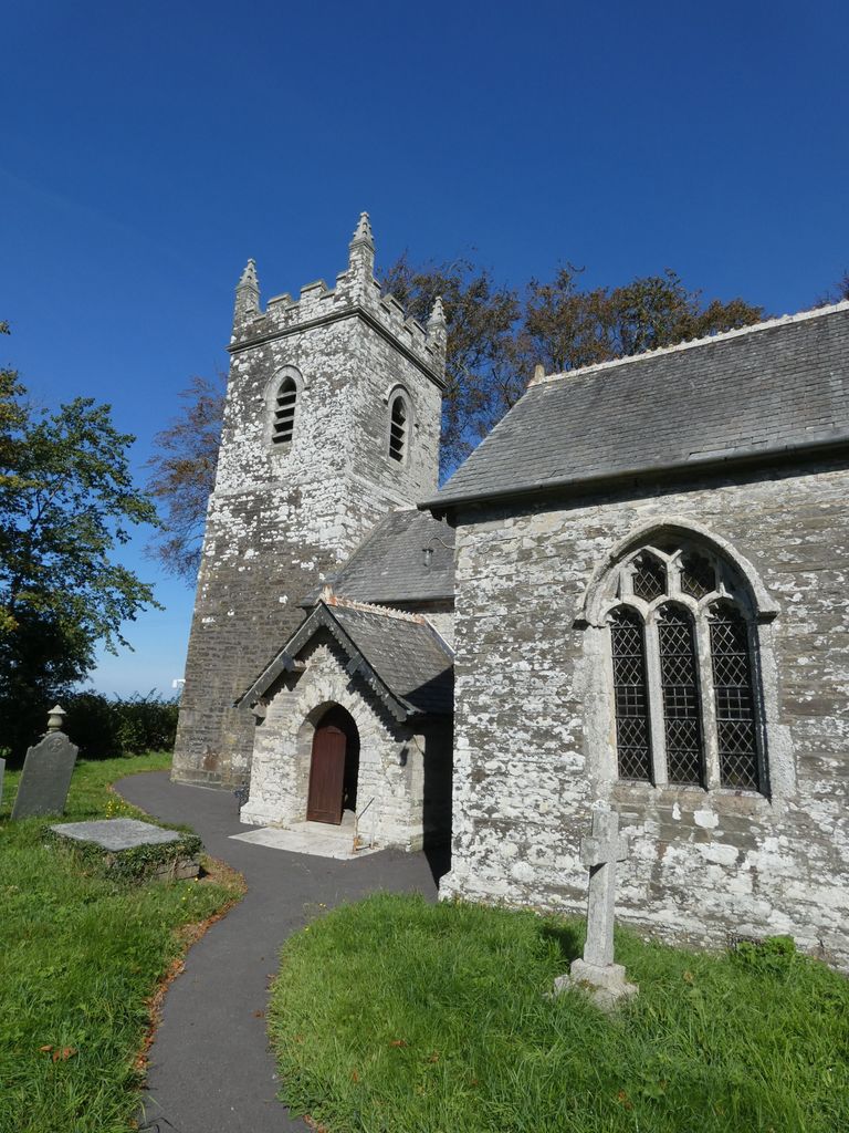
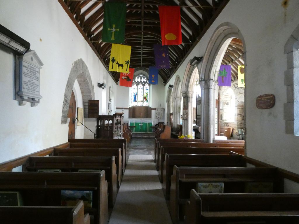
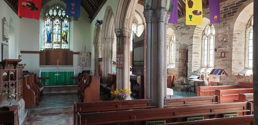
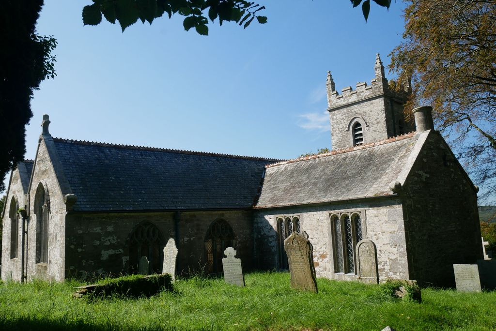
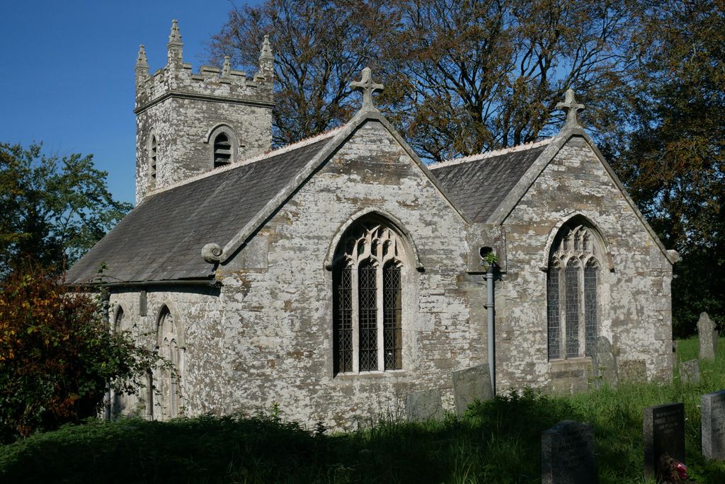
| Description | : | The parish church of Helland, in the Anglican Diocese of Truro and county of Cornwall England, is a Grade II listed building, and part of the Camel Side Cluster of Churches Helland Parish Church is dedicated to St Helena, who was the mother of Constantine. The Church is pre Norman, the stonework is circa 13th century, however in the mid 17th century the tower became ruinous and has not been entirely rebuilt. The plain font is thought to be 700 years old. The church tower has a pyramidal roof has one main bell and eight carillon bells The banners which... Read More |
frequently asked questions (FAQ):
-
Where is St. Helena Churchyard?
St. Helena Churchyard is located at 5 Tredethy Rd Helland, Cornwall Unitary Authority ,Cornwall , PL30 4QBEngland.
-
St. Helena Churchyard cemetery's updated grave count on graveviews.com?
0 memorials
-
Where are the coordinates of the St. Helena Churchyard?
Latitude: 50.5100000
Longitude: -4.7200000
Nearby Cemetories:
1. St. Protus & St. Hyacinth Churchyard
Blisland, Cornwall Unitary Authority, England
Coordinate: 50.5272500, -4.6811400
2. Bodmin New Cemetery
Bodmin, Cornwall Unitary Authority, England
Coordinate: 50.4761490, -4.7194810
3. Bodmin Old Cemetery
Bodmin, Cornwall Unitary Authority, England
Coordinate: 50.4757460, -4.7177320
4. Bodmin, Dissenters
Cornwall Unitary Authority, England
Coordinate: 50.4757031, -4.7170733
5. St Conan Churchyard
Egloshayle, Cornwall Unitary Authority, England
Coordinate: 50.4970780, -4.7714730
6. St Michael's Churchyard
Landrake, Cornwall Unitary Authority, England
Coordinate: 50.4747593, -4.7171859
7. Bodmin Jail
Bodmin, Cornwall Unitary Authority, England
Coordinate: 50.4749180, -4.7284800
8. St Petroc Churchyard
Bodmin, Cornwall Unitary Authority, England
Coordinate: 50.4713620, -4.7167860
9. Centenary Methodist Chapel
Bodmin, Cornwall Unitary Authority, England
Coordinate: 50.4708490, -4.7235180
10. Grey Friars
Bodmin, Cornwall Unitary Authority, England
Coordinate: 50.4705630, -4.7190570
11. St Lawrence Community Churchyard
Bodmin, Cornwall Unitary Authority, England
Coordinate: 50.4700220, -4.7345900
12. St. Meubred Churchyard
Cardinham, Cornwall Unitary Authority, England
Coordinate: 50.4879010, -4.6474830
13. Glynn Valley Crematorium
Bodmin, Cornwall Unitary Authority, England
Coordinate: 50.4589010, -4.6874190
14. Egloshayle Churchyard
Egloshayle, Cornwall Unitary Authority, England
Coordinate: 50.5125936, -4.8208436
15. St Hydroc Churchyard
Lanhydrock, Cornwall Unitary Authority, England
Coordinate: 50.4411580, -4.6981200
16. Gunwen Methodist Chapel
Bodmin, Cornwall Unitary Authority, England
Coordinate: 50.4186600, -4.7427070
17. St. Adwenna Churchyard
Advent, Cornwall Unitary Authority, England
Coordinate: 50.6033553, -4.6798271
18. St Julitta Lanteglos Churchyard
Lanteglos, Cornwall Unitary Authority, England
Coordinate: 50.6095360, -4.7038460
19. Restormel Road Cemetery
Lostwithiel, Cornwall Unitary Authority, England
Coordinate: 50.4100830, -4.6693240
20. Holy Trinity Churchyard
Bolventor, Cornwall Unitary Authority, England
Coordinate: 50.5602100, -4.5708200
21. St. Bartholomew Church Cemetery
Lostwithiel, Cornwall Unitary Authority, England
Coordinate: 50.4073690, -4.6691250
22. Lanivet Churchyard
Lanivet, Cornwall Unitary Authority, England
Coordinate: 50.4000600, -4.7038300
23. Delabole Cemetery
Delabole, Cornwall Unitary Authority, England
Coordinate: 50.6202400, -4.7317980
24. Lanlivery Churchyard
Lanlivery, Cornwall Unitary Authority, England
Coordinate: 50.3998158, -4.7030720

