
| Memorials | : | 7 |
| Location | : | Cheddleton, Staffordshire Moorlands District, England |
| Coordinate | : | 53.0689530, -2.0448230 |
frequently asked questions (FAQ):
-
Where is St Edward the Confessor Churchyard?
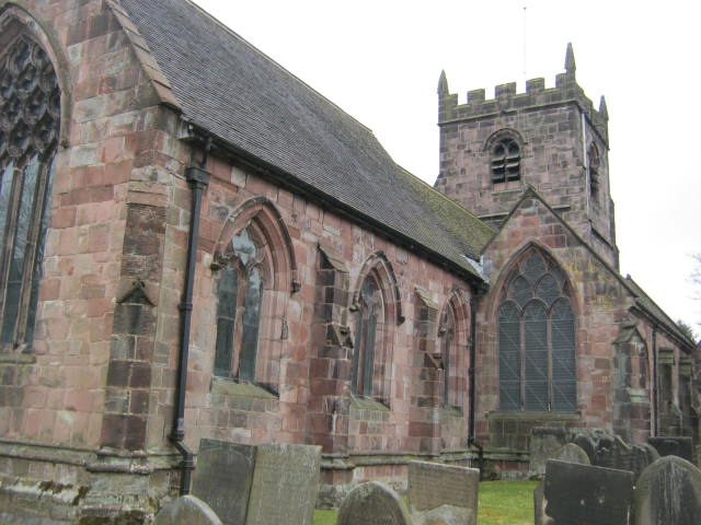
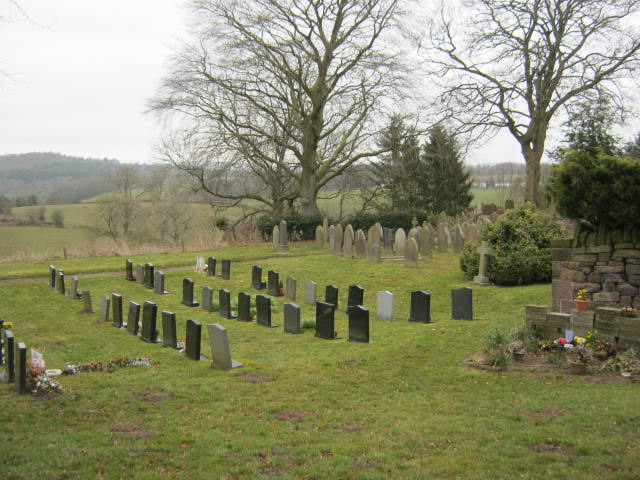
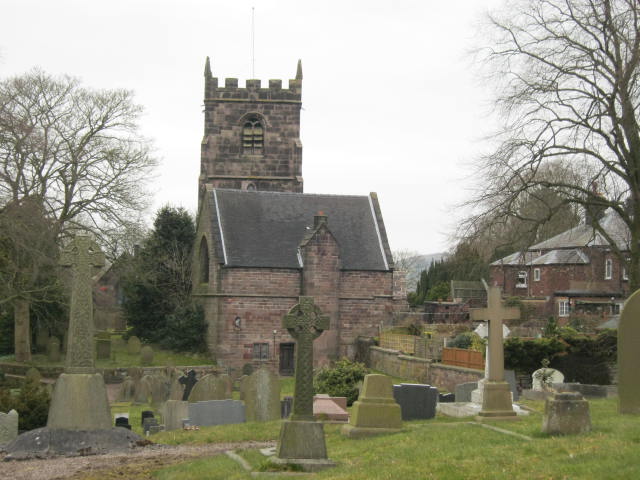
St Edward the Confessor Churchyard is located at Cheddleton, Staffordshire Moorlands District ,Staffordshire ,England.
-
St Edward the Confessor Churchyard cemetery's updated grave count on graveviews.com?
7 memorials
-
Where are the coordinates of the St Edward the Confessor Churchyard?
Latitude: 53.0689530
Longitude: -2.0448230

Nearby Cemetories:
1. St Edwards Lawn Cemetery
Cheddleton, Staffordshire Moorlands District, England
Coordinate: 53.0744437, -2.0385063
2. St Chad Churchyard
Longsdon, Staffordshire Moorlands District, England
Coordinate: 53.0887220, -2.0625850
3. St John the Baptist Churchyard
Wetley Rocks, Staffordshire Moorlands District, England
Coordinate: 53.0409100, -2.0555020
4. Leek Cemetery
Leek, Staffordshire Moorlands District, England
Coordinate: 53.1000880, -2.0248680
5. St Edward the Confessor Churchyard
Leek, Staffordshire Moorlands District, England
Coordinate: 53.1068190, -2.0266150
6. St. Luke's Churchyard
Endon, Staffordshire Moorlands District, England
Coordinate: 53.0812200, -2.1086100
7. St Luke Churchyard
Leek, Staffordshire Moorlands District, England
Coordinate: 53.1061400, -2.0191430
8. St Chad Churchyard
Bagnall, Staffordshire Moorlands District, England
Coordinate: 53.0558430, -2.1082770
9. St. Michael and All Angels Churchyard
Horton, Staffordshire Moorlands District, England
Coordinate: 53.1135330, -2.0879040
10. St. Michael's Churchyard Extension
Horton, Staffordshire Moorlands District, England
Coordinate: 53.1139430, -2.0878020
11. Buxton Road Cemetery
Leek, Staffordshire Moorlands District, England
Coordinate: 53.1154780, -2.0029690
12. St. Philip and St. James Churchyard
Milton, Stoke-on-Trent Unitary Authority, England
Coordinate: 53.0503730, -2.1403780
13. St Anne Churchyard
Brown Edge, Staffordshire Moorlands District, England
Coordinate: 53.0832490, -2.1429880
14. Carmountside Cemetery and Crematorium
Milton, Stoke-on-Trent Unitary Authority, England
Coordinate: 53.0449570, -2.1394910
15. St. Werburgh Churchyard
Kingsley, Staffordshire Moorlands District, England
Coordinate: 53.0195390, -1.9815730
16. Baptist Chapel Churchyard Cemetery
Walkern, East Hertfordshire District, England
Coordinate: 53.0228400, -1.9644900
17. St. Mark the Evangelist Churchyard
Foxt, Staffordshire Moorlands District, England
Coordinate: 53.0362440, -1.9473820
18. St Bartholomew Churchyard
Norton in the Moors, Stoke-on-Trent Unitary Authority, England
Coordinate: 53.0604630, -2.1595270
19. Abbey of St Mary
Abbey Hulton, Stoke-on-Trent Unitary Authority, England
Coordinate: 53.0200000, -2.1300000
20. St. Luke Churchyard
Onecote, Staffordshire Moorlands District, England
Coordinate: 53.0935720, -1.9289360
21. St. Mary's Churchyard
Bucknall, Stoke-on-Trent Unitary Authority, England
Coordinate: 53.0240220, -2.1424430
22. St Mildred Churchyard
Whiston, Staffordshire Moorlands District, England
Coordinate: 53.0211310, -1.9477990
23. St. Matthew's Churchyard
Meerbrook, Staffordshire Moorlands District, England
Coordinate: 53.1446350, -2.0177810
24. Christ Church Churchyard
Biddulph Moor, Staffordshire Moorlands District, England
Coordinate: 53.1220780, -2.1402320